Rand McNally Road Atlas United States and Eastern Canada
The 1933 edition of the Rand McNally Road Atlas, covering the United States and portions of Canada.
Out of stock


Description
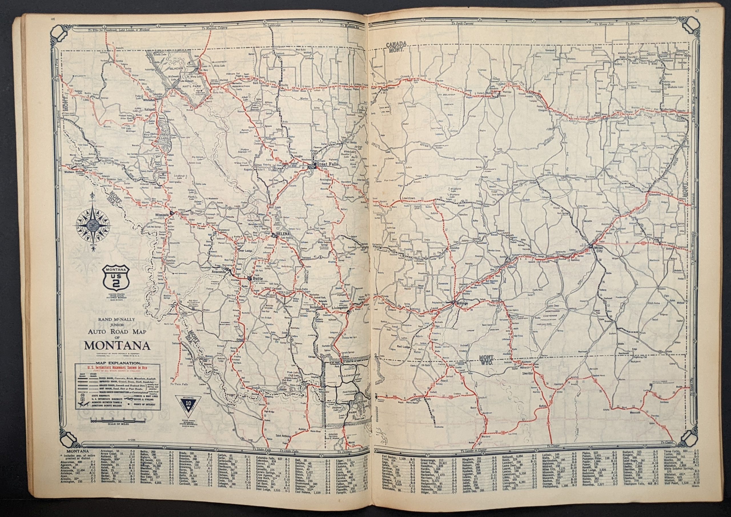
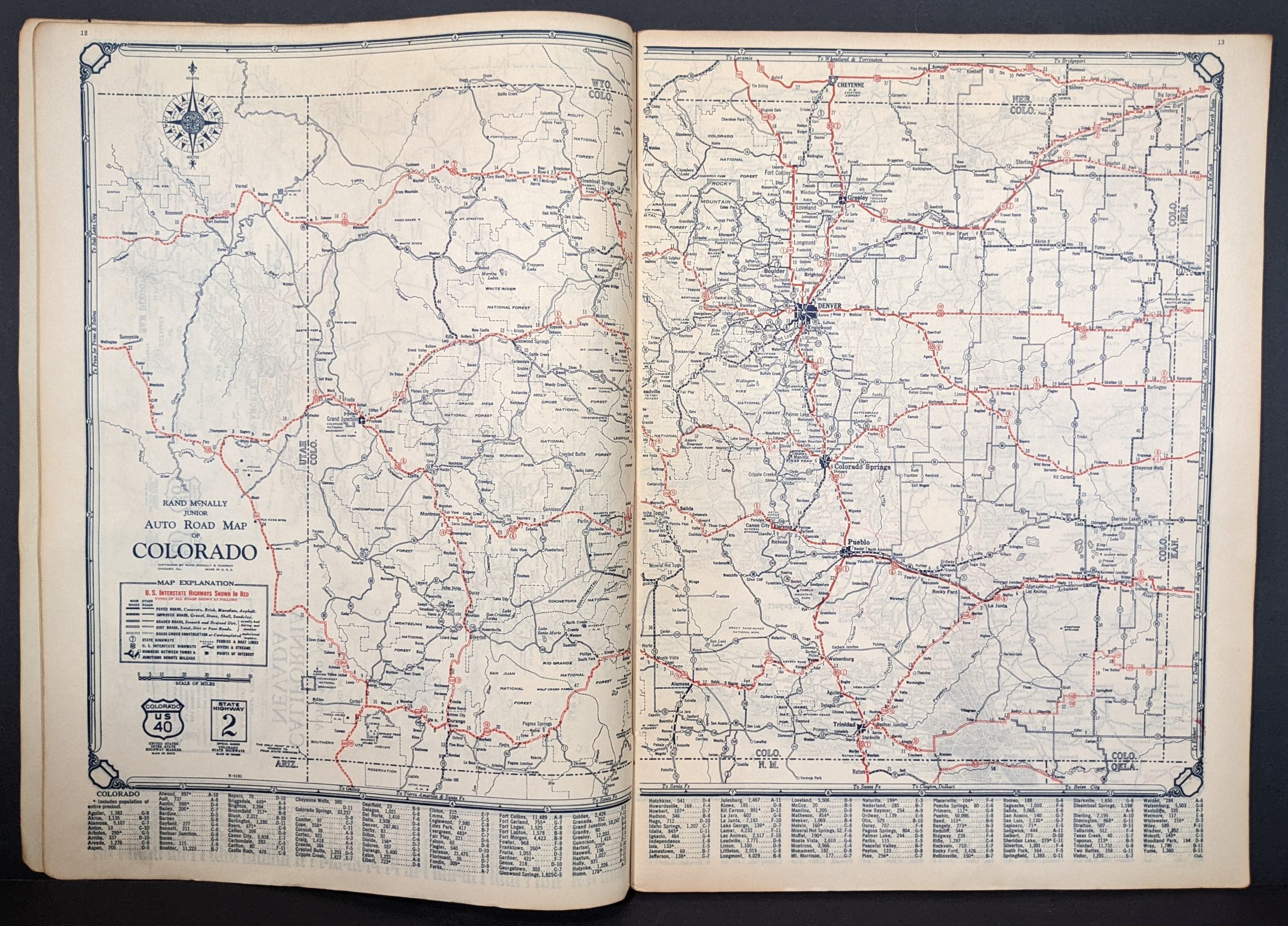
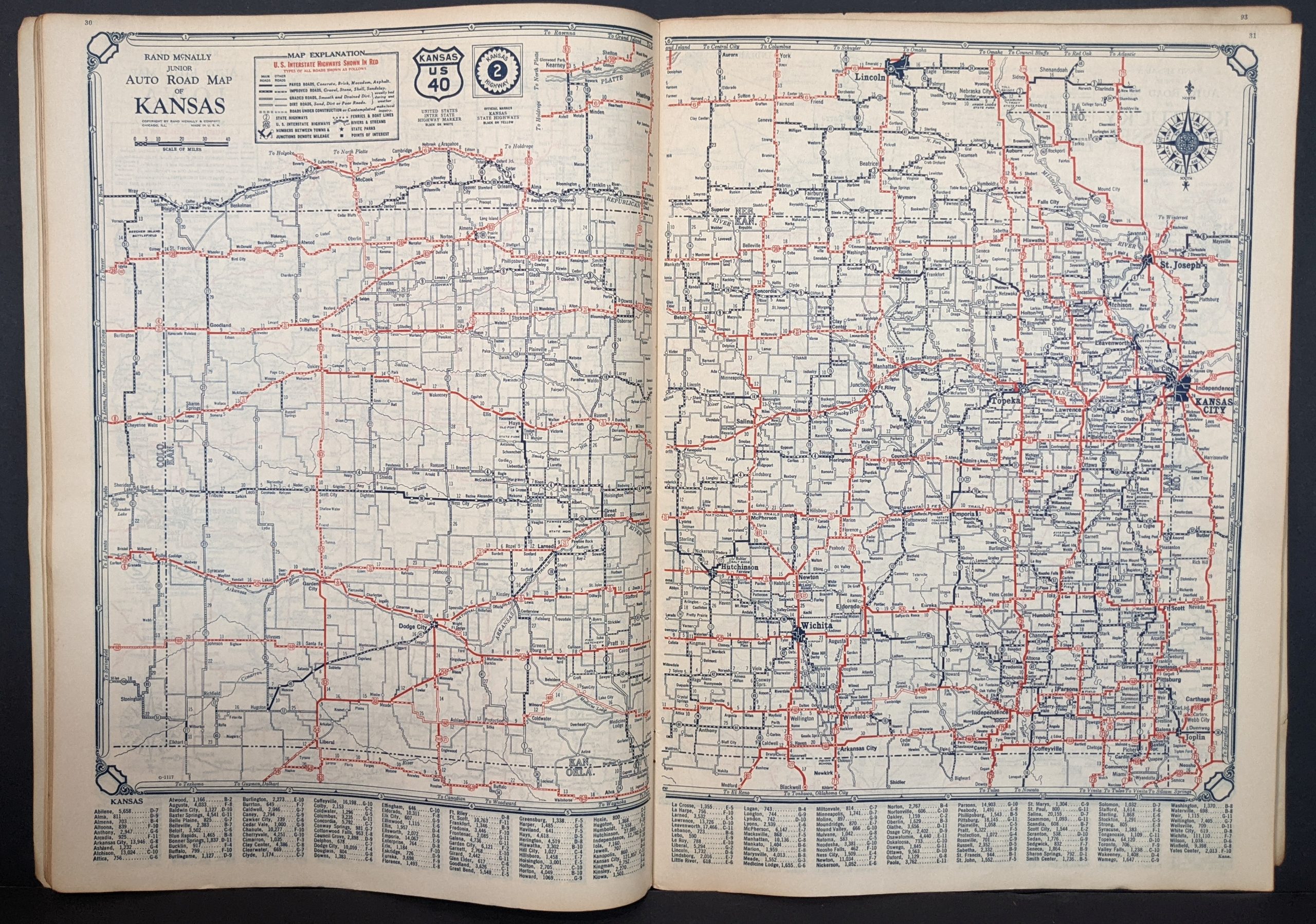
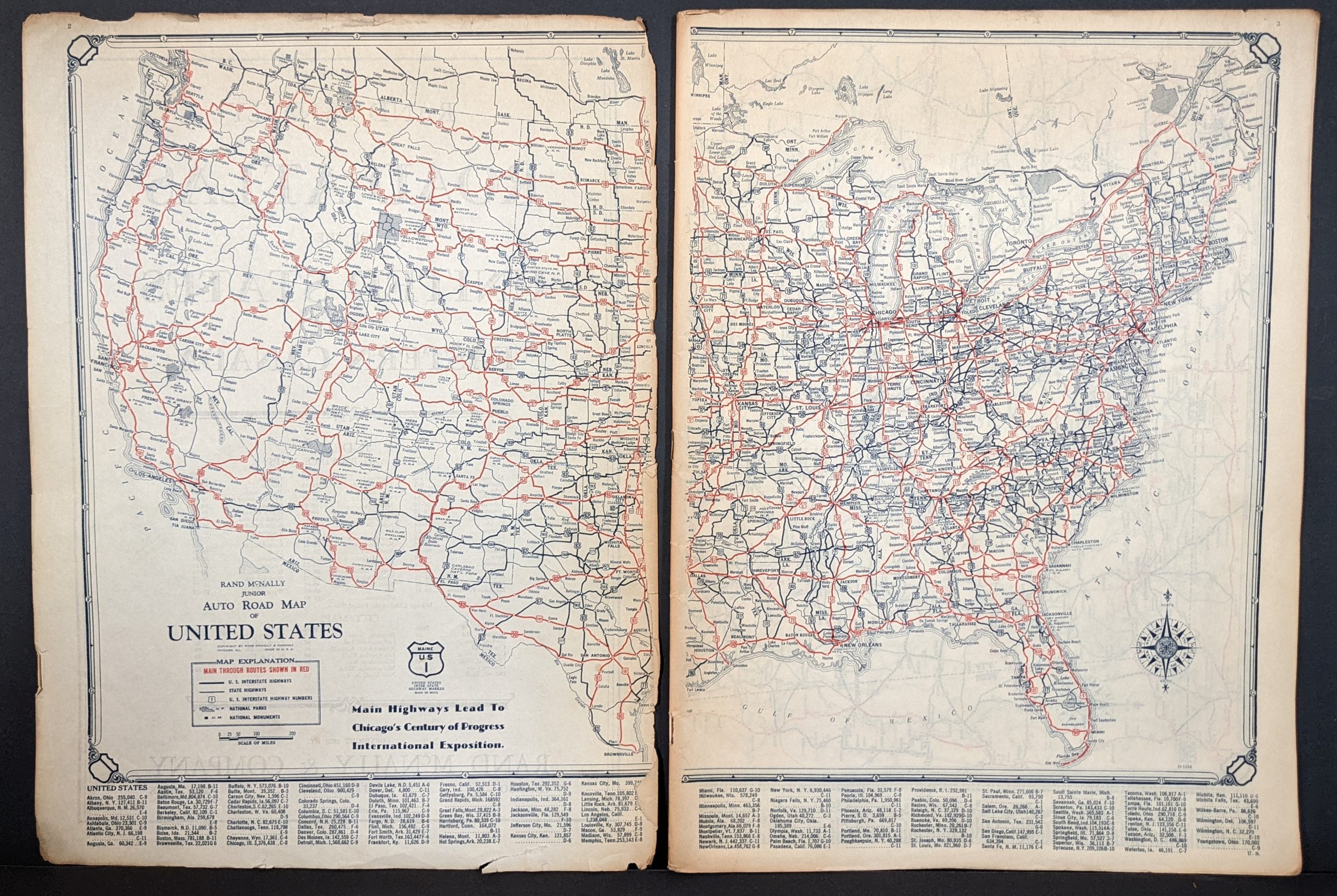
The first road atlas covering the entire United States published by Rand McNally was issued in 1924, though it’s not known in any extant examples today. This is an edition issued slightly later – 1933 – in conjunction with the World’s Fair held in Chicago, Illinois that year.
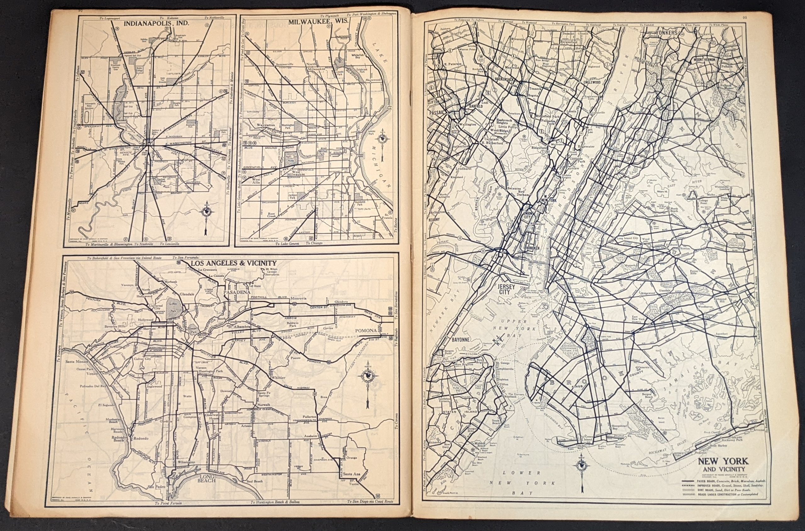
Its 96 pages present road maps of each U.S. state and the Canadian provinces of Quebec and Ontario in alphabetical order. Each sheet shows the various types of roads in service and highlights, in red, an early version of the U.S. Interstate Highway System that predates the modern network by over two decades. State parks, geographic features, and other locations of interest are also identified on each map. City plans of the major urban centers are also included, along with a mileage chart of the United States.
Published in Chicago by Rand McNally & Company in 1933.
Source: History of Rand McNally.
Map Details
Publication Date: 1933
Author: Rand McNally
Sheet Width (in): 10
Sheet Height (in): 13.5
Condition: C+
Condition Description: 96 pp. color lithographed atlas with stapled binding. Front cover is present, but loose and heavily worn. The title page (which includes the left side of the U.S. map) is also loose and torn around the outer edges with minor paper loss. Other contents are present and in much better shape, with faint toning and a few small edge tears.
Out of stock