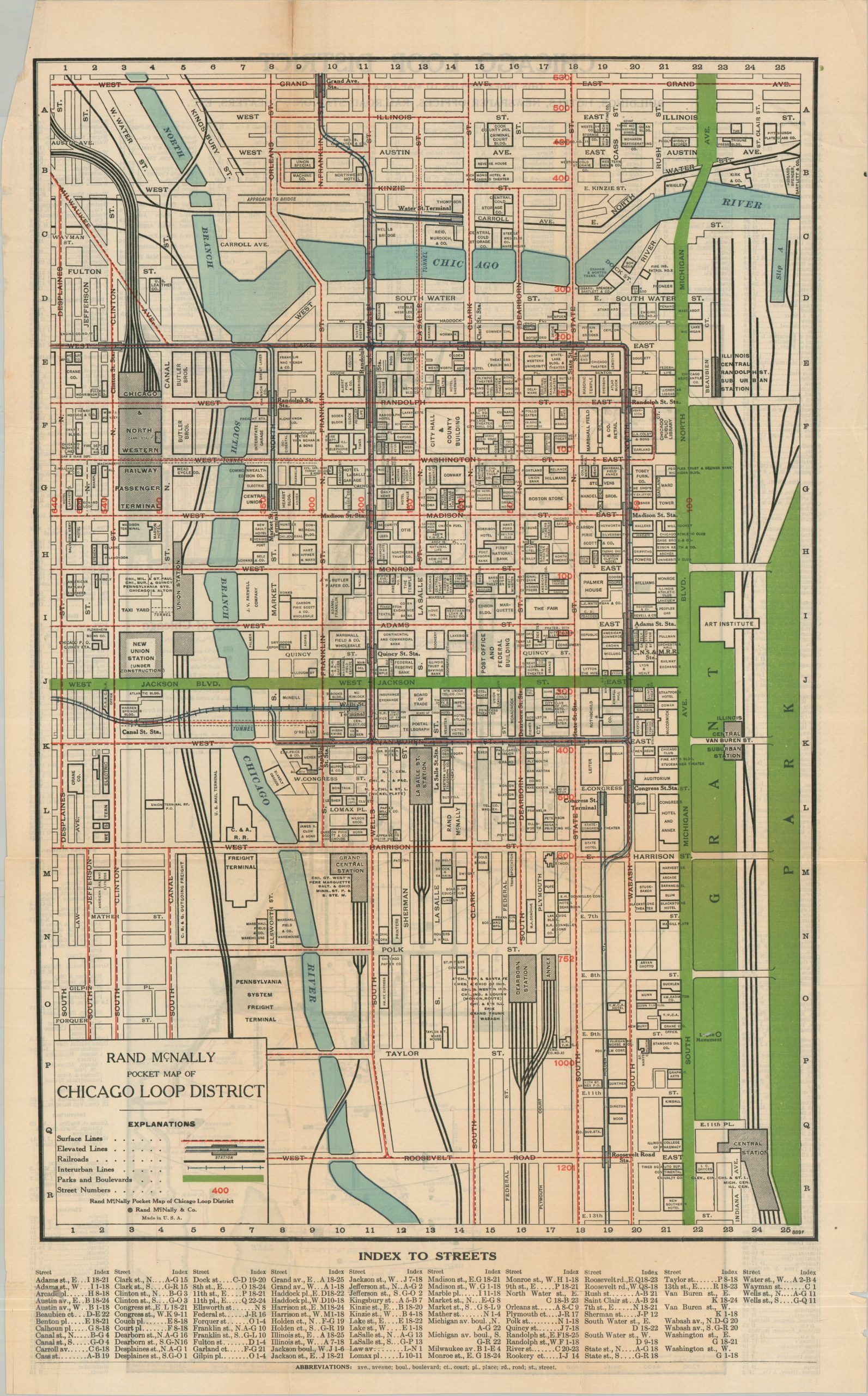
Rand McNally Pocket Map of Chicago Loop District
$95.00
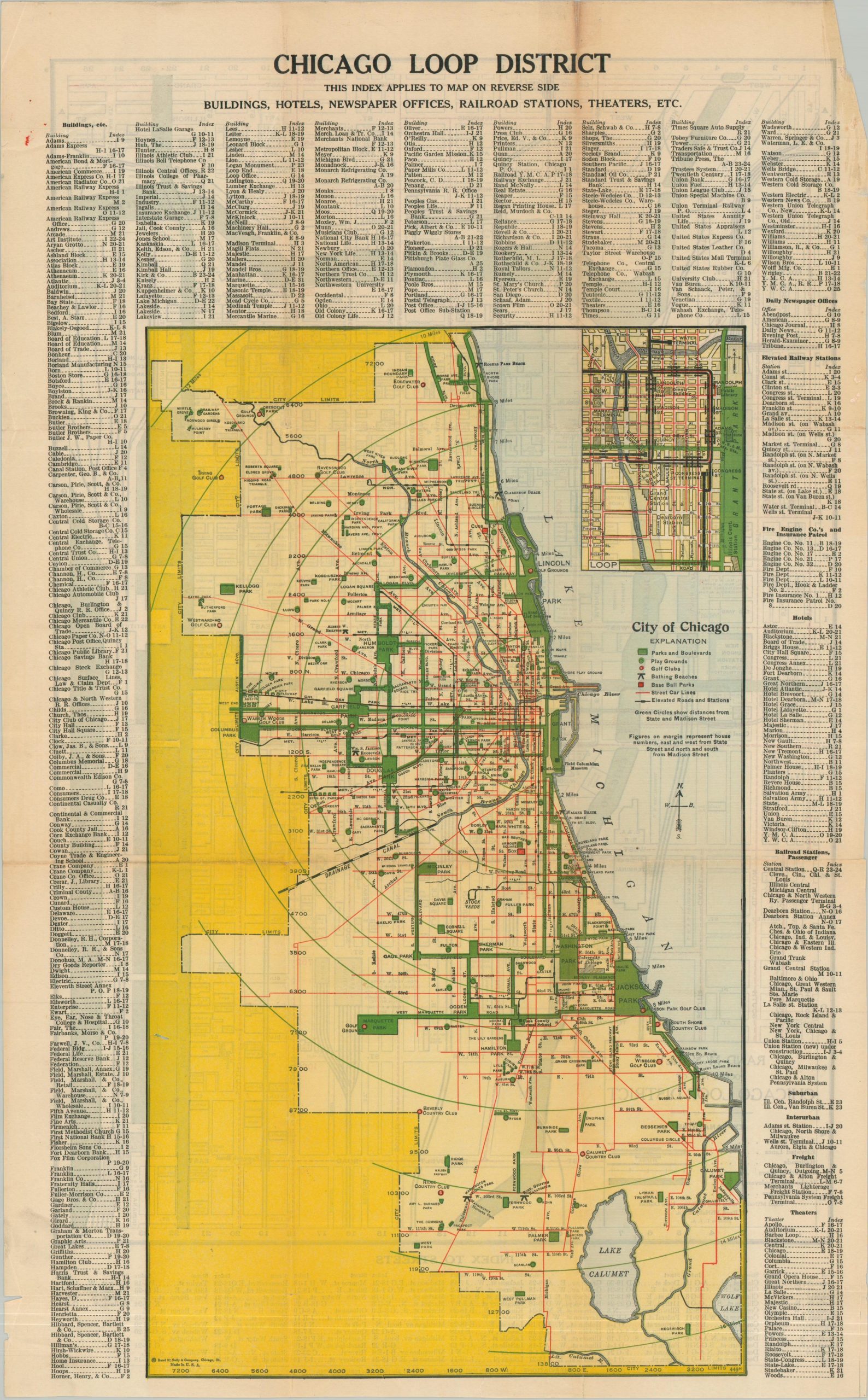
Chicago during the early 1920s.
1 in stock
Description
This is a detailed large-scale map of Chicago’s Loop, bordered approximately by the Chicago River and Grant Park. Buildings throughout the downtown area are labeled individually. Union Station is noted as ‘Under Construction’, helping to narrow the date of production from 1919-1925. The verso presents a color map of the entire city limits, highlighting public recreation (parks, golf courses, bathing beaches, etc.), the transportation network, and major infrastructure.
Map Details
Publication Date: c. 1922
Author: Rand McNally & Co.
Sheet Width (in): 13.50
Sheet Height (in): 22.25
Condition: B
Condition Description: Double-sided pocket map (removed from original covers) with heavy wear and toning along old folds. Old repairs along clean splits, scattered marginal tears, creased corners, and other moderate issues (the image remains largely unaffected). About good condition overall.
$95.00
1 in stock