Rand McNally Panoramic Map of the United States
A visually impressive map of the United States.
Out of stock
Description
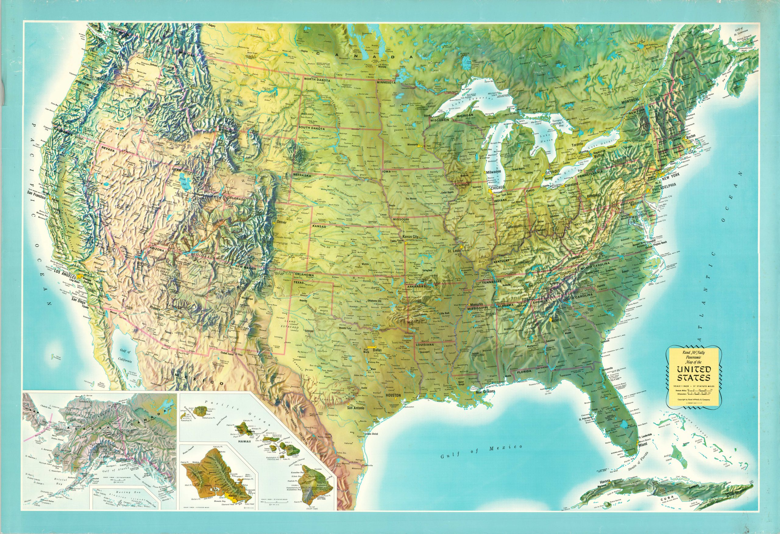
This lovely vintage map of the United States was published in Chicago by Rand McNally around 1970. Major metropolitan areas are highlighted in yellow, state borders are faintly shaded in red, and many large towns and cities are named.
Railroads and interstates are omitted, allowing America’s diverse topography and varied landscapes to be the star of the show. Prominent geographic features and National Parks are also labeled. Inset maps in the lower left show Hawaii and Alaska.
Map Details
Publication Date: c. 1970
Author: Rand McNally
Sheet Width (in): 40
Sheet Height (in): 57
Condition: B+
Condition Description: Moderate wear visible along the outer margins, including several small tears, wrinkling, and a few errant chips in the upper left. Some scattered soiling and spotting in the upper right corner. Good to very good condition overall.
Out of stock