Rand McNally Official 1921 Auto Trails Map District No 12
$225.00
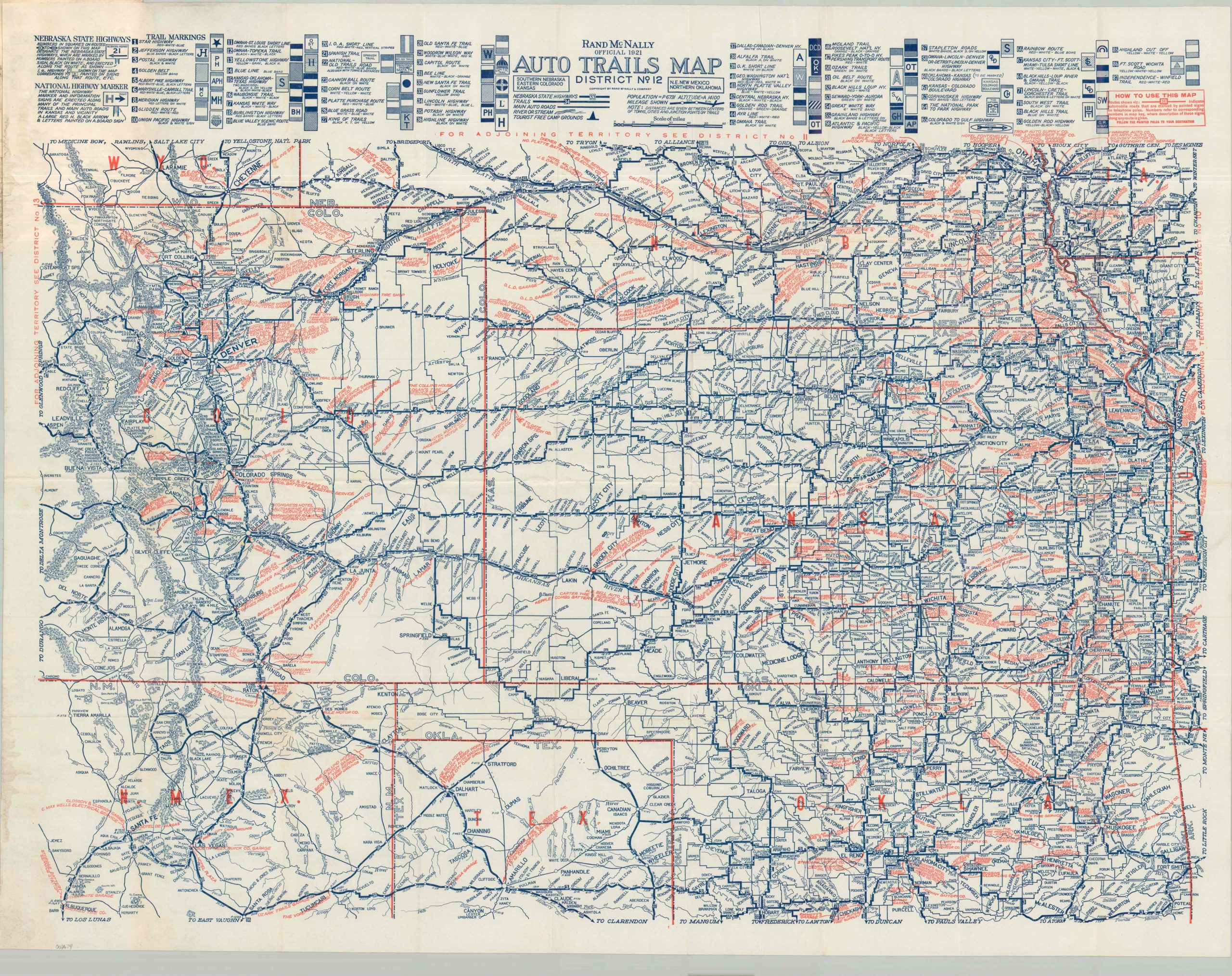
An interesting road map of the Great Plains from the early 1920s.
1 in stock
Description
This fascinating pocket guide to America’s High Plains was published by Rand McNally in 1921. The image captures the regional road network during a transformative period. As privately sponsored and organized auto trails were becoming increasingly confusing and inefficient, states began to step in with their own system of numbering. Nebraska State Highways are shown with white boxed numbers, whereas the competing trails are noted in blue. Each system also vied for signage space – the markings along the top of the sheet would have been pasted or painted onto utility poles to identify the route.
In addition to providing a useful reference to the region’s road network, the sheet also serves as a catalog of local traveler amenities. Red overprinting identifies dozens of auto supply stores, restaurants, hotels, garages, and other businesses of specific utility to the motorist. Small triangles pinpoint the location of Tourist Free Camp Grounds. These outdoor areas, often sponsored by rural municipalities, varied widely in comfort and convenience, ranging from empty, muddy fields to fenced-in parks with permanent cottages. Additional firms are listed in the accompanying booklet, which also includes city plans, advertisements, and information about Rand McNally publications.
Map Details
Publication Date: 1921
Author: Rand McNally
Sheet Width (in): 34.00
Sheet Height (in): 26.50
Condition: A-
Condition Description: Large single-sided road map folded and affixed to 52 pp. guidebook with stapled binding and illustrated paper wraps. Some light wrinkling and creasing on the map, along with soiling in the lower left corner. The booklet is also pretty dirty, but remains in good condition overall.
$225.00
1 in stock