Rand McNally Junior Auto Trails Map Wyoming
Introducing numbered highways to Wyoming.
Out of stock
Description
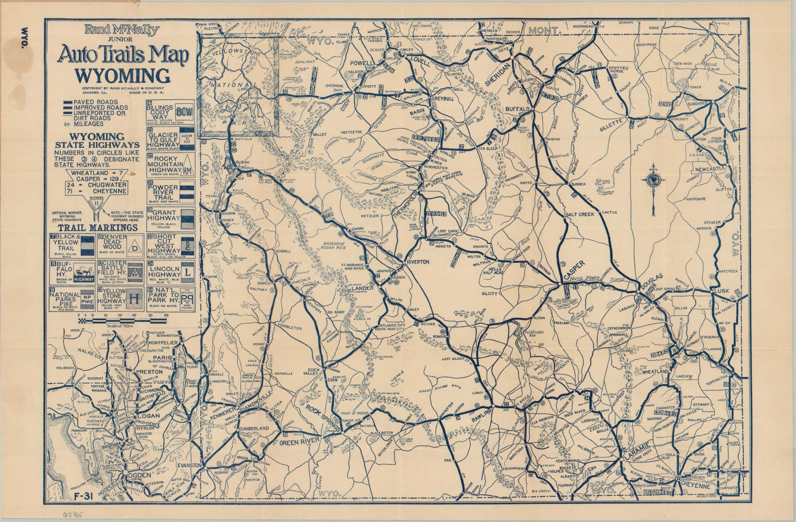
In 1922, the state of Wyoming organized a system of numbered auto routes to help guide the rapidly growing number of motorists. These were in addition to the named auto trails already in existence, supported by various private groups and associations. Both are shown on this map (often overlapping), though the quality of the surface varies significantly. Paved roads are shown with dual ‘tracks’ adjacent to the line, while improved roads (presumably gravel) are shown with only one track. Dirt roads are thin and generally unlabeled, while distances between points are noted in many cases.
Published in Chicago by Rand McNally in 1924, according to the date code (of-31), printed in the lower left. Two years later, the introduction of the National Numbered Highway system would make many of Wisconsin’s state routes obsolete. The map is affixed to a cover advertising Goodrich Tires and showing distribution by the Lawrence Buick Company of Rock Springs, Wyoming.
Map Details
Publication Date: 1924
Author: Rand McNally
Sheet Width (in): 18
Sheet Height (in): 12
Condition: A-
Condition Description: Single-sided printed map, folded and affixed to stiff paper covers (moderately creased and worn). Some staining in the upper left margin from the original adhesive, but overall in very good condition.
Out of stock