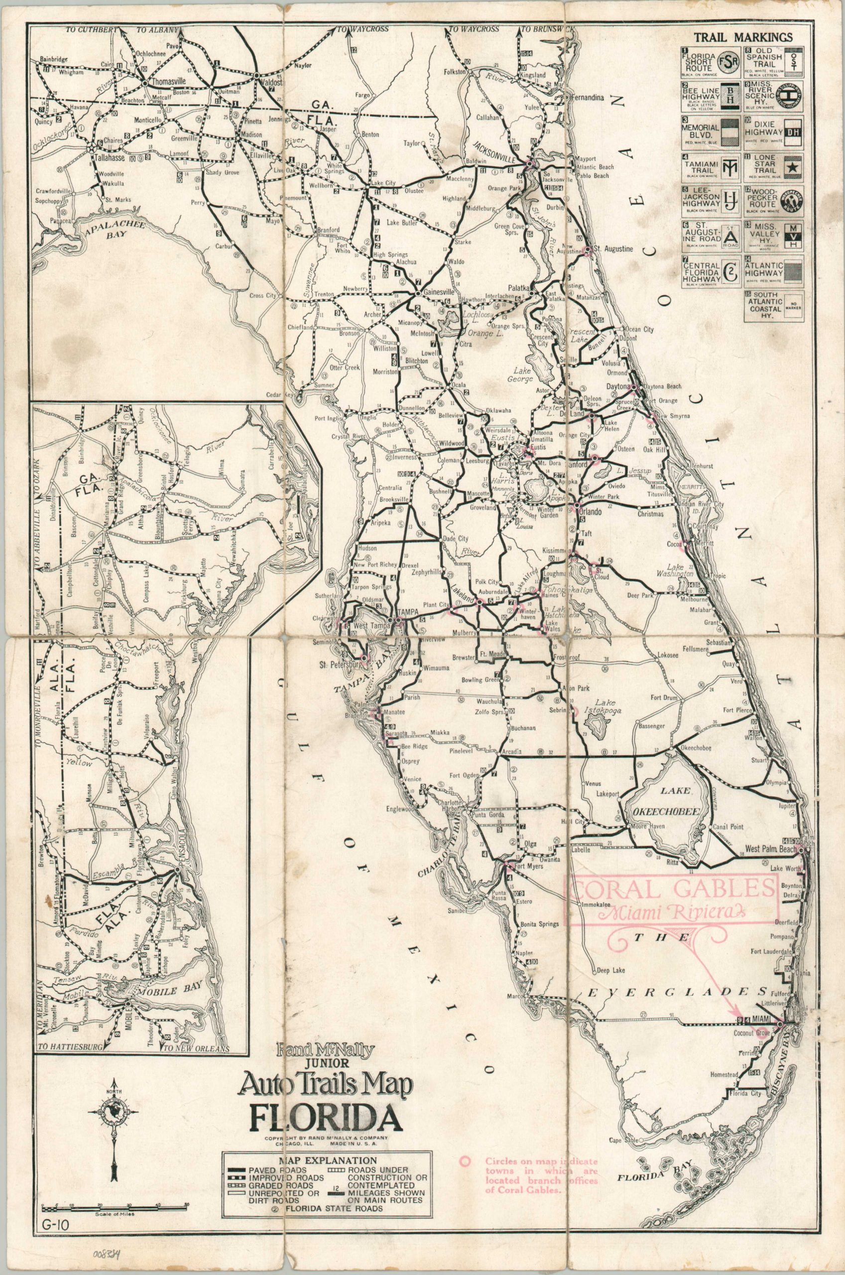
Rand McNally Junior Auto Trails Map Florida
$185.00
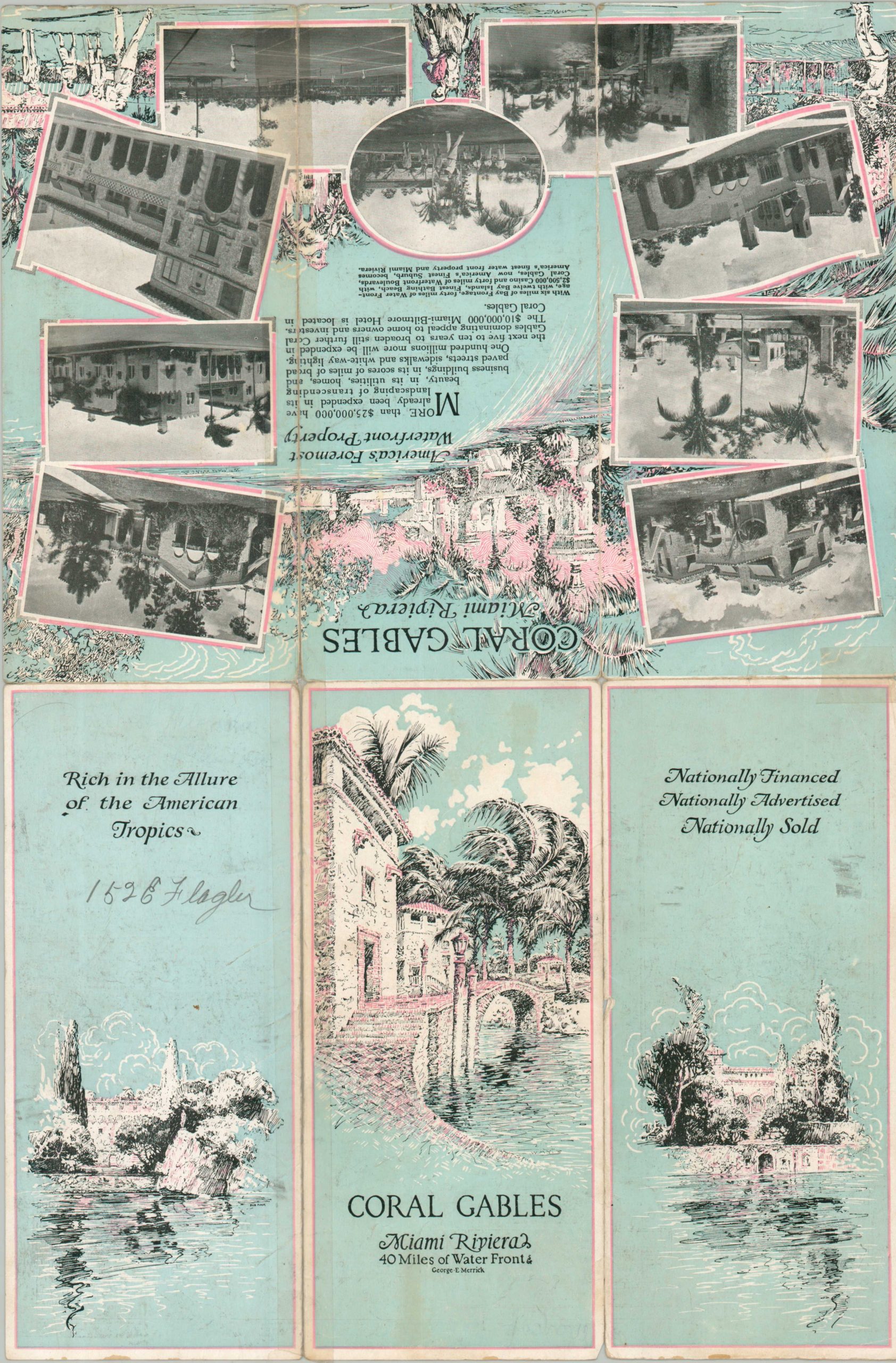
An uncommon 1920s promotional piece for Coral Gables, Florida.
1 in stock
Description
This rare road map of Florida was published by Rand McNally in 1925, during the height of the state’s precipitous 1920s Land Boom (largely ended by the 1926 Miami hurricane). Paved, improved (gravel), graded, unreported, and completed roads are noted with different styles of lines, described in the legend (lower left). Florida state numbered highways (introduced in 1923) are marked with small circles, while fifteen different auto trails are also noted in dark boxes. Their respective markings are noted in the upper right and would have been posted on utility poles or special signs to help the motorist find their way.
Red overprinting indicates the location of Coral Gables, a newly incorporated city on a meteoric rise under the development of George Merrick. Persuasive text, illustrations, and photographs on the verso offer more on the area, Rich in the Allure of the American Tropics. “Finest Bathing Beach, with $2,500,000 Casino and forty miles of Waterfront Boulevards, Coral Gables, now America’s Finest Suburb, becomes America’s finest waterfront property and Miami Riviera.”
Map Details
Publication Date: 1925
Author: Rand McNally
Sheet Width (in): 11.90
Sheet Height (in): 17.90
Condition: B-
Condition Description: Double-sided map brochure with heavy wear and separation along folds, repaired on verso with a mix of old cellophane and archival tape. Several areas of soiling and dirty fingerprints throughout the image (see scan), though the image remains legible. Better than fair condition, but not by much.
$185.00
1 in stock