
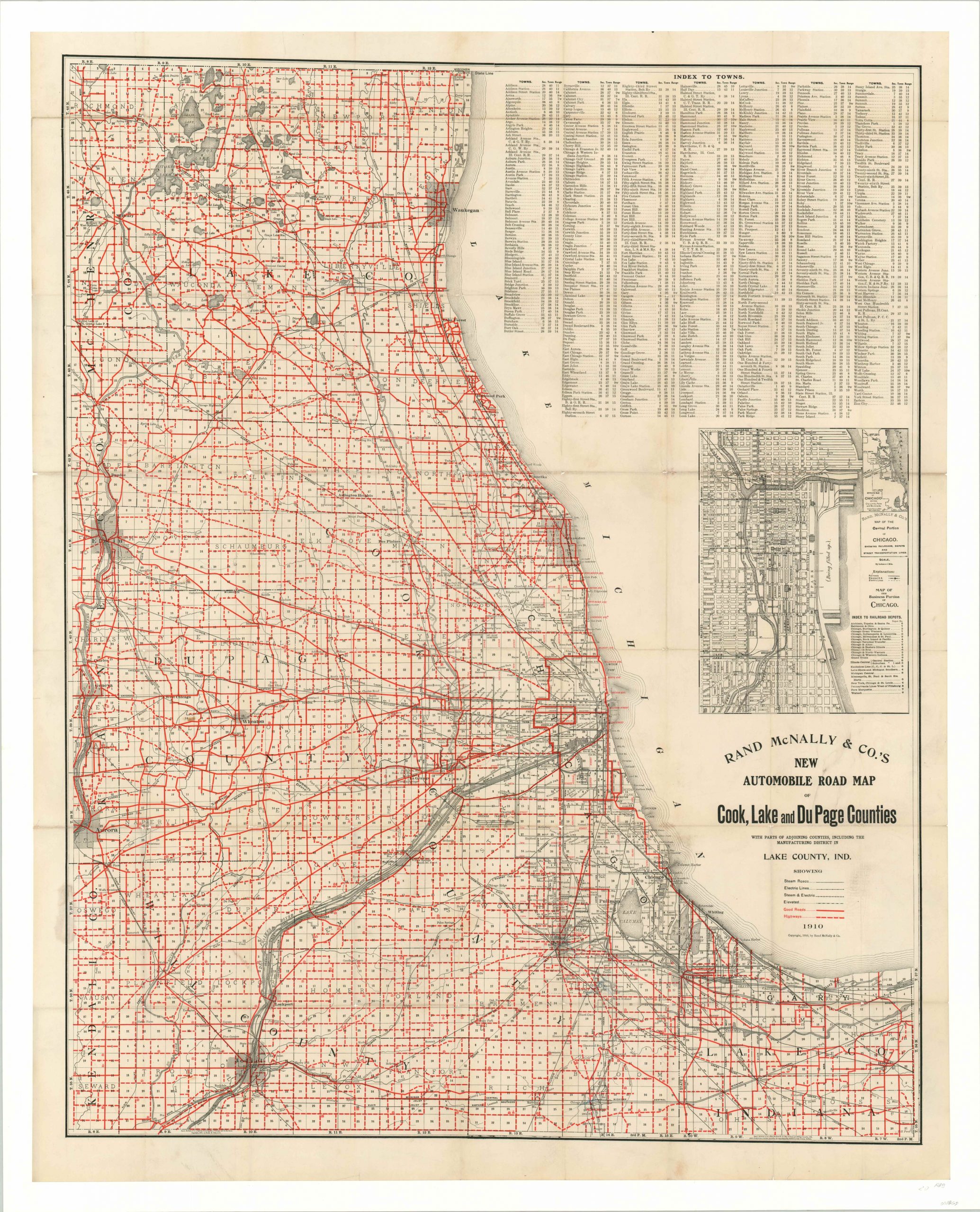
Rand McNally & Co’s New Automobile Road Map of Cook, Lake and DuPage Counties
$425.00
Magnificent transportation map of the greater Chicagoland area published the year after the adoption of the Burnham Plan.
1 in stock
Description
Though motor tourism was still in its infancy, the automobile was gaining rapidly in popularity across the nation by the end of the first decade of the 20th century. Such a demand necessitated the publications of maps such as this, which shows the status of local roads throughout the Chicagoland region.
The image is cleverly distorted (note how it extends to the Wisconsin state line to the north) and there is no scale included, but the area represented is approximately 2,300 square miles. Such breadth could only be realistically accessed by the automobile, and the map highlights the quality of roads that serve the region. I’m not sure what differentiates between ‘good roads’ and ‘highways’ but it’s presumed the former are preferred and likely include some level of improvement like pavement or macadam.
Other links in Chicago’s transportation chain are also noted within the map. A hodgepodge of steam, electric, and elevated railroads, or a combination thereof, can be seen connecting between a complex network of collar cities like Evanston, Elgin, Aurora, Joliet, and Gary, Indiana. In inset map of Chicago’s Loop shows the locations of various transportation or freight depots and additional rail lines in operation throughout the city.
A fascinating relic from the early days of automobile travel, published locally by Rand McNally in 1910.
Map Details
Publication Date: 1910
Author: Rand McNally
Sheet Width (in): 38.5
Sheet Height (in): 48
Condition: B+
Condition Description: Formerly folded into a pocket map, now professionally flattened and mounted on linen. Evident discoloration along the former fold lines, and minor image loss at several of the fold intersections. Small stain in the lower left where the map was formerly adhered to the covers. Faint scattered soiling evident in a few other places, but the map remains in good to very good condition and is well preserved.
$425.00
1 in stock