Rand McNally Commonwealth Series Europe
$125.00
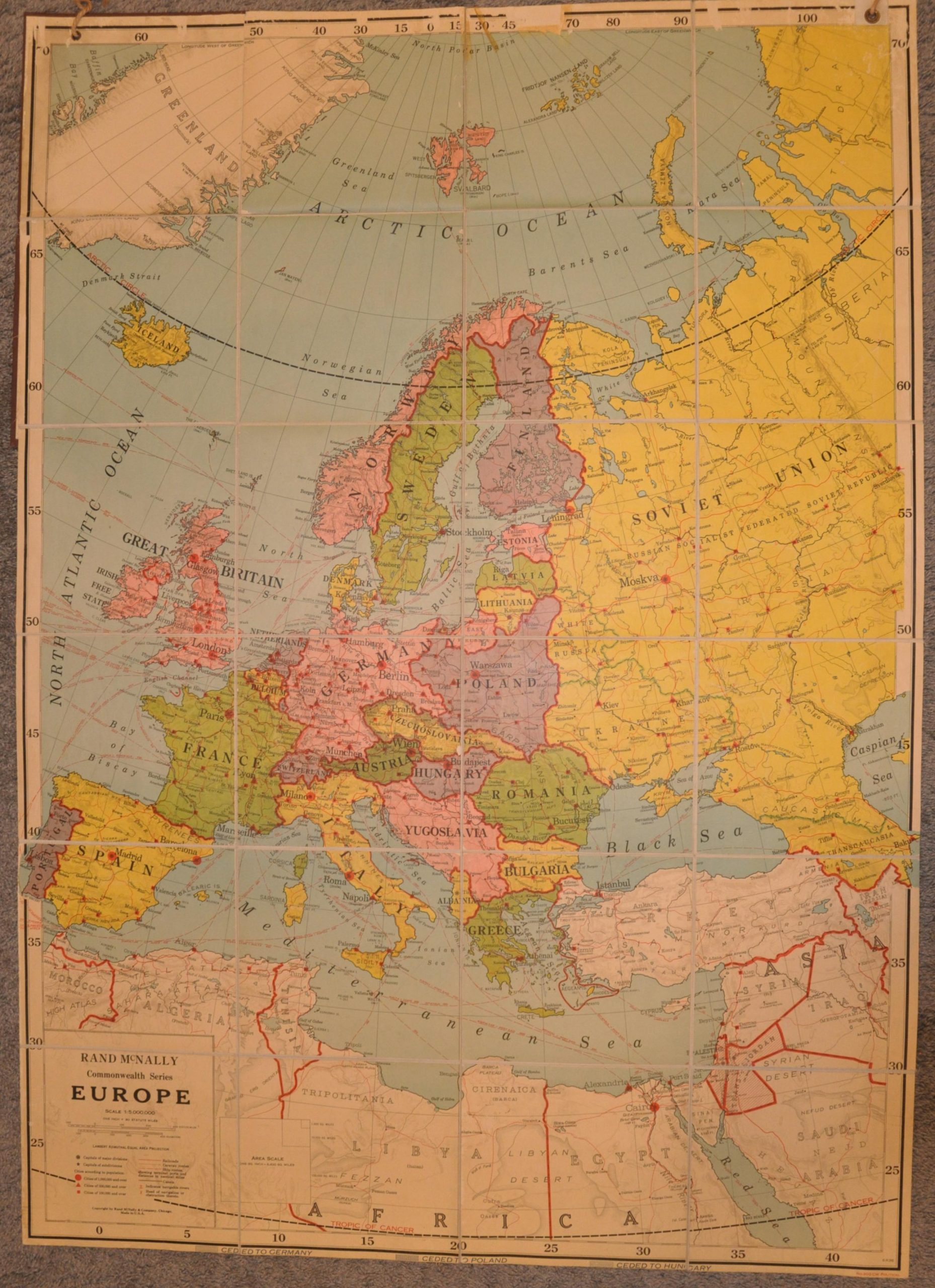
Europe on the brink of war.
1 in stock
Description
This large and vibrantly colored political map of Europe was published by Rand McNally & Company in late 1938, based on the outline of the national borders of Germany, Austria, and Czechoslovakia. Hitler’s territorial machinations are reflected in large parcels of acquired territory, as well as land forcibly ceded by his neighbors to Poland and Hungary. A small key along the bottom of the sheet labels these transfers – the results of the Munich Agreement and the First Vienna Award.
Elsewhere throughout the image, a variety of strategic information is presented. Topography is depicted in hachures and navigable rivers, major cities, and overseas possessions are labeled. Ship routes, caravan lines, and railroads are noted in bright red – though airline routes are omitted.
The large map was designed for display in a school or educational space. This particular example was discarded from Antigo Public Schools. One can certainly imagine those high-school-age children learning about contemporary current events with anxiety and dread.
Map Details
Publication Date: 1938
Author: Rand McNally
Sheet Width (in): 39.4
Sheet Height (in): 55.5
Condition: B+
Condition Description: Massive color wall map dissected into 24 segments and affixed to linen. Folds into stiff brown boards. Ex-school property (withdrawn), with some tape loss at the top, old ropes in the upper grommets (where hung), and scattered soiling around the edges. A bit of wear and loss at the intersections of each panel. Good condition overall.
$125.00
1 in stock