Rand McNally & Co.’s Standard Guide Map of the World’s Columbian Exposition at Chicago, 1893.
Detailed plan of the 1893 Columbian Exposition by Rand McNally.
Out of stock

Description
The Columbian Exposition held at Chicago’s Jackson Park in 1893 is one of the most iconic events in the (relatively short) history of the great city. Less than 25 years after a devastating fire destroyed much of its downtown, Chicago rapidly rebuilt to surpass New York, St. Louis, and Washington, D.C. as the host of a World’s Fair to celebrate the 400th anniversary of Columbus’ arrival to the New World. Though it opened a year later than originally hoped, the fair was a tremendous success and saw over 27 million attendees during its six-month run.
This map of the White City and adjacent Midway Plaisance was published in Chicago in 1893 by Rand McNally & Company. Dozens of buildings, exhibits, and attractions are outlined and identified in the accompanying index. Highlights include the gigantic Manufacturers and Liberal Arts Building, the iconic Ferris Wheel, a casino, and the Art Galleries (rebuilt as today’s Museum of Science and Industry).
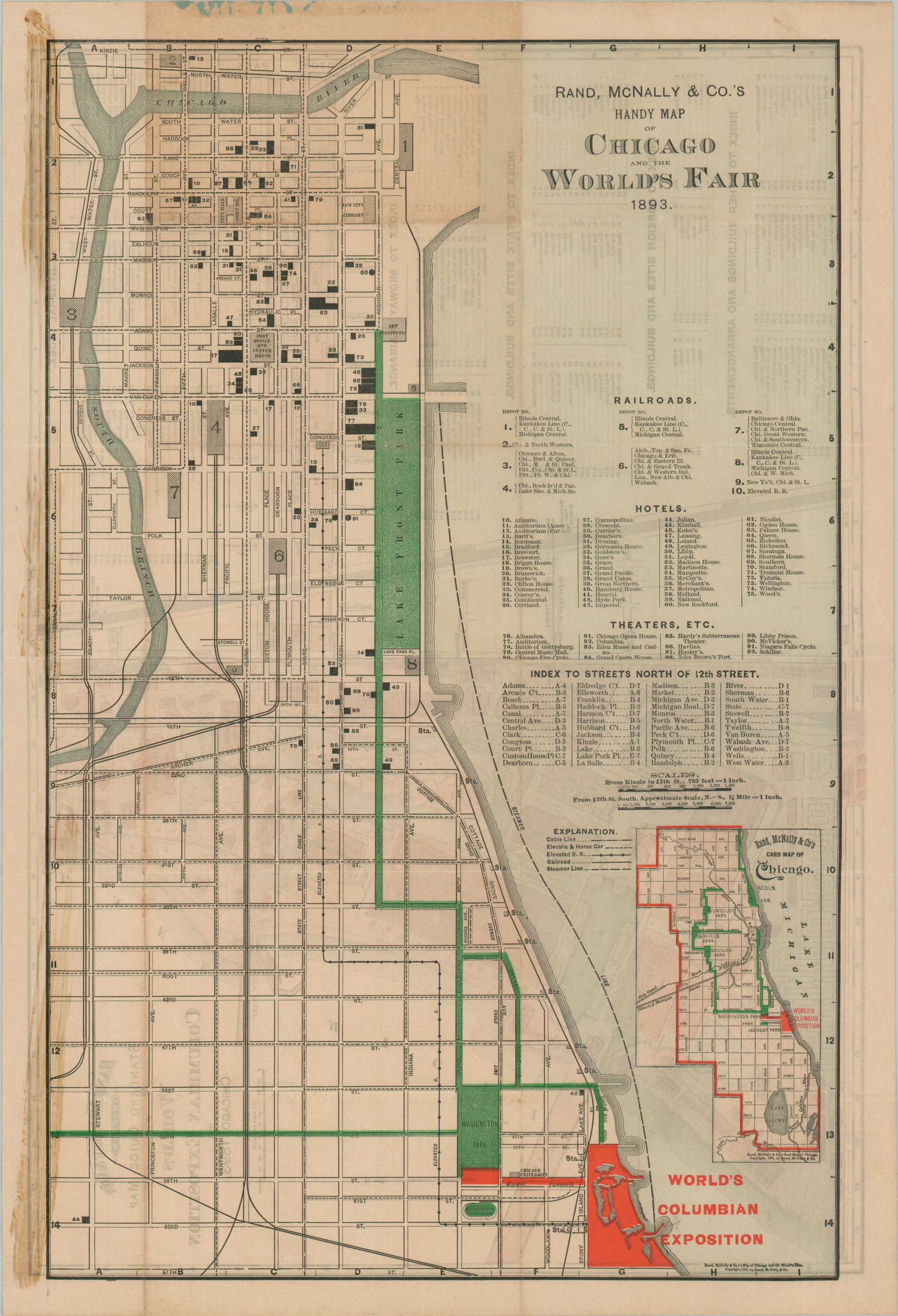
The verso presents a ‘Handy Map of Chicago and the World’s Fair’ emphasizing the available transportation routes from downtown to Jackson Park. Numerous locations of interest are labeled.
Map Details
Publication Date: 1893
Author: Rand McNally
Sheet Width (in): 20.4
Sheet Height (in): 14.1
Condition: B
Condition Description: Streaks of old adhesive residue are visible in the upper corners and there is moderate wear along old fold lines. Scattered toning and offsetting, along with some marginal soiling. About good condition overall.
Out of stock