Rand McNally & Co.’s’ Map of Chicago
$250.00
Chicago on the eve of the Columbian Exposition.
1 in stock
Description
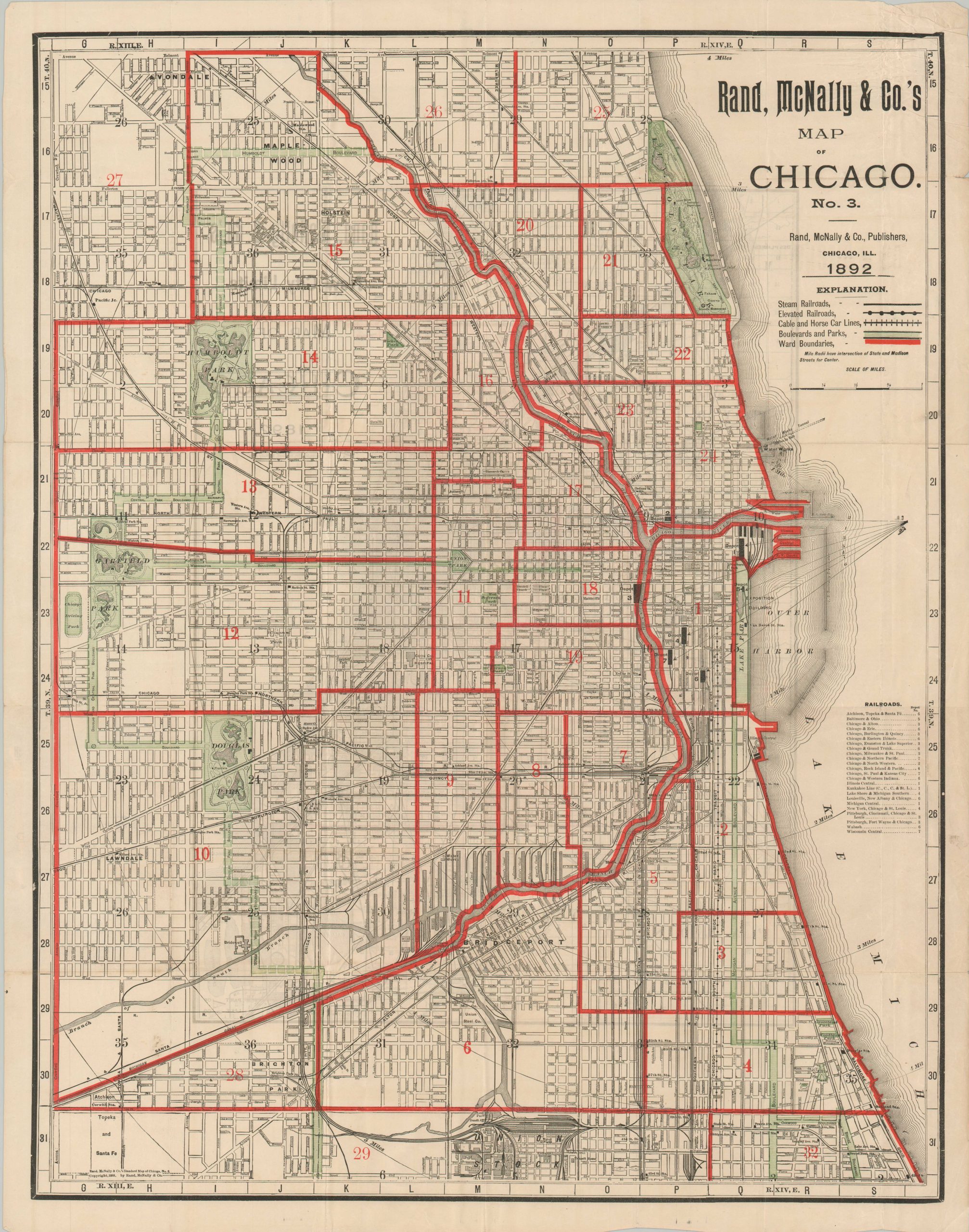
This interesting map of Chicago was published locally by Rand McNally in 1892, the year prior to the city hosting the iconic Columbian Exposition at Jackson Park. Oddly, there is no mention anywhere of the World’s Fair on the map itself – possibly because a base map from 1888 was used and updated with additional information.
Such details include the organization of a robust transportation network comprised of steam railroads, elevated lines, and streetcars powered by horses and/or electric cables. Eight depots are noted around downtown, with a key identifying the corresponding companies that operate within each. Boulevards and parks are highlighted in green – the city’s iconic ‘Emerald Necklace’ – and political wards are outlined in red, though only a portion of Chicago’s 50 wards are included in the image.
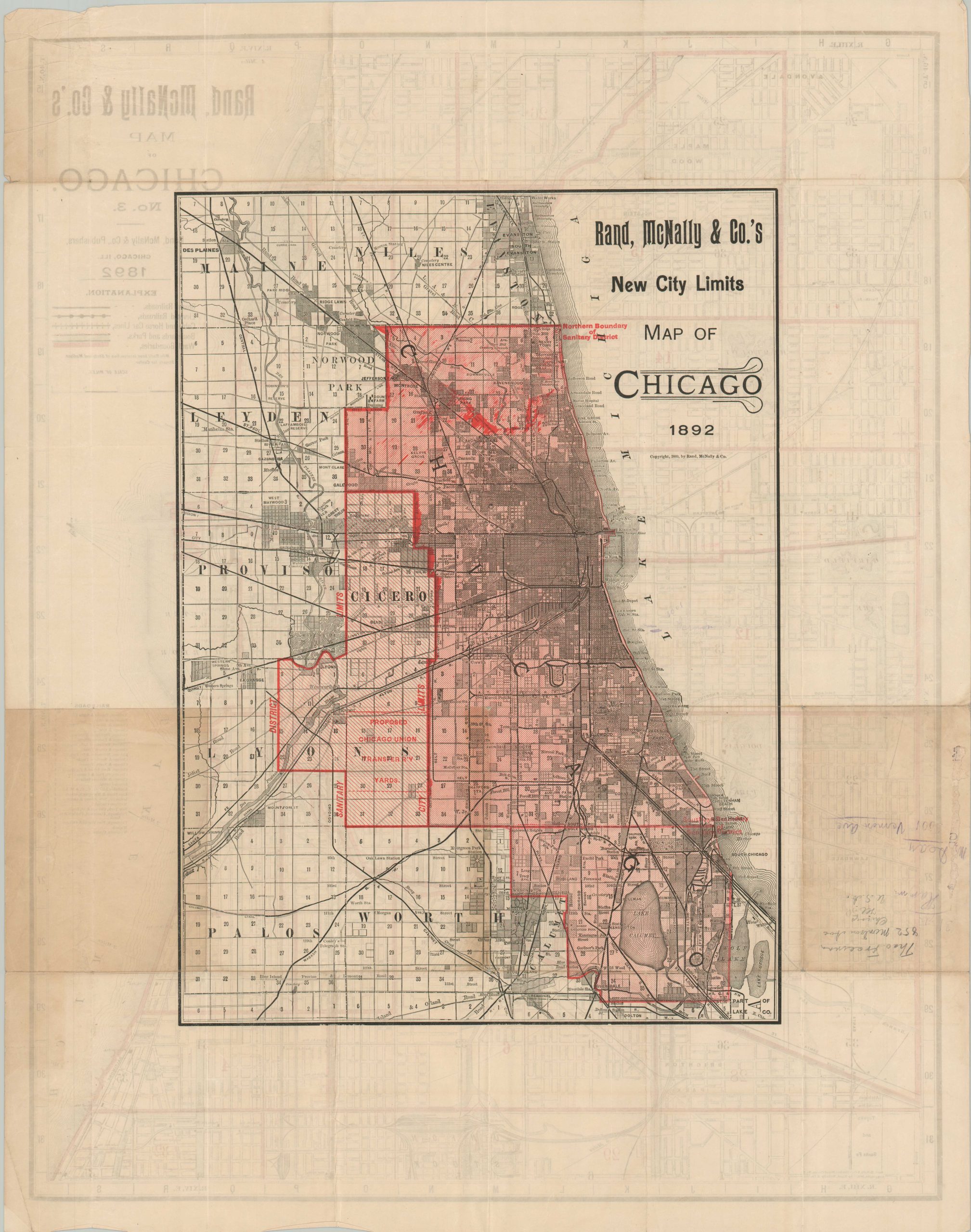
Other labeled locations of interest include elevated stations, public buildings, monuments, part of the Union Stock Yard, Bridewell Prison, and the Interstate Industrial Exposition Building, demolished the same year as publication to make way for the Art Institute. The verso presents a map of the entire city that highlights the expansion of the Sanitary District, annexations from 1890, and the proposed Chicago Union Transfer Railway Yards.
Source: Encylopedia of Chicago;
Map Details
Publication Date: 1893
Author: Rand McNally
Sheet Width (in): 21.8
Sheet Height (in): 27.6
Condition: B+
Condition Description: Double-sided map with creasing and wear along originally issued fold lines. Soiling and wear visible in the margins, including a few small tears. Wrinkled upper right corner. Toning and manuscript annotations in pencil on the verso do not affect the image. Good to very good overall
$250.00
1 in stock