Rand, McNally & Co.’s Indexed Atlas of the World Map of Cuba
$90.00
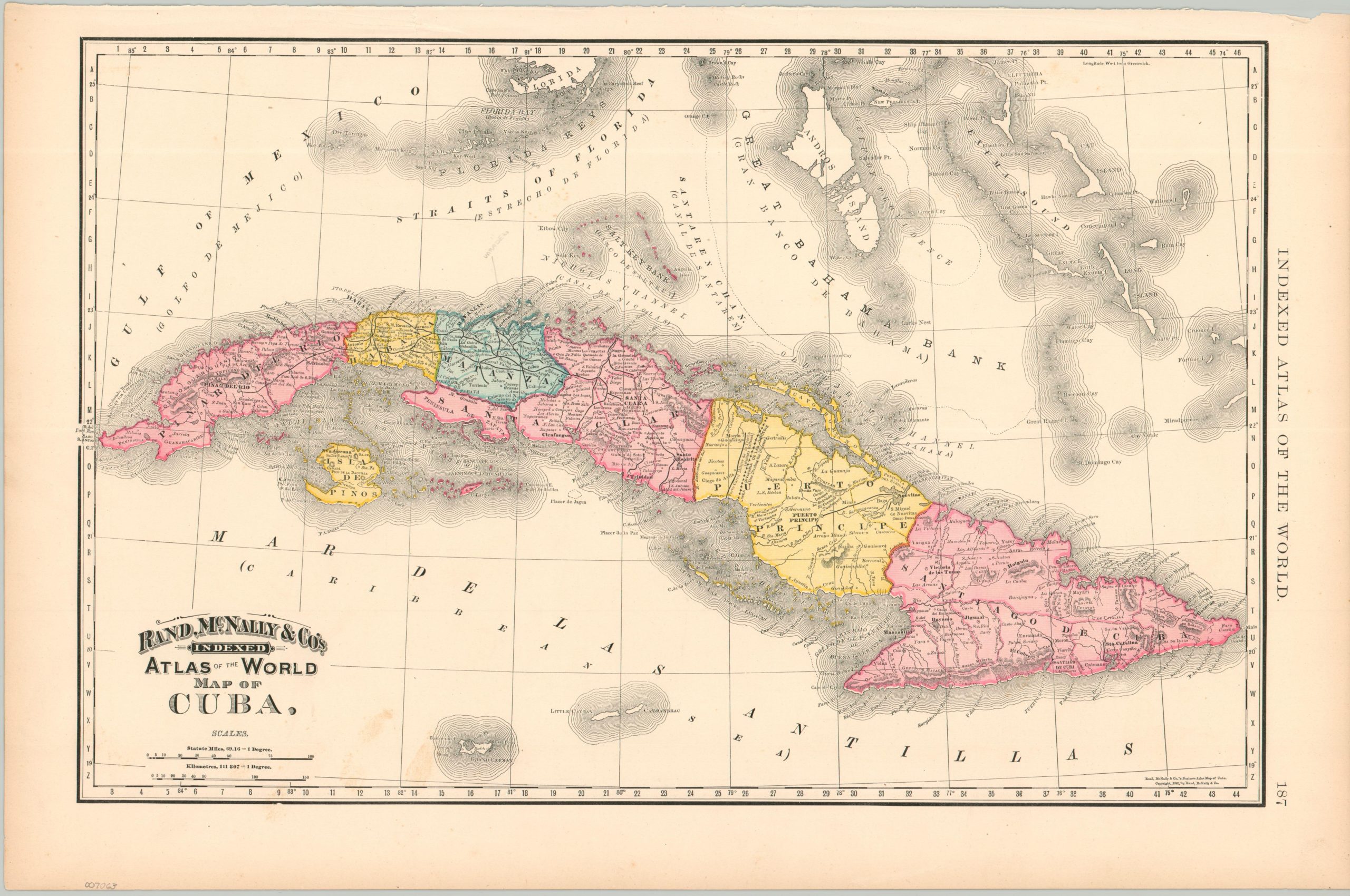
Spanish Cuba, about to erupt into its bloody War of Independence (1895 – 1898).
1 in stock
Description
This lively and engaging map of Cuba was published in 1893 by the Chicago-based Rand McNally & Co. as part of the firm’s Indexed Atlas of the World. The brightly colored image shows the island divided into provinces and criss-crossed with railroads. Toponyms identify a fascinating variety of Spanish settlements, native villages, geographic features, and more. Notable items of interest include the dividing line of the local Catholic diocese, Fort Jefferson on the Dry Tortugas, and the point where Columbus (allegedly) first landed on Cat Island in the Bahamas.
The map reflects the oppressive Spanish presence that would lead to the outbreak of the Cuban War of Independence a few years after printing. The labeled mines, plantations, and coastal cities represent bastions of colonial power amid a native population experiencing severe political and economic repression. The United States would take advantage of these circumstances as a partial justification for entering the Spanish-American War (1898).
Map Details
Publication Date: 1893
Author: Rand McNally
Sheet Width (in): 21.75
Sheet Height (in): 14.6
Condition: A-
Condition Description: Color printed map on a single sheet disbound from an atlas. Moderate marginal wear, including an irregular upper binding edge, faint toning, and a few small tears. Good to very good condition overall. Printed text on versol.
$90.00
1 in stock