Railway Terminal Map of Chicago
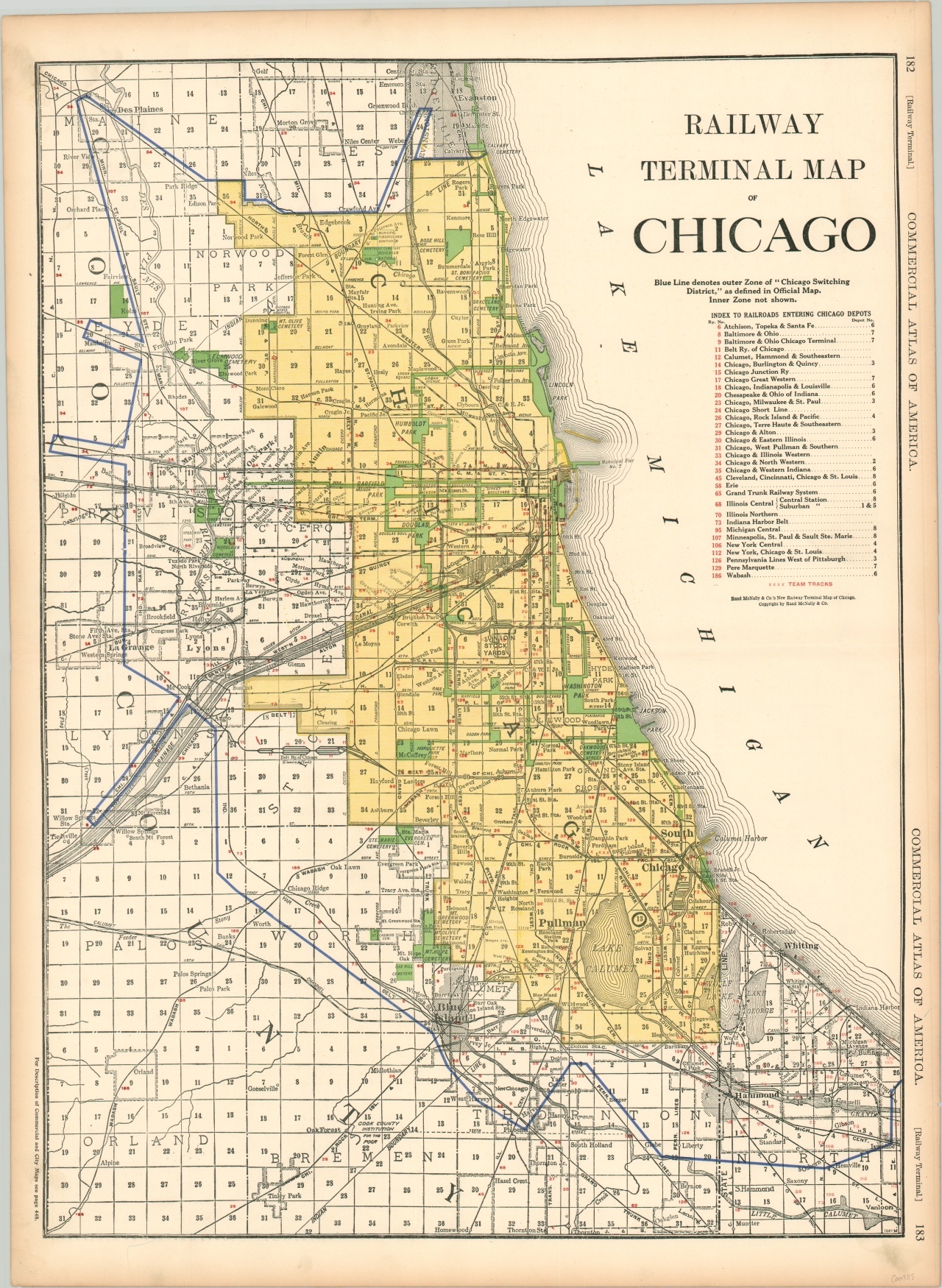
WWI-era map of Chicago’s complex network of railroads.
Out of stock
Description
Railways have played a huge role in the history of Chicago and this map, published during a time of significant industrialization in the city, highlights that fact well. Thirty-two separate rail lines are listed on the ‘Index to Railroads Entering Chicago Depots’ and large junctions can be seen around the Union Stock Yards, Chicago Belt Railway Clearing Yard, Pullman, the Lakefront, Calumet Harbor, and elsewhere. Team tracks, small spurs generally used to load freight, are also shown.
The boundaries of the Chicago Switching District is denoted using a thick blue line, and the city limits are highlighted in yellow. Contrasting against the industrial theme is the park and boulevard system, brightly colored in green.
Published in Chicago by Rand McNally as part of their Commercial Atlas of America in 1918.
Map Details
Publication Date: 1918
Author: Rand McNally
Sheet Width (in): 20.25
Sheet Height (in): 28
Condition: A-
Condition Description: Dirty fingerprints in the lower corners and toned in the outer margin, consistent with age. Creased along horizontal fold line. Good to very good condition overall.
Out of stock