Railroad Map of Wisconsin
$395.00
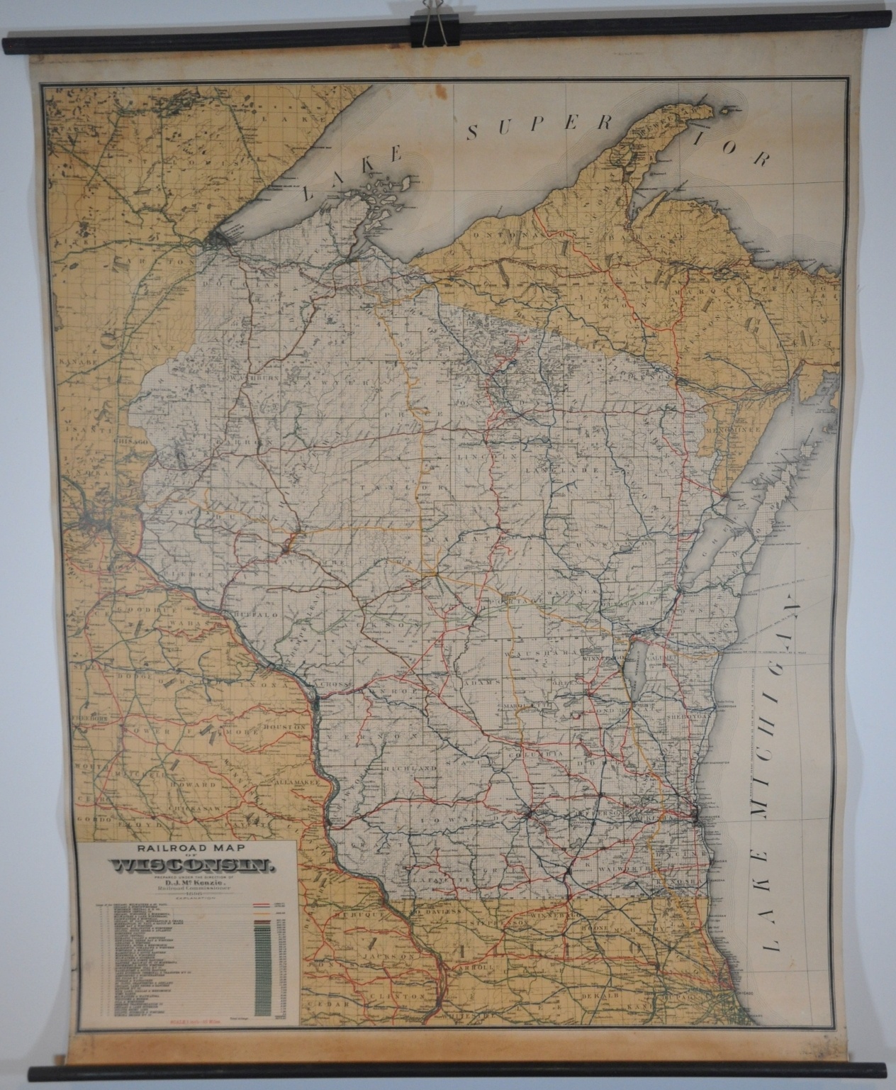
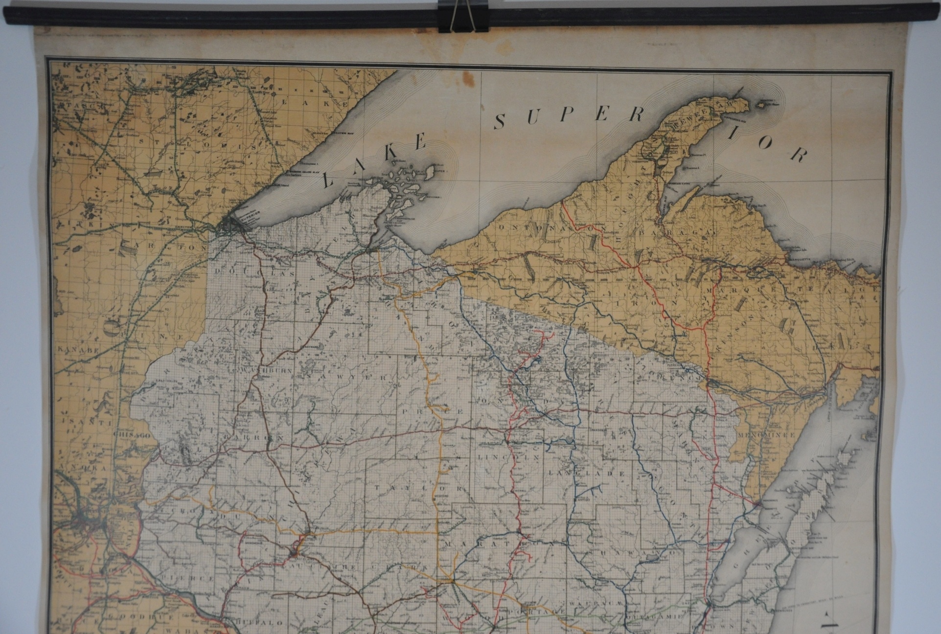
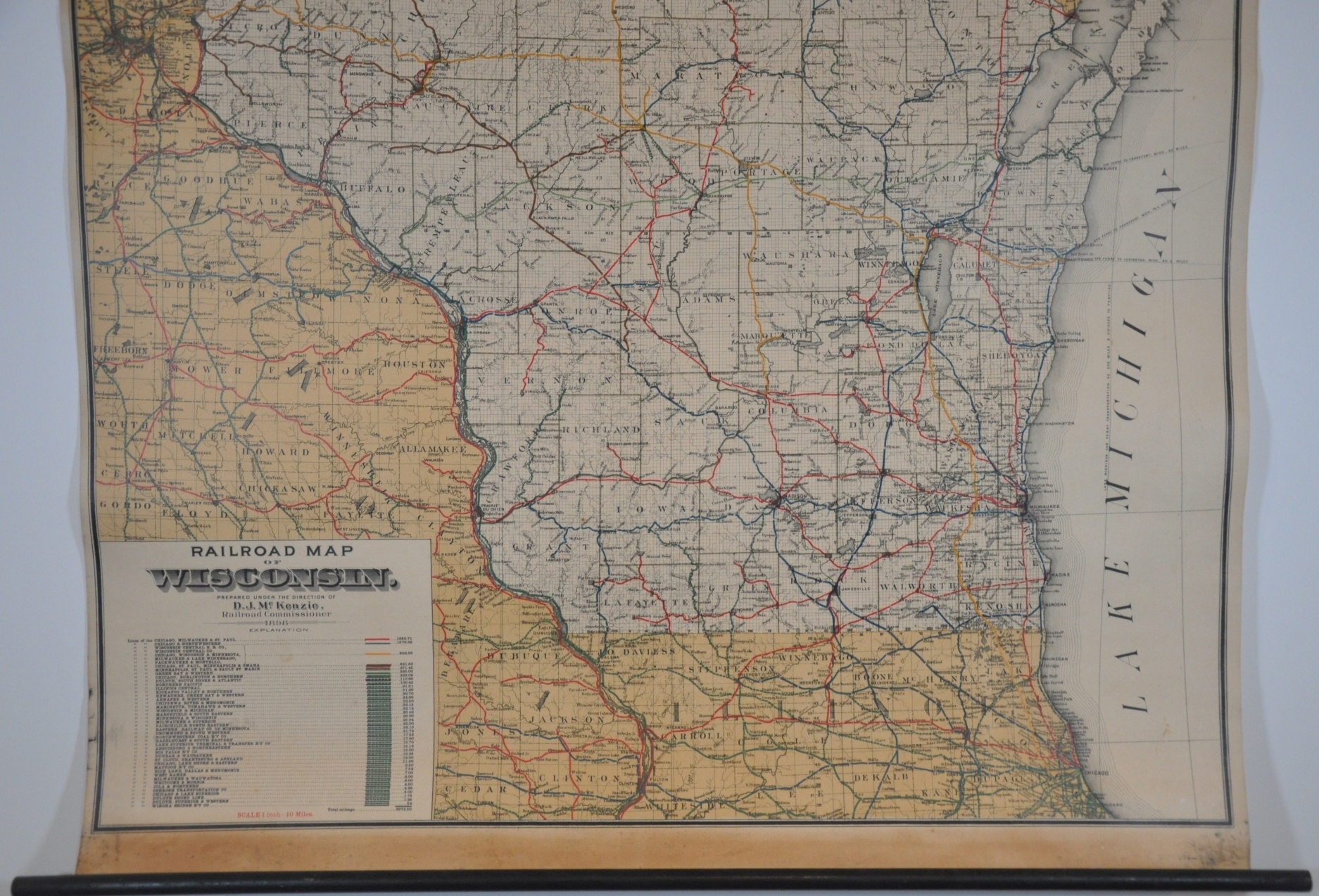
Wisconsin’s railroads at the close of the 19th century.
1 in stock
Description
This large wall map is a tremendous display of the railroad’s proliferation across Wisconsin during the second half of the 19th century. Lines are shown stretching to nearly every corner of the state, allowing for the easy transportation of commodities like wheat, lumber, and ore to market centers on the Mississippi and Great Lakes. Chicago is one such example and is also included in the image.
Forty-six separate railways are identified in the lower left, with the routes of the seven largest operators identified in custom colors. The total length of each company’s lines is provided as well, from the Chicago, Milwaukee & St. Paul (1,650) to the diminutive Winona Bridge Railway (54). In 1850, the state registered just five miles of operating railroads, whereas in 1898, that number had jumped to 6,372. The mileage would peak at around 7,500 during the 1920s.
The map was prepared under the direction of D.J. McKenzie and published in Milwaukee in 1898 by the Railroad Commission of Wisconsin.
Map Details
Publication Date: 1898
Author: D.J. McKenzie
Sheet Width (in): 34.00
Sheet Height (in): 42
Condition: A-
Condition Description: Large wall map mounted on linen and affixed to old wooden rollers, painted black. Strips of discoloration visible along the top and bottom of the sheet, with further soiling and dark spots in the lower corners (confined to the margin). A few spots across the image, including upper center, but overall the map remains in very good condition.
$395.00
1 in stock