
Q.R.L.H. & P.C.O. Plan of the City of Quebec
$110.00
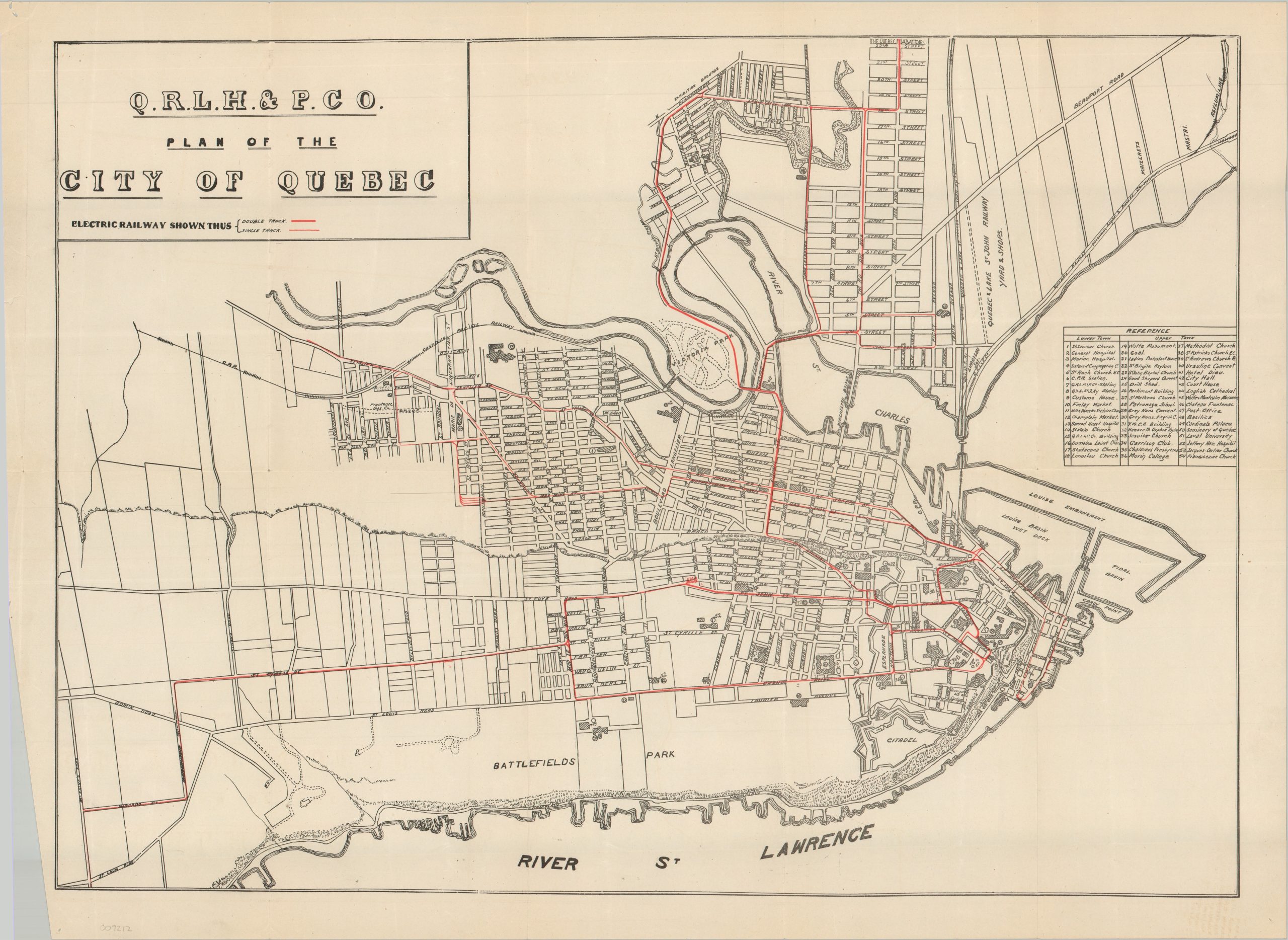
An uncommon overview of Quebec City’s interurban system in the early 20th century.
1 in stock
Description
This straightforward street plan of Quebec City, published around 1911, highlights the operational electric railway lines of the Quebec Railway, Light, Heat & Power Company. Single and double tracks are noted, while more than fifty locations of interest are numbered and identified in the corresponding key. Various other landmarks are labeled directly on the map, including the Exhibition Grounds, Battlefields Park, the Quebec, Lake & St. John Railway Yards, and the historic Citadel.
The work is undated, but it was likely issued shortly after Rodolphe Forget’s “Le Merger” consolidated a number of railway, street railway, gas, and electric companies into the Quebec Railway, Light, Heat & Power Company in late 1909. Forget assumed the presidency at the company’s inaugural board meeting in March 1910, making the map an interesting snapshot of the newly consolidated transportation and utility empire in Quebec.
Map Details
Publication Date: c. 1911
Author: Quebec Railway, Light, Heat & Power Company
Sheet Width (in): 23.75
Sheet Height (in): 17.25
Condition: B+
Condition Description: Single-sided street plan, creased along old folds and showing moderate wear in the left margin, including several tears and sharp wrinkles. A bit of extraneous creasing and pinholes in the corners. Good to very good condition overall.
$110.00
1 in stock