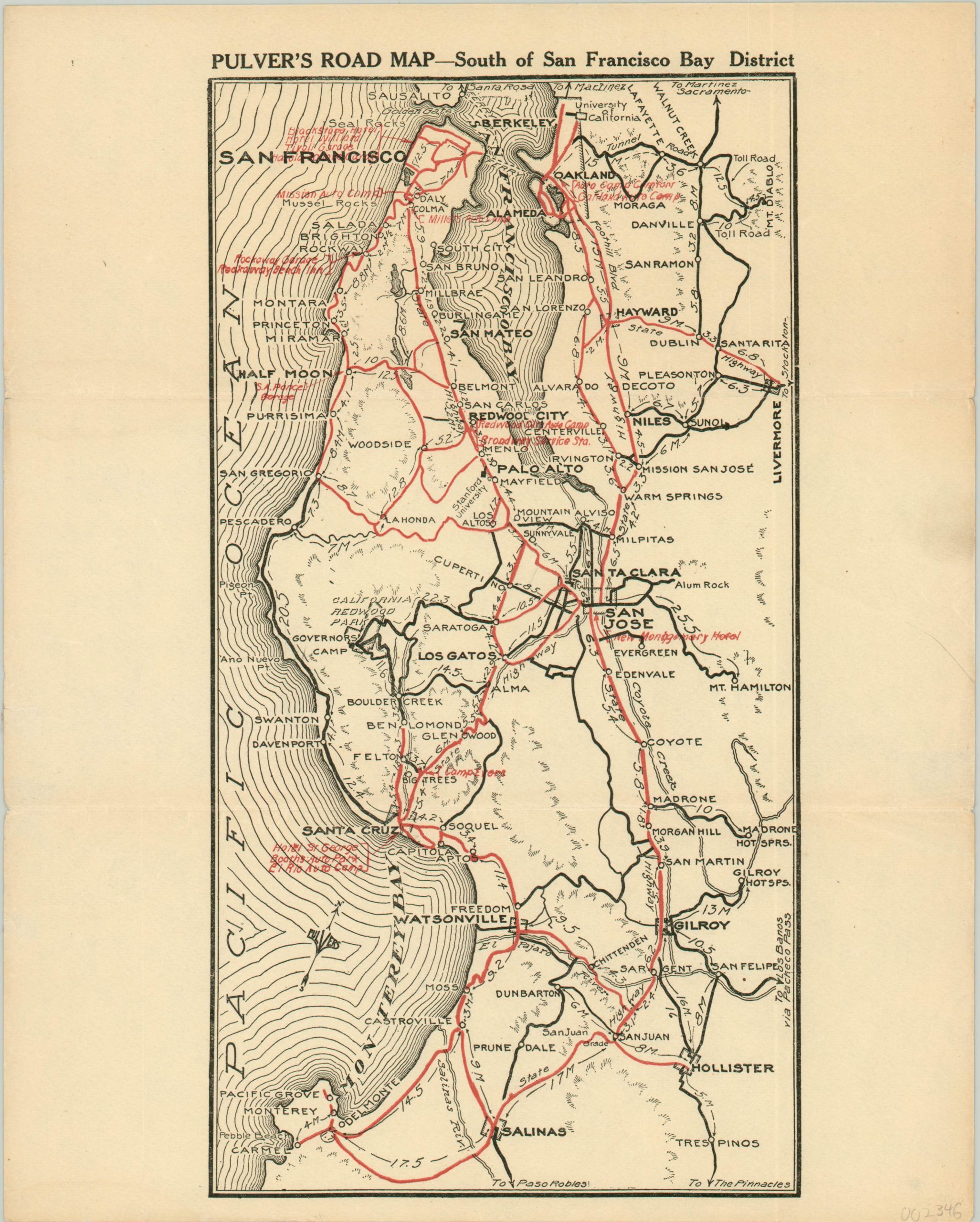
Pulver’s Road map – South of San Francisco Bay District
$75.00
Early road map of the southern Bay Area in California.
1 in stock
Description
This simple road map covers San Francisco’s Bay Area south of the city as far as Salinas and the Monterrey Peninsula. Certain routes are highlighted in red (likely of particular interest to the publisher), with distances between various points noted in miles. Locations of interest, especially to a motorist, are identified across several major urban areas. Garages, hotels, and auto parks are emphasized.
The map is dated using the presence of the new Montgomery Hotel in San Jose, which originally opened in 1911. Published around 1912 by Edward Pulver & Son.
Map Details
Publication Date: c. 1912
Author: Edward Pulver & Son
Sheet Width (in): 9.50
Sheet Height (in): 11.90
Condition: A-
Condition Description: Light creasing along two horizontal fold lines, with a bit of extraneous wrinkling in the right margin.
$75.00
1 in stock

