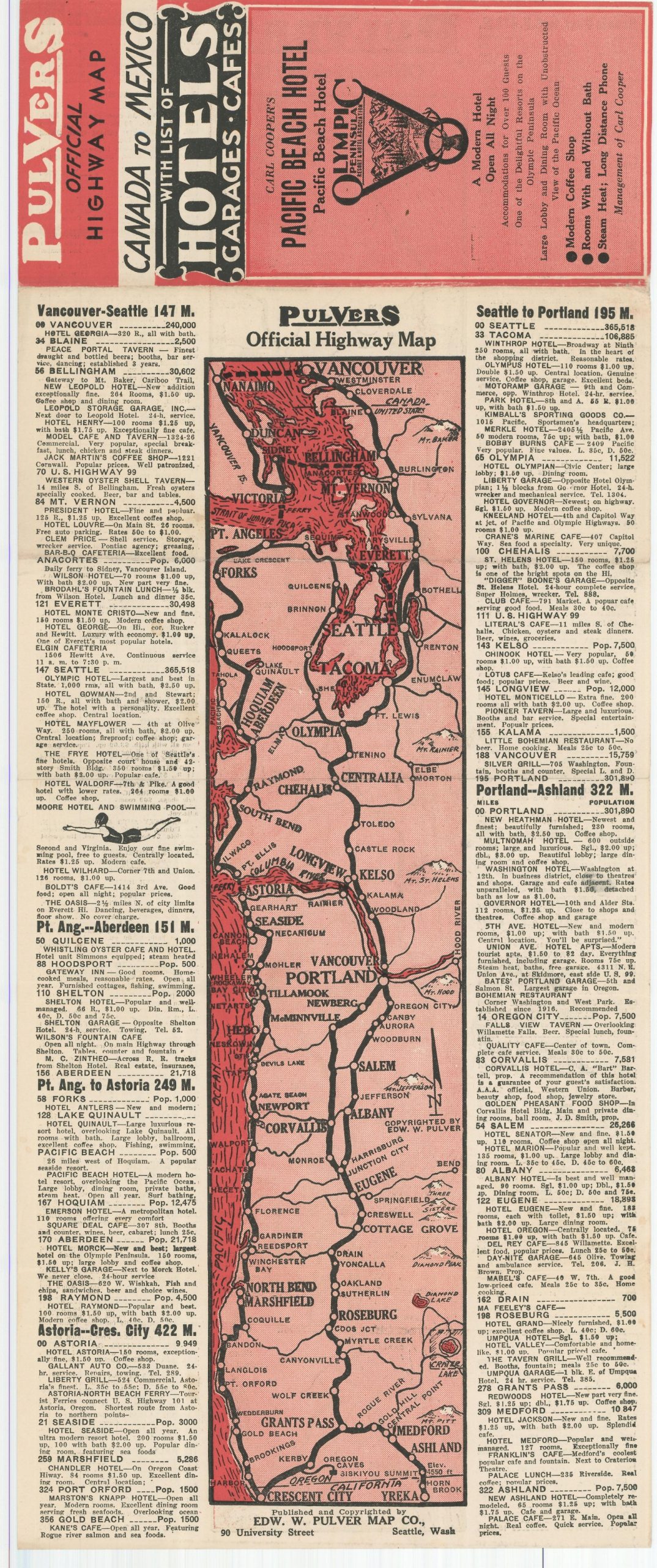
Pulvers Official Highway Map Canada to Mexico with list of Hotels Garages Cafes
$95.00
Hit the road along the West Coast from Vancouver to Tijuana.
1 in stock
Description
This fascinating Depression-era road map was published by the Edward Pulver Map Company of Seattle around 1930, based on the population statistics provided throughout. An advertisement on the front cover for Carl Cooper’s Pacific Beach Hotel on the Olympic Peninsula indicates Pulver’s maps were designed for distribution along the depicted region.
A relatively simple image shows the primary automobile routes from Vancouver, Canada to Tijuana, Mexico through western Washington, Oregon, and California. Strategically situated text on either side describes the roads and towns between major points in some detail, providing mileage, highway routes, and recommended traveler’s amenities like cafes, garages, and hotels. Of particular interest are the Alligator Farm and Ostrich Farm found outside of Los Angeles, the Olympic Hotel in Seattle (still operational today), and Palm Springs (population: 200).
Map Details
Publication Date: c. 1930
Author: Edward W. Pulver
Sheet Width (in): 7.9
Sheet Height (in): 19
Condition: A
Condition Description: Double-sided folding brochure with light wear and creasing along the fold lines and outer edges. Very good to near fine overall.
$95.00
1 in stock


