
Pulver’s Auto Highway Map of Washington
$75.00
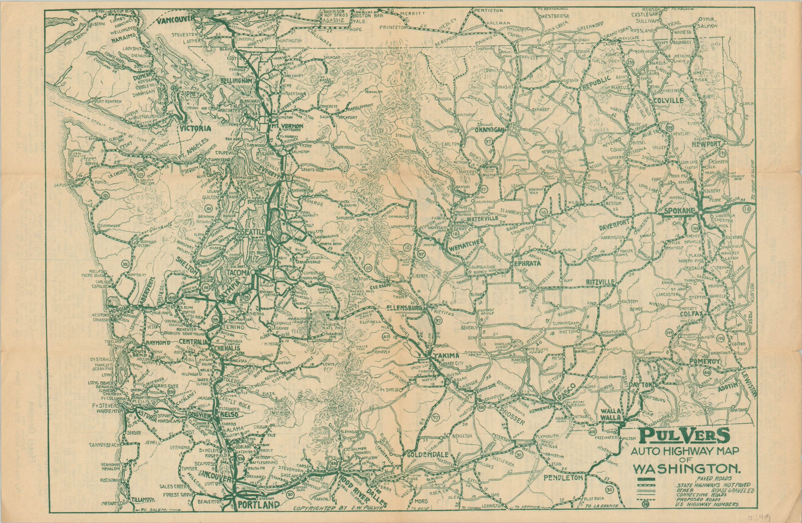
Road map of Washington advertising the opening of the Naches Pass through Rainier National Park.
1 in stock
Description
This detailed map of Washington and a sliver of southern Canada was published in the early 1930’s by E.W. Pulver of Seattle. The emphasis is on the statewide road network; with paved, graveled, connecting, and proposed roads outlined according to the legend below the title. U.S. Highways are numbered where applicable, and distances (in miles) are noted between points.
The verso features a tourists’ directory noting the locations of accommodations, points of interest, and transportation depots across the state. A panel also advertises the new opening of the Naches Pass through Rainier National Park. The route, later renamed Mather Memorial Parkway, was completed in 1932.
Map Details
Publication Date: c. 1932
Author: Edward Pulver & Son
Sheet Width (in): 15.75
Sheet Height (in):
Condition: B+
Condition Description: Light soiling and creasing along originally issued fold lines. Faint toning down the centerfold and along the outer edges of the sheet, but overall remains in good to very good condition.
$75.00
1 in stock