Puget Sound and San Juan Islands
$250.00
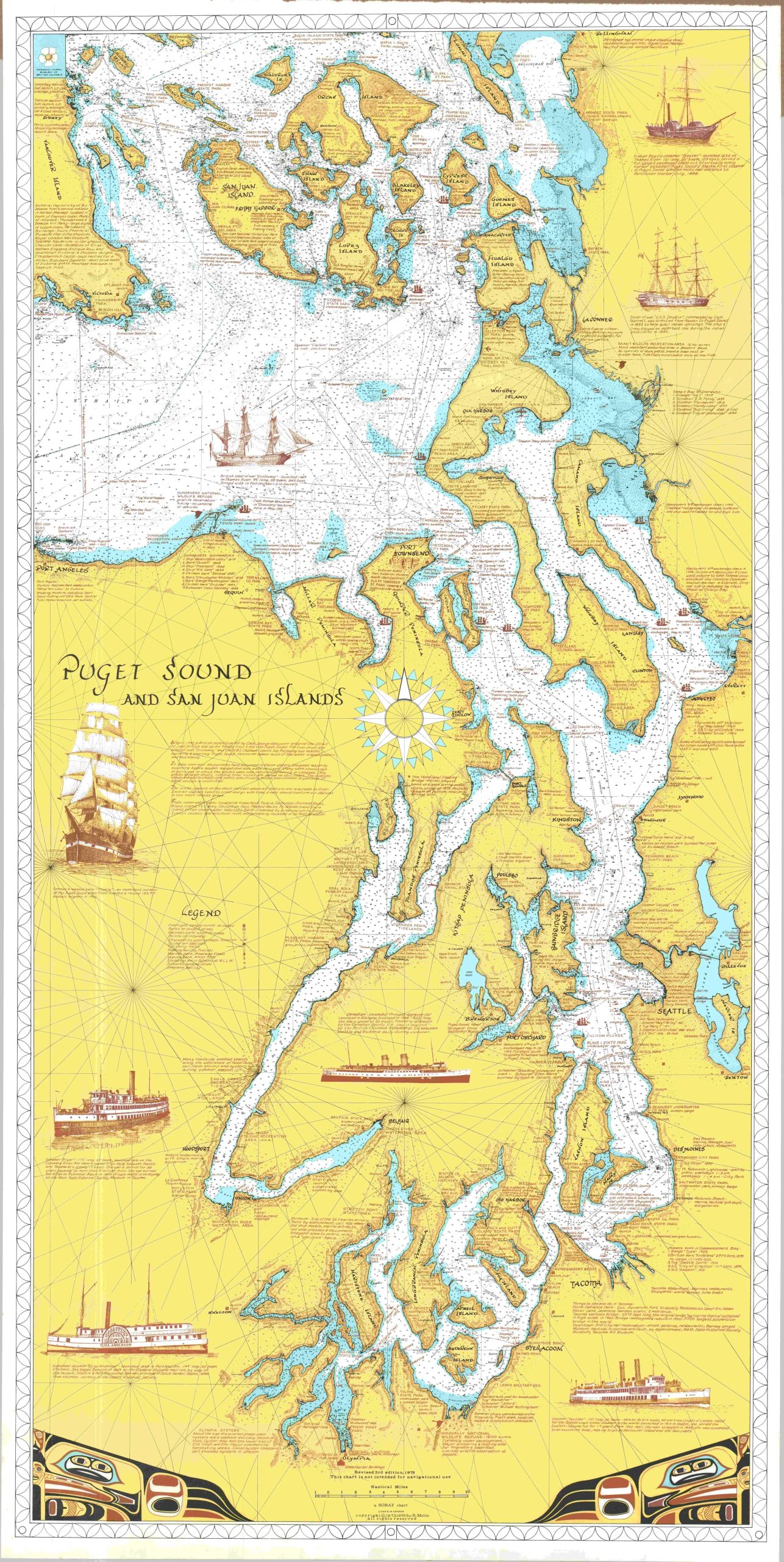
A beautiful coastal chart of Puget Sound that measures almost five feet long!
1 in stock
Description
This huge chart of Washington State’s Puget Sound covers the area between Olympia in the south to Bellingham in the north, and includes the southeastern tip of Canada’s Vancouver Island. Apart from standard maritime information like depth soundings (in fathoms), navigational beacons, buoys, anchorages, and shipping traffic lines, the map presents a wealth of fascinating information of interest to the tourist and local alike. Shipwreck sites, of which there are allegedly over four hundred, are indicated, along with the locations of campgrounds, picnic areas, and other points of interest.
Countless annotations and blocks of text provide background on historical sites, geographic details, and local attractions. Illustrations of several former and active ships on the Puget Sound are also visible in the negative spaces. These include sailing sloops like the H.M.S. Discovery and U.S.S Decatur, steam liners like the Princess Marguerite and Flyer, and cargo vessels such as the Hudson Bay Company steamer Beaver and the German Thekla.
The map was designed and copyrighted by R.O. Malin and originally published by Sobay in 1973. This is the revised third edition, updated to 1979. Lithographed in Canada.
Map Details
Publication Date: 1979
Author: R.O. Malin
Sheet Width (in): 29.75
Sheet Height (in): 53.00
Condition: A
Condition Description: Large color printed map on a single-sided sheet. Faintly wrinkled in a few spots, where previously rolled, but overall in very good to near fine condition.
$250.00
1 in stock