
Prospective Maritime Jurisdictions in the Polar Seas
An apparently impartial survey regarding territorial sovereignty around the North and South poles.
Out of stock
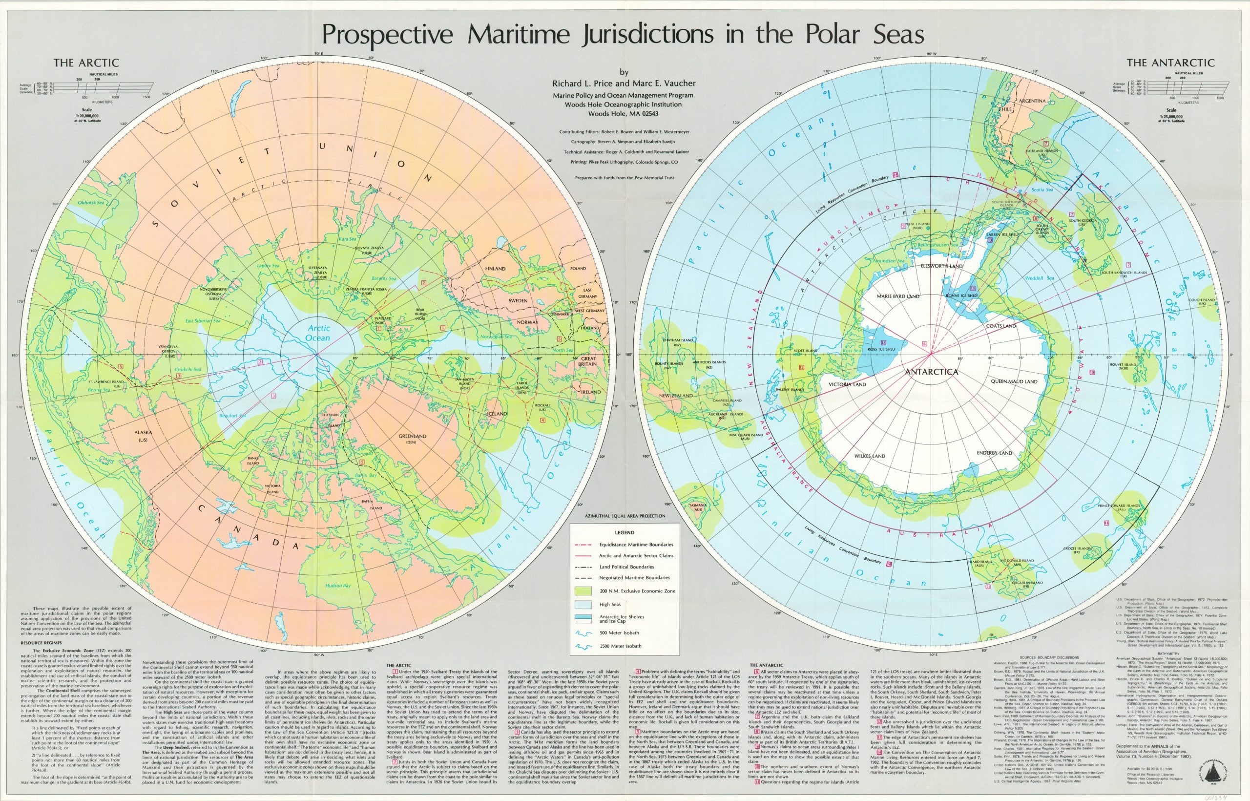
Description
This scholarly map was produced as a joint effort between numerous entities in 1983 as a way to define maritime jurisdictions in the Arctic Circle and around Antarctica. Boundaries, territorial claims, and political borders are outlined along with ice flow, economic zones, and the high seas regions. Text at the bottom of the sheet outlines the governing bodies, historical organization, and unresolved issues.
Though the map was published during the Cold War, the problems identified within the map and accompanying text continue to grow with ever-increasing global warming. Published in 1983 as a supplement to the Annals of the Association of American Geographers by members of the Woods Hole Oceanographic Institution.
Map Details
Publication Date: 1983
Author: Richard Price and Mark Vaucher
Sheet Width (in): 37.50
Sheet Height (in): 23.75
Condition: A
Condition Description: Near fine condition, with creasing along originally issued fold lines.
Out of stock