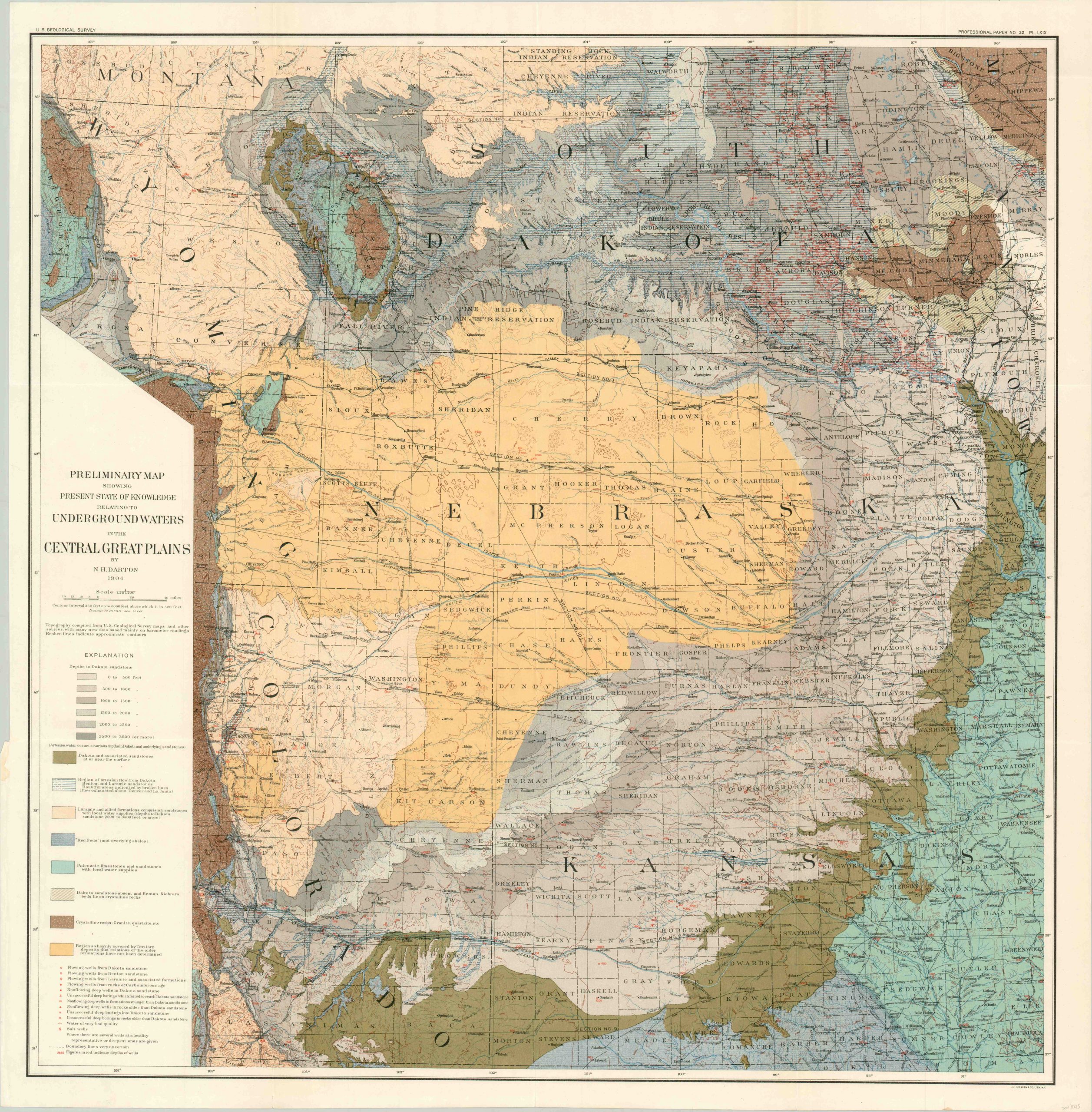
Preliminary Map Showing Present State of Knowledge Relating to Underground Waters in the Central Great Plains
$110.00
Early 20th century USGS survey of the geographic composition of the Great Plains.
1 in stock
Description
Water has been an important consideration on the Great Plains ever since it was first inhabited by indigenous populations thousands of years ago. Today it is no different, especially given the region’s robust agricultural output.
This map, published by the United States Geological Survey in 1904, shows the state of federal geographic understanding at the beginning of the 20th century. Vibrant lithographic color identifies the geologic composition and depth while contours provide topographic data. The location of wells and borings are also noted, along with their depths.
Of particular note are the shallower wells that can be found in Nebraska, versus those dug further east, likely resulting from the massive Ogallala Aquifer. This shallow water table aquifer is one of the largest in the world, at nearly 175,000 square miles, and was discovered in 1898 by N.H. Darton, the geologist who prepared this map for publication.
Map Details
Publication Date: 1904
Author: N.H. Darton
Sheet Width (in): 32.00
Sheet Height (in): 33.00
Condition: A
Condition Description: A bit of creasing and wear along fold lines, but in near fine condition overall.
$110.00
1 in stock

