Preliminary Comprehensive City Plan of Chicago
$350.00
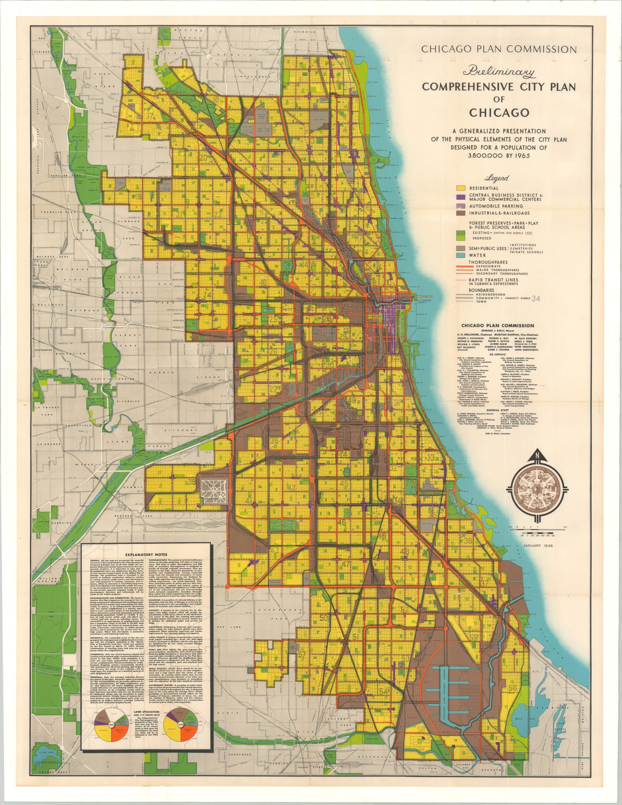
“A generalized presentation of the physical elements of the city plan designed for a population of 3,800,000 by 1965.”
1 in stock
Description
This interesting postwar map of Chicago uses a vibrant palette of colors to highlight the City Planning Commission’s vision for the future – namely, how they hope to improve the physical footprint of the city and reduce vacancy almost entirely by 1965. According to a contemporary Chicago Tribune article, ” The plan “envisions a city of 514 neighborhoods surrounded by a framework of thorofares, edges of industrial areas, and public lands. The neighborhoods, in turn, will be incorporated into 59 communities, each a small city of 50,000 to 80,000 residents. Each will contain a high school, a large park and athletic play field, and a major shopping center.”
Various land uses such as residential, commercial, transportation, and forest preserves are noted according to the legend in the center right. Proposed updates take the form of new expressways and public transit options, a centralized government center in the West Loop, increasing the number and size of parks, and a new Chicago airport (visible in the northwest). Explanatory notes in the lower left provide additional details and two pie charts that compare the various ratios of land use in 1940 and 1965.
The map was designed and published by the Chicago Plan Commission in January of 1946.
Source: Connecting the Windy City
Map Details
Publication Date: 1946
Author: Chicago Plan Commission
Sheet Width (in): 38.1
Sheet Height (in): 49.8
Condition: A
Condition Description: Formerly folded, now flattened and mounted to a sheet of linen for preservation and stability. Very faint wear along fold lines and scattered soiling in the upper right corner, but in very good to near fine condition overall.
$350.00
1 in stock