Preliminary Chart of Hudson River Sheet No. 3 From Poughkeepsie to Troy New York
$95.00
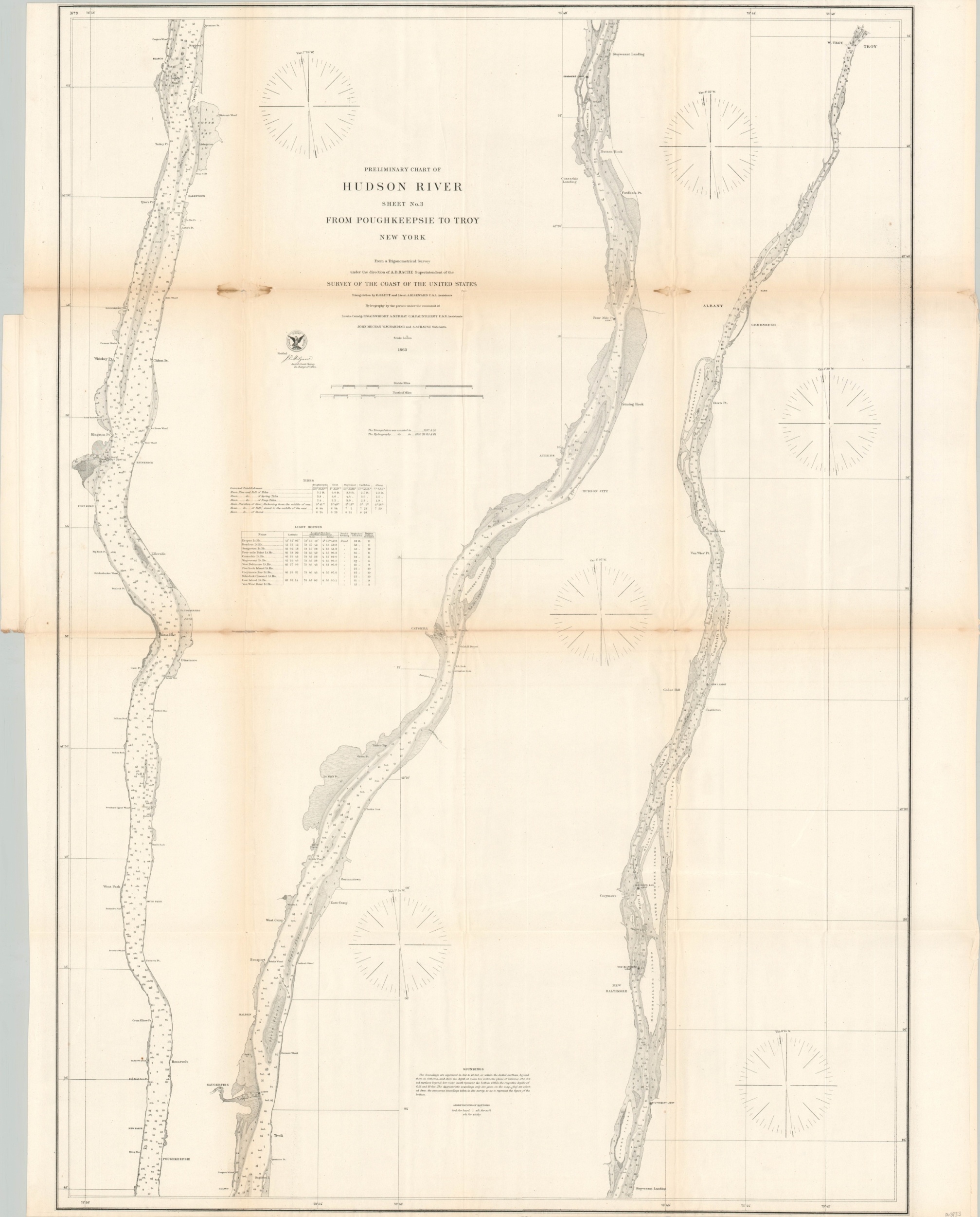
Civil-war era maritime chart of the Hudson River.
1 in stock
Description
This detailed navigational survey charts the course of the Hudson River between Poughkeepsie (lower left) and Troy, New York (upper right). Depth sounds are provided in feet (up to 18 ft) or fathoms (deeper than 18 ft) and the composition of the riverbed is noted as hard, soft, or sticky. Important geographic landmarks, piers & wharves, settlements, and navigational beacons are identified throughout. A tidal table for five cities and list of lighthouses is also provided.
The map was compiled the United States Coast Survey under the direction of A.D. Bache and published in 1863. Triangulation calculations were performed by E. Blunt and A.H. Seward in 1857-58, while hydrographic data was collected by R. Wainwright, A. Murray, and C.M. Fauntleroy between 1858 and 1861.
Source: Hudson River Valley Institute
Map Details
Publication Date: 1863
Author: A.D. Bache
Sheet Width (in): 31
Sheet Height (in): 39.5
Condition: B
Condition Description: Moderate wear and discoloration along originally issued fold lines, including two offsetting damp stains near the upper quarter of the page. Several spots of separation have been repaired on the verso with archival tape, though small edge tears and holes at fold intersections remain.
$95.00
1 in stock