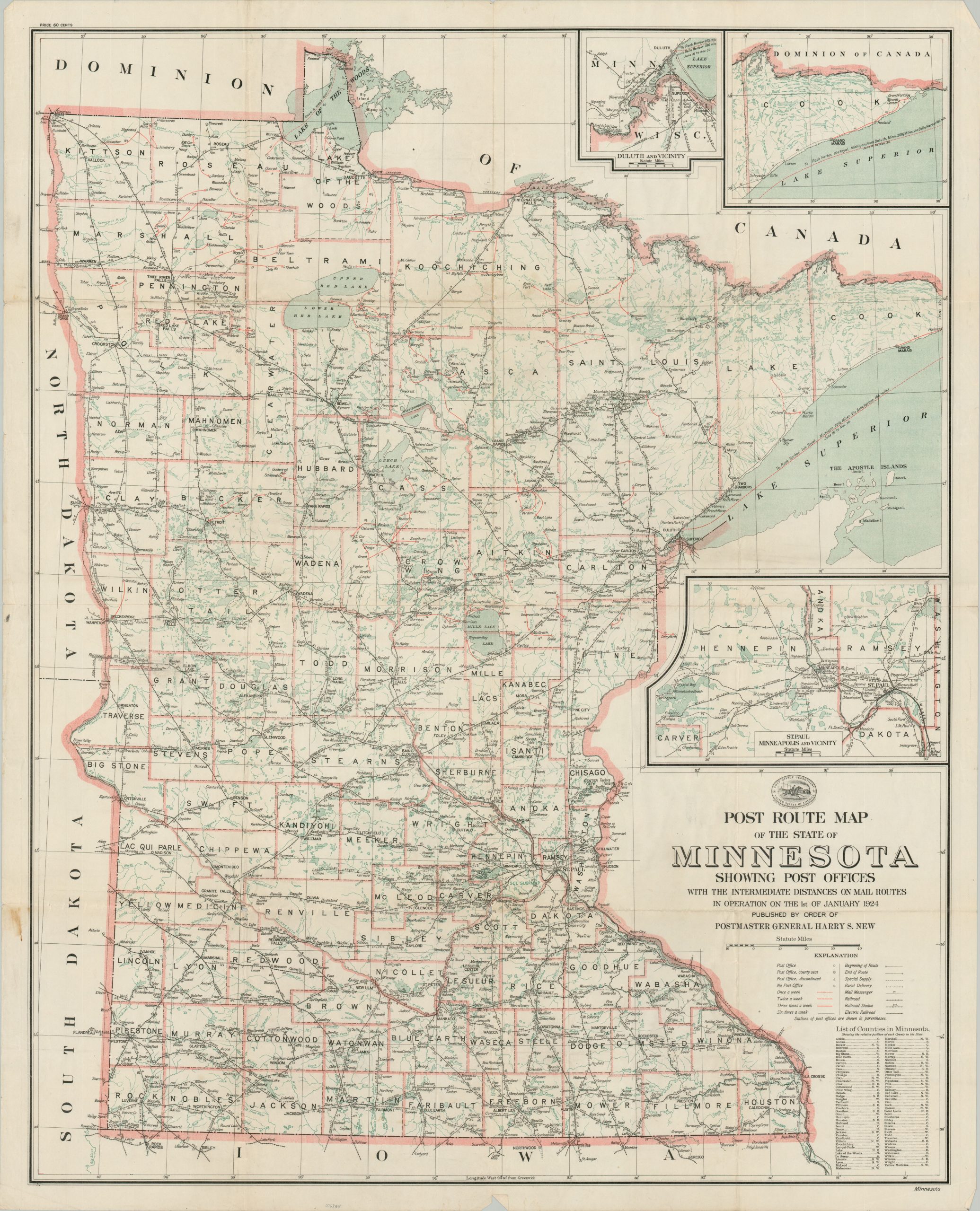
Post Route Map of the State of Minnesota
$95.00
The postal infrastructure of Minnesota during the mid-1920s.
1 in stock
Description
This uncommon map of Minnesota was published in 1924 by the United States Post Office Department under the authority of Postmaster General Harry S. New. The image highlights the delivery capacity of the post office across the vast ‘Land of 10,000 Lakes’, ranging in frequency from once to six times per week.
Towns are labeled according to their post office status. Delivery routes (including rural and special supply) are noted according to the legend in the lower right. Electric and steam railroads are also shown. Insets offer further details on the area around the Twin Cities and Duluth.
Map Details
Publication Date: 1924
Author: Harry S. New
Sheet Width (in): 36.5
Sheet Height (in): 45.25
Condition: A-
Condition Description: Color printed map on a single, large sheet (blank on verso). Some wear along old fold lines including scattered toning, moderate creasing, and a few spots of clean separation at fold intersections. Further wear and scattered staining visible in the margins. Very good overall.
$95.00
1 in stock