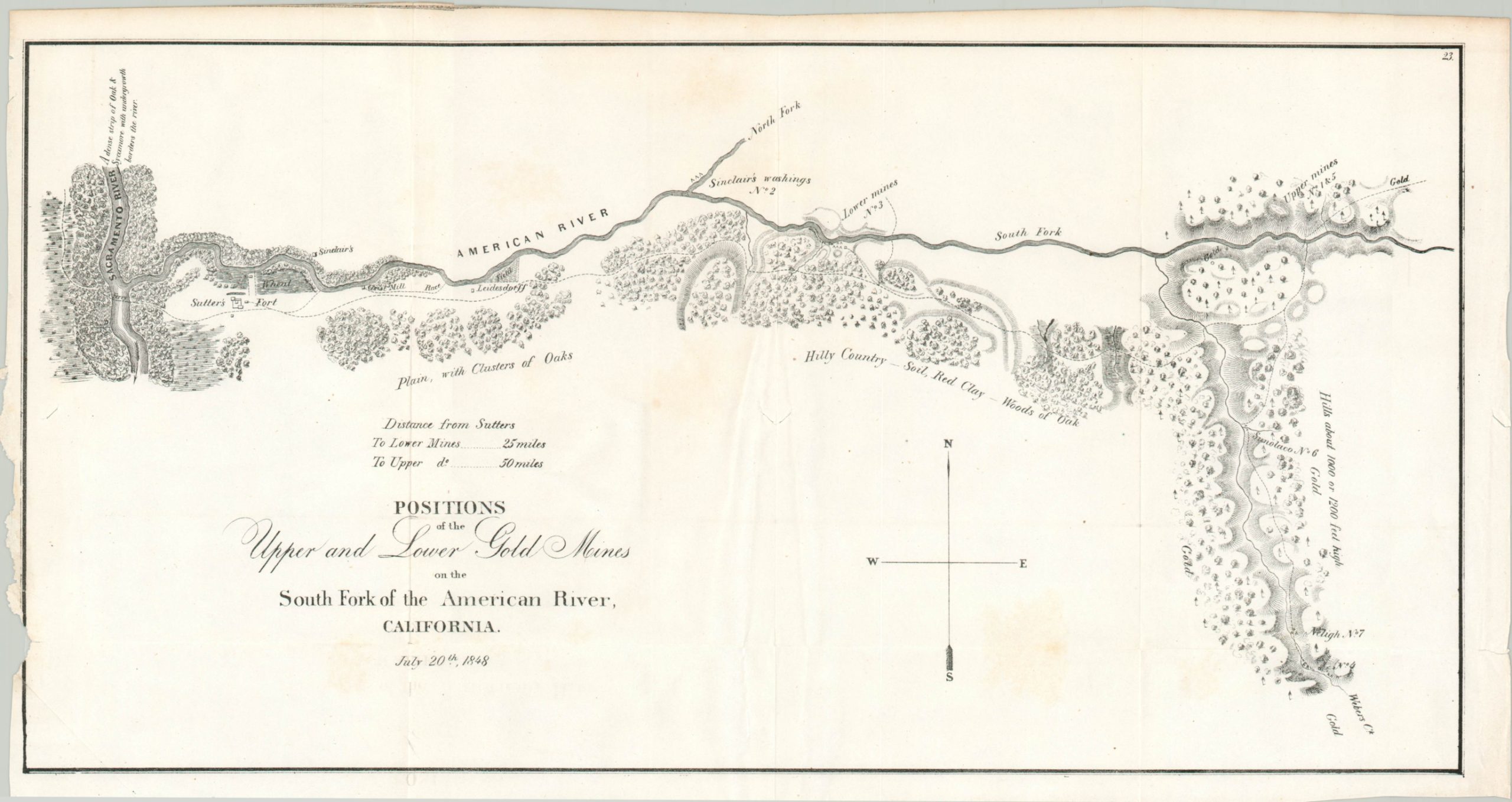
Positions of the Upper and Lower Gold Mines on the South Fork of the American River, California
$295.00
Mapping the California Gold Rush by William Tecumseh Sherman.
1 in stock
Description
The California Gold Rush was one of the most iconic eras in the history of the American West. In 1848, James Marshall found traces of gold while he was constructing a mill on the American River for John Sutter. He took his discovery to Sutter and the two decided to keep it a secret while mineral rights to the area were secured.
However, by March whispers of treasure began to circulate in San Francisco and in December President Polk confirmed its existence, reporting ‘there were about 4,000 persons engaged in collecting gold’ and ‘the explorations already made warrant the belief that the supply is very large and that gold is found at various places in an extensive district of the country.’ It can see how this encouraging news would prompt the subsequent Gold Rush and the thousands of ‘forty-niners’ who made their way west in 1849.
This is a nice example of one of the first printed maps to show the early claims. Sutter’s Fort is shown near the juncture of the American and Sacramento Rivers, while the mill is a bit further upriver. Land claims, washings, a and mines are labeled throughout the well-forested area. Topography is depicted in hachure and gold is tantalizingly splashed across several spots to the east.
The map was drawn by William Tecumseh Sherman, of later Civil War fame, as one of three he produced during a tour of the gold fields in the summer of 1848. It was published by the Government Printing Office and included in a congressional copy of President Polk’s 1848 report to Congress.
A fascinating promotional piece that played a direct role in the early dissemination of news about the Gold Rush.
Sources: Friis (Federal Exploration of the American West Before 1800) pg. 13; Polk’s Message to Congress; Discovery of Gold (Library of Congress)
Map Details
Publication Date: 1848
Author: William T. Sherman
Sheet Width (in): 18.75
Sheet Height (in): 10.1
Condition: B+
Condition Description: Lightly creasing along originally issued fold lines and a ragged left binding edge has a few tears, one of which just enters the plate line. One or two small separations within the sheet have been repaired on the verso.
$295.00
1 in stock

