
Poli Arctici, et Circumiacentium Terrarum Descriptio Novissima
$2,000.00
An incredible synthesis of Arctic geography and commercial interests from the mid-17th century.
1 in stock
Description
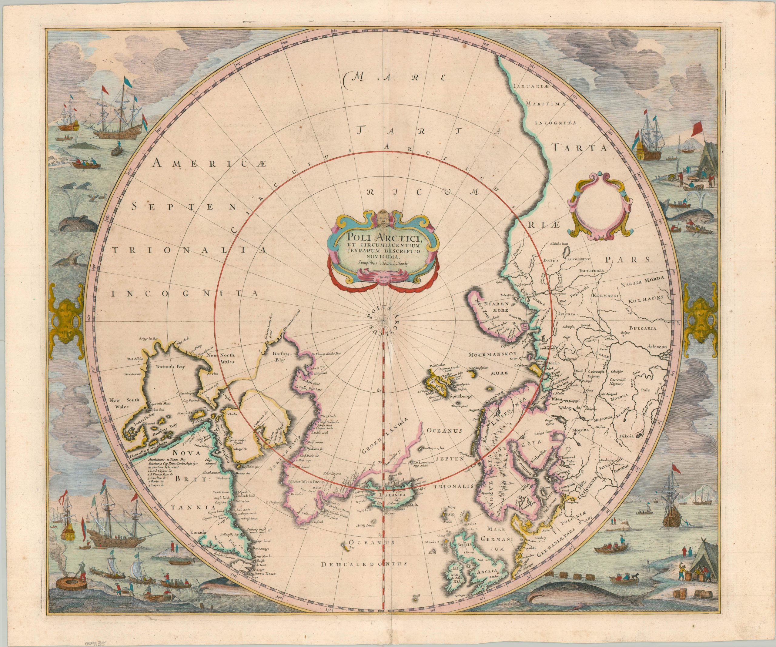
This striking polar map presents the Arctic world from approximately 50° north latitude, centered on the North Pole and extending across northern Europe, Asia, Greenland, and North America. Engraved by Henricus Hondius and first published in 1636, it replaced Gerard Mercator’s influential but increasingly outdated 1595 map of the Arctic. Hondius incorporated the latest geographical information from the rapidly expanding exploration of the Northwest and Northeast Passages, producing one of the most important Dutch maps of the Arctic issued during the first half of the seventeenth century. This example, the third state, dates to the late 1630s or c. 1640, when the map was being issued in the French editions of Hondius and Janssonius atlases.
Hondius drew particularly upon English exploration. The outline of Hudson Bay derives substantially from Henry Briggs’ 1625 map, while Thomas James’ 1633 expedition supplied additional information along the western coast. Baffin Island is correctly treated as an island, while the passage westward remains unresolved, leaving much of northwestern North America tantalizingly open. The map also incorporates the competing ambitions of English and Dutch navigators: eastern Greenland bears names such as “M. Forbishers Strete,” “Q. Elisabeths Forland,” and “London Coast,” while the Labrador coast carries Dutch names including “Orange Bay” and “Hollantsche Bay.” The Northeast Passage likewise remains an active geographical question, with incomplete coastlines around Novaya Zemlya and Spitsbergen reflecting the limits of contemporary knowledge.
The surrounding vignettes are among the map’s most memorable features, depicting Dutch whalers pursuing whales and walrus in the Arctic seas, hauling their catches ashore, and processing the animals for oil and other products. They reflect the rapidly expanding Dutch whaling industry around Spitsbergen, Greenland, and Labrador, which was itself an important source of new geographic information. Other notable details include Iceland and erupting Mount Hekla, the elusive island of Brasil west of Ireland, the still partly unknown coast of eastern Tartary, and the numerous bays and waterways identified along the North American Arctic.
Map Details
Publication Date: c. 1640
Author: Henricus Hondius
Sheet Width (in): 22.26
Sheet Height (in): 18.60
Condition: A-
Condition Description: Beautiful example, a striking copperplate engraving with modern hand color on a strong sheet. A bit of archival reinforcement along the centerfold, some light marginal soiling, and archival hinge tape on the verso (which shows French text). Good to very good condition overall.
$2,000.00
1 in stock