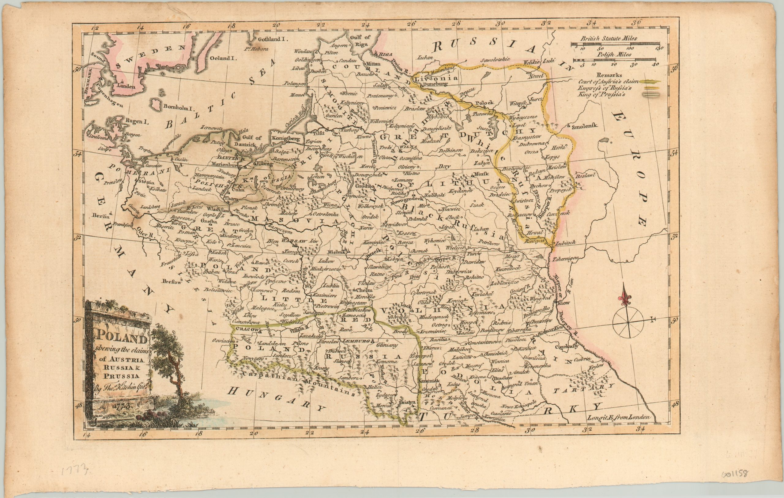
Poland Shewing the claims of Austria, Russia & Prussia
$125.00
Kitchin’s map showing the results from the first partition of Poland.
1 in stock
Description
Despite being a powerful political and military player throughout much of the 17th century, the Polish-Lithuanian Commonwealth begin a steep decline in the first decades of the 1700’s. Situated at the junction between the great powers of Austria, Russia, and Prussia, the federation was subjected to numerous wars and often at the mercy of the perceived balance of power on the continent.
Unable to defend itself and with hostile enemies within its borders, the Polish parliament agreed to cede certain areas of territory to the primary belligerents in what is known as the First Partition of Poland (1772). Thomas Kitchin published this map the following year, showing the extent of the claims imposed by Russia, Prussia, and Austria. Despite losing almost 20% of its territory, the Commonwealth would continue to exist until the third, and final 18th century partition, in 1795.
Map Details
Publication Date: 1773
Author: Thomas Kitchin
Sheet Width (in): 13.6
Sheet Height (in): 8.5
Condition: A-
Condition Description: Soiling in the margins and along the outer edges. The sheet is slightly toned with uneven outer edges. Remains in excellent condition, with lovely hand color.
$125.00
1 in stock

