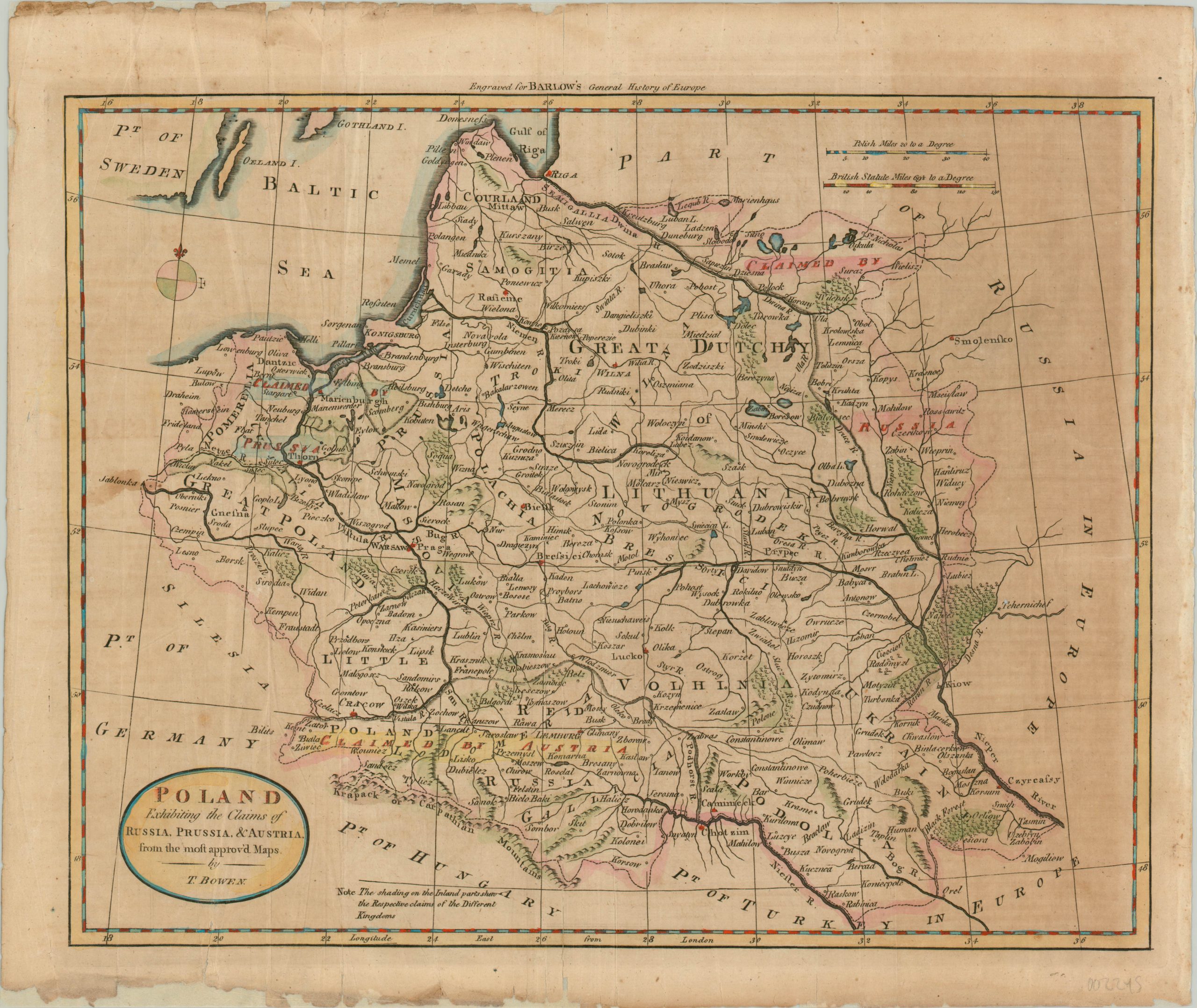
Poland Exhibiting the Claims of Russia, Prussia, & Austria.
Hand colored map showing the territorial claims from the First Partition of Poland.
Out of stock
Description
Russia’s ascendency in the mid-18th century worried its neighbors on the European continent, and a series of successful conquests against the weakening Ottoman Empire led Austria to the brink of war. Frederick the Great of Prussia was wary of becoming involved in such a conflict, and instead directed attention towards a possible alternative.
The Prussian king suggested that each of the three nations take a portion of Poland to retain the balance of power, and eventually an agreement was reached in 1772 which the Polish leader was forced to ratify the following year. This map shows the claims of Russia, Prussia, and Austria about a decade after they were obtained.
Pink, blue, and yellow color respectively highlights the general areas, while shaded borders reflect the outline of the acquired territory. Unfortunately for Poland, these forced transfers were not enough to satiate imperial ambitions, and subsequent partitions in 1793 and 1795 would eventually lead to the temporary dissolution of the country.
Engraved by Thomas Bowen in London for inclusion in Barlow’s General History of Europe.
Map Details
Publication Date: c. 1780
Author: Thomas Bowen
Sheet Width (in): 17.75
Sheet Height (in): 15.00
Condition: C
Condition Description: Heavy toning on the right side of the sheet and several areas of staining and discoloration elsewhere within the image. A raggedy margin has been shorn up with archival tape, and the map is brightened up a bit by some lovely hand color.
Out of stock

