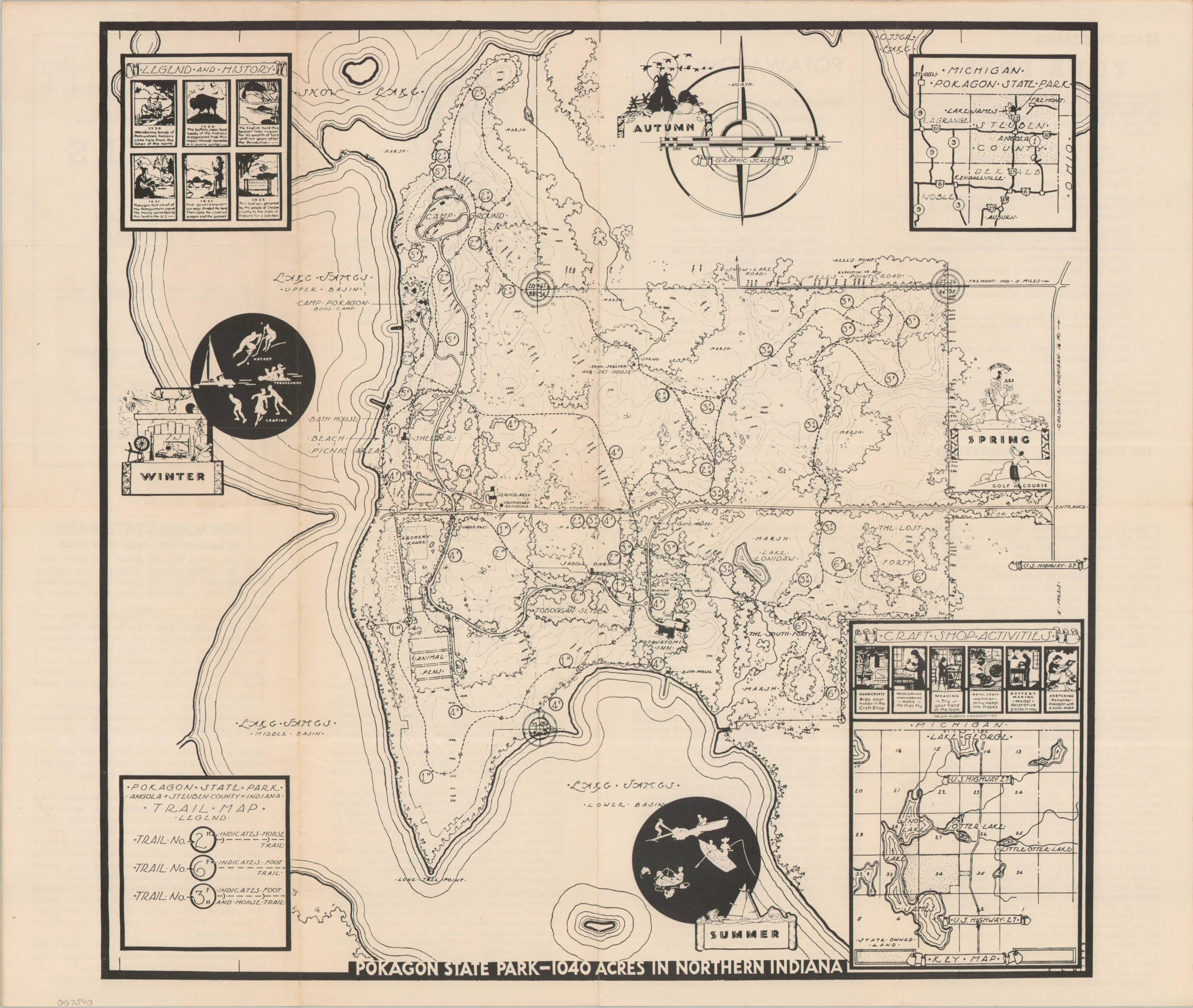
Pokagon State Park – 1040 Acres in Northern Indiana
A detailed map of Pokagon State Park, about 15 years after it was first established.
Out of stock
Description
This charming map showcases all there is to see and do at Indiana’s Pokagon State Park. Three different hiking trails are shown snaking through the archery range, animal pens, toboggan slide, historic Potawatomi Inn, and numerous other visitor amenities. Local ‘Legends and History’ is offered in the upper left, while the four edges highlight recreational opportunities for each of the seasons.
Vignettes attributed to Helen Aldrich Swenson in 1937, according to fine text in the lower right inset. The lower right border contains the initials E.L.N. and the date 1939, from which the publication year was derived.
Interestingly, the descriptive text on the verso appears to be outdated, as it lists the parks’ acreage at 937 (vs. the 1,044 acres in the map’s title). During the period, the park was home to members of the Civilian Conservation Corps, who contributed significantly to its lasting beautification and permanent structures.
Map Details
Publication Date: 1939
Author: Indiana Conservation Department
Sheet Width (in): 18
Sheet Height (in): 14.25
Condition: A-
Condition Description: Double-sided folding trail map with toning on the front covers that does not affect the image. Light wear along old folds and in the margins. Very good overall.
Out of stock