Pocket Map of the United States and Uncle Sam’s Family Tree
“Valuable Information for Yourself and the Boys and Girls” – front cover
Out of stock
Description
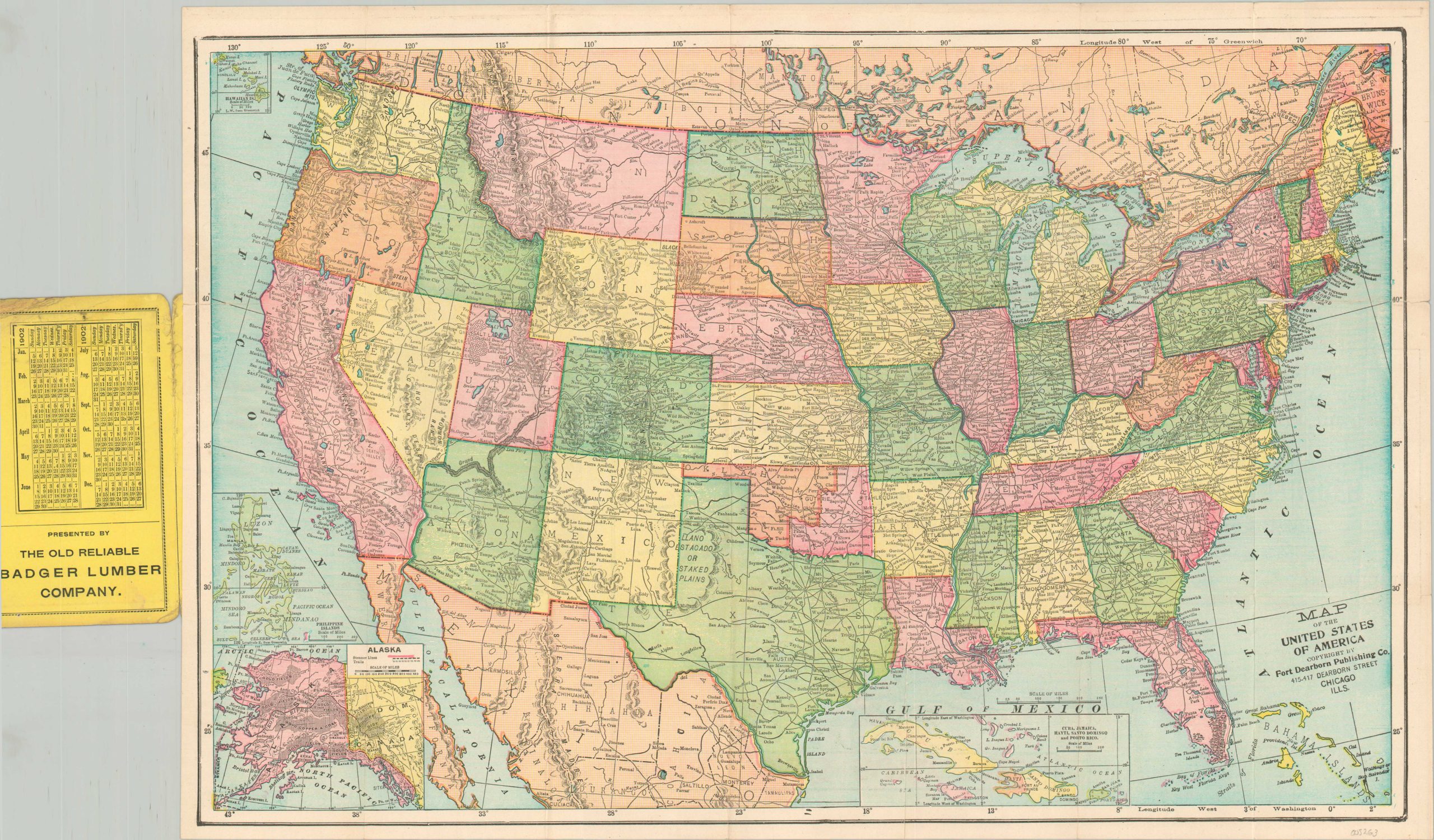
This intriguing pocket map of the United States, presented by the Old Reliable Badger Lumber Company of Kansas City, MO, provides an exceptionally detailed snapshot of the nation at the turn of the 20th century. The primary image, copywritten by the Fort Dearborn Publishing Company of Chicago, shows the continental U.S. in vibrant lithographed colors, with a large network of railroads connecting the country from coast to coast.
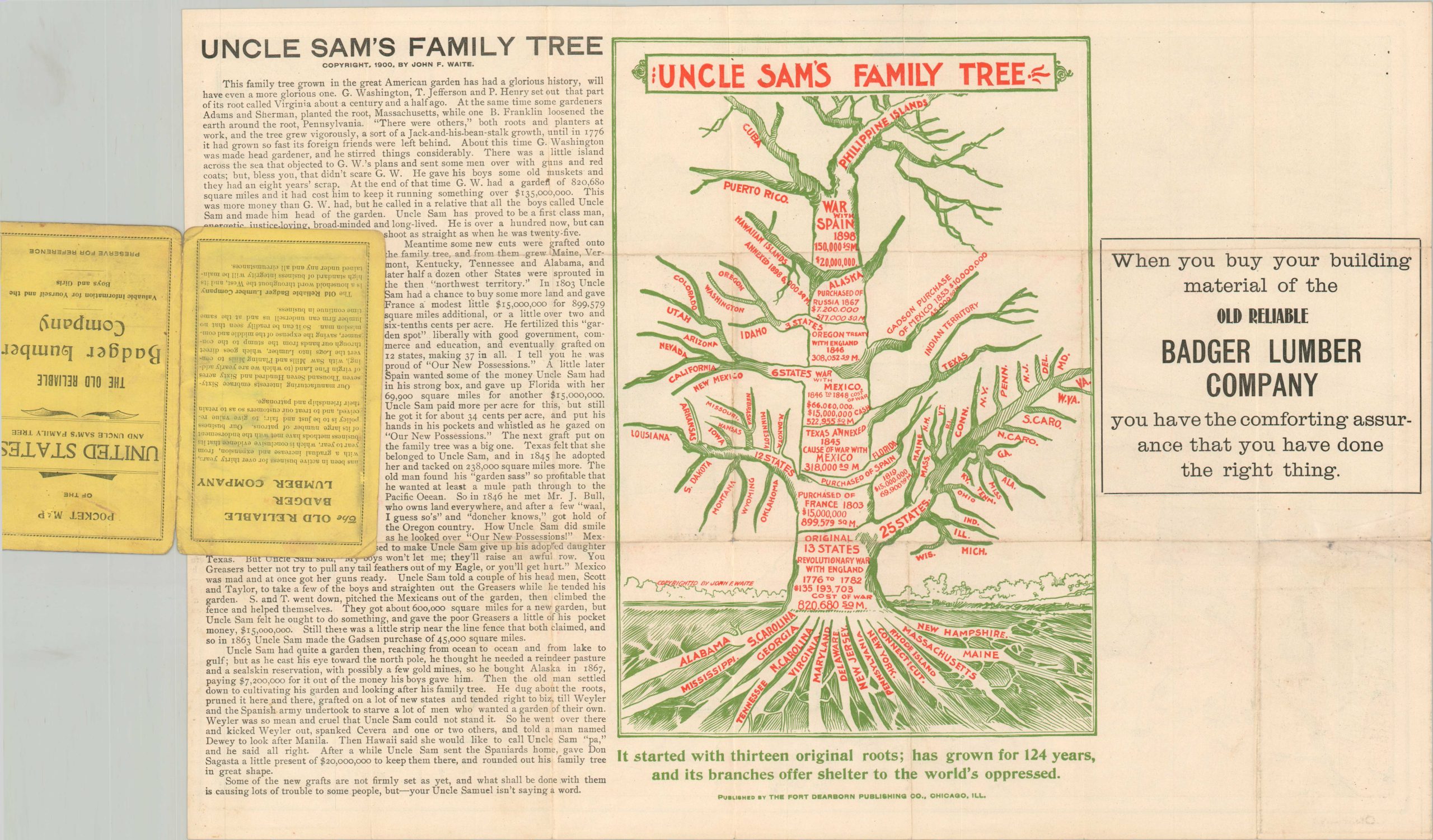
Insets show the overseas components of the American Empire; including the Philippines, Alaska, Hawaii, Puerto Rico, and Cuba (then under U.S. military occupation). The imperial theme is reinforced by an intriguing diagram printed on the printed on the verso – ‘Uncle Sam’s Family Tree’ – copywritten by John F. Waite in 1900. It presents the growth of the U.S. and its various dependencies in the form of a literal tree, from the roots of the 13 colonies to the top branches composed of territorial spoils from the Spanish-American War. Text at the bottom celebrates: “It started with thirteen original roots: has grown for 124 years and its branches offer shelter to the world’s oppressed.”
A text description accompanies the illustration. The summary of the Mexican-American War is as follows: “Uncle Sam told a couple of his head men, Scott and Taylor, to take a few of the boys and straighten out the Greasers while he tended his garden. S. and T. went down, pitched the Mexicans out of the garden, then climbed the fence and helped themselves. They got about 600,000 square miles for a new garden, but Uncle Sam felt he ought to do something, and gave the poor Greasers a little bit of his pocket money, $15,000,000. The ludicrously imperialist commentary concludes with the unsettling comment – “Some of the new grafts are not firmly set as yet, and what shall be done with them is causing lost of trouble to some people, but – your Uncle Sam isn’t saying a word.”
Map Details
Publication Date: 1902
Author: Fort Dearborn Publishing Company
Sheet Width (in): 20.6
Sheet Height (in): 13.7
Condition: A-
Condition Description: Pocket map folded into 21 segments and affixed to original yellow paper wraps. Covers are partially separated along the spine and show moderate wear, creased corners, and scattered soiling. Several areas of separation along fold lines have been repaired on the verso with archival tape. Very good condition overall.
Out of stock