Poates Highway and Regional Guide of the United States
America’s highway network the year prior to the official federal numbering.
Out of stock


Description
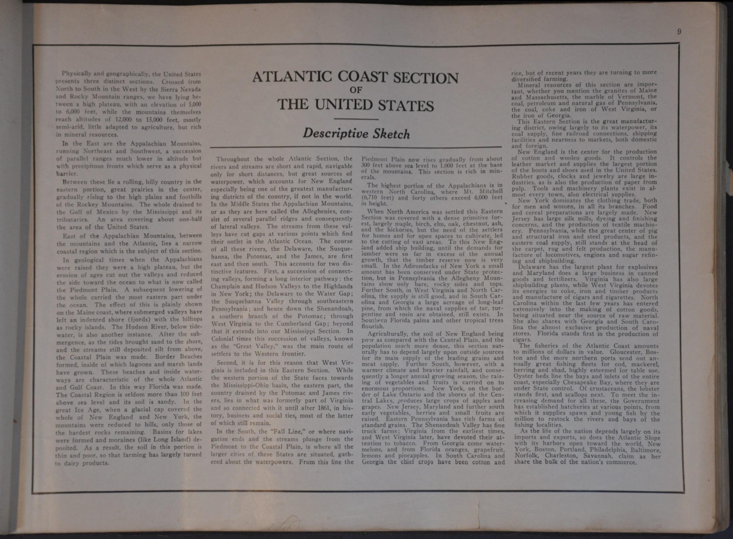
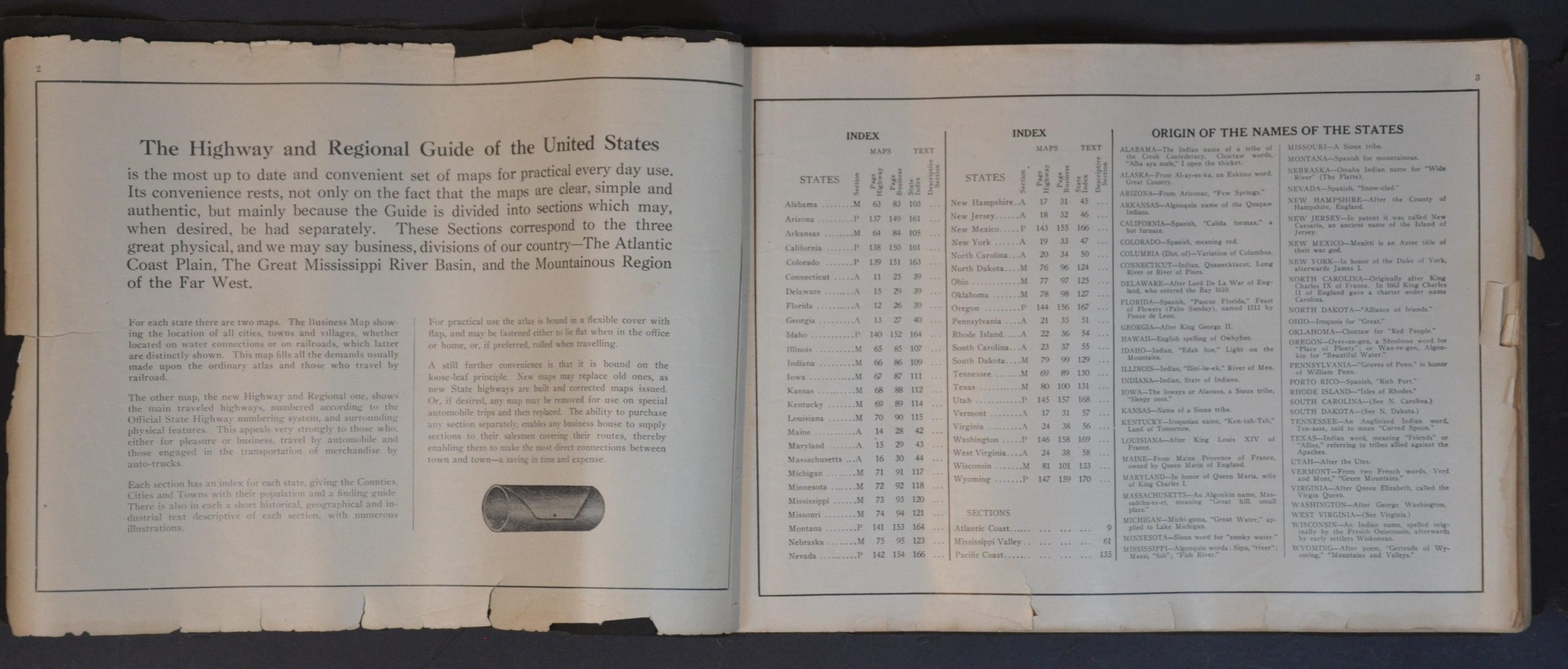
“The Highway and Regional Guide of the United States is the most up to date and convenient set of maps for practical everyday use. Its convenience rests, not only on the fact that the maps are clear, simple and authentic, but mainly because the Guide is divided into sections which may, when desired, be had separately.” – pg. 2.
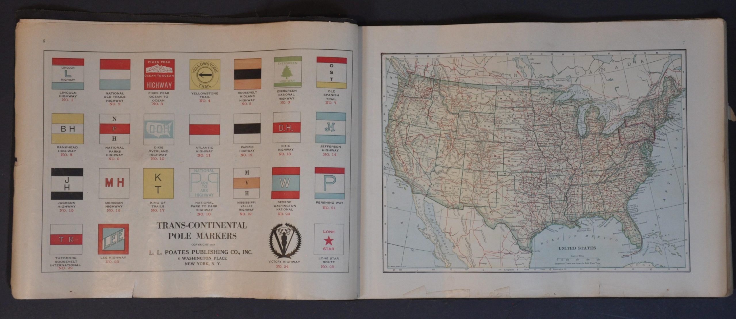
This uncommon atlas was copyrighted in 1925 and published by the L.L. Poates Publishing Co., Inc. of New York. Designed with the traveler in mind, the riveted binding allows for the easy removal of individual sheets while the protective cover allows the volume to be tightly rolled (presumably for a glove compartment). An index, origin of state names, list of road mileage by state, and other interesting facts are followed by a ‘key’ map of the national highway network and color illustrations of trans-continental pole markers.
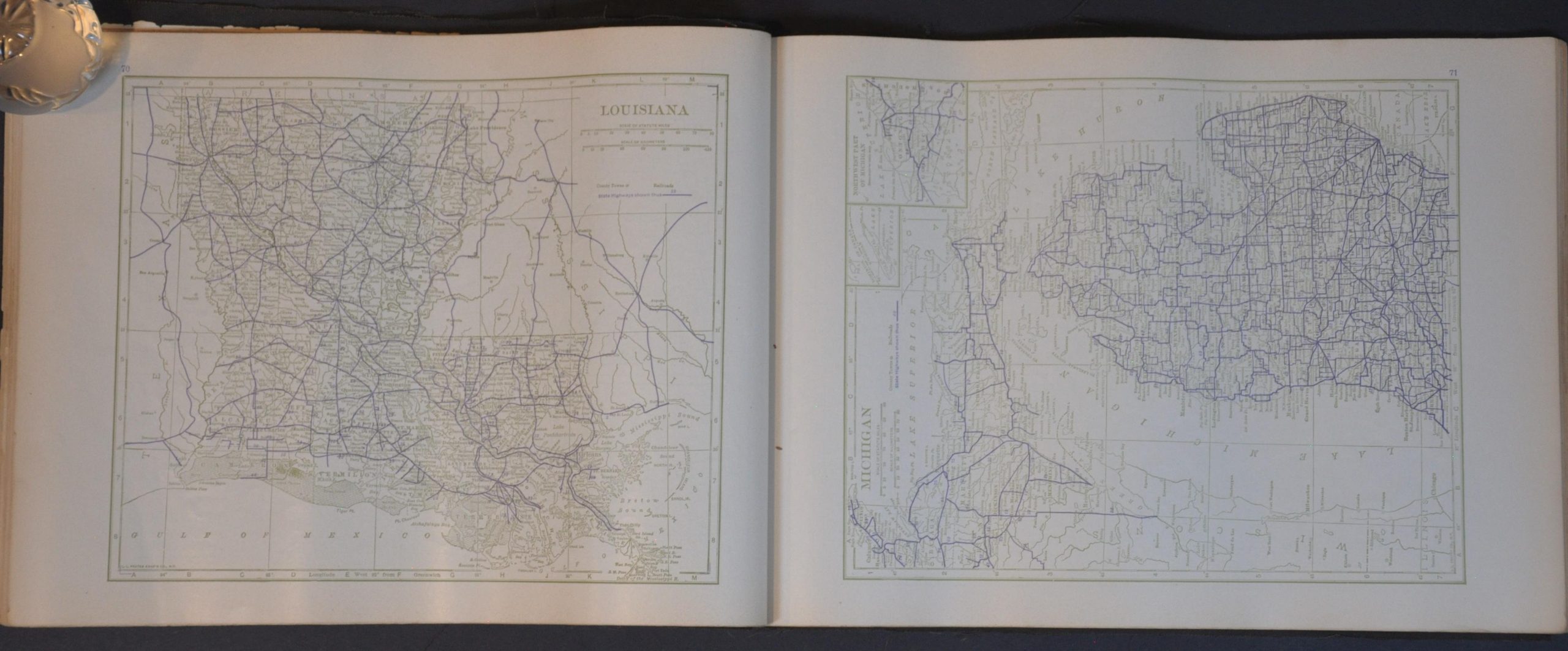
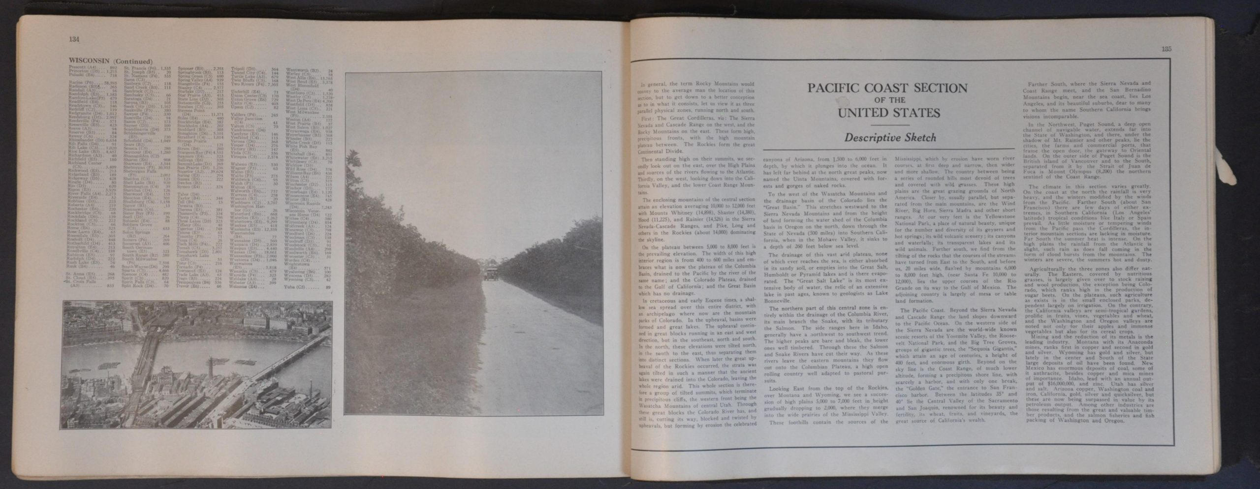
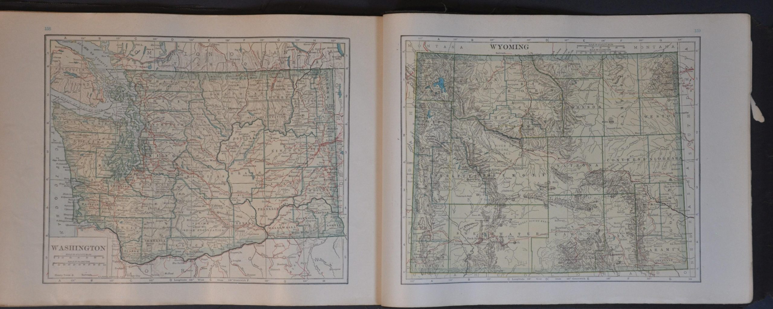
State maps are organized into three sections: the Atlantic Coast, the Mississippi Valley, and the Pacific Coast. Each entry is depicted twice – once in full color, akin to a ‘regular’ atlas map (i.e. showing railroads, towns, county outlines, etc.). A second, more skeletal state plan outlines the primary highways, although no distinction is made between varying surfaces. A ‘Descriptive Sketch’ of each region, a few black and white photographs, and an index of place names are also included.
Map Details
Publication Date: 1925
Author: Poates Corporation
Sheet Width (in): 9.75
Sheet Height (in): 14.00
Condition: B+
Condition Description: 170 pp. atlas bound in a flexible black leather cover, designed to be folded or rolled. Covers show some distressing, creasing, and minor loss. Contents are worn in the margins, with numerous small tears, chips, creased corners, and some light toning. Title page is worst affected - the maps are generally in very good condition.
Out of stock