Pleasure Map of the Sea, Mountains, and Desert Showing Resorts in Riverside County and Adjacent Territory
Uncommon pictorial map of Southern California by Mary Hall Atwood.
Out of stock
Description
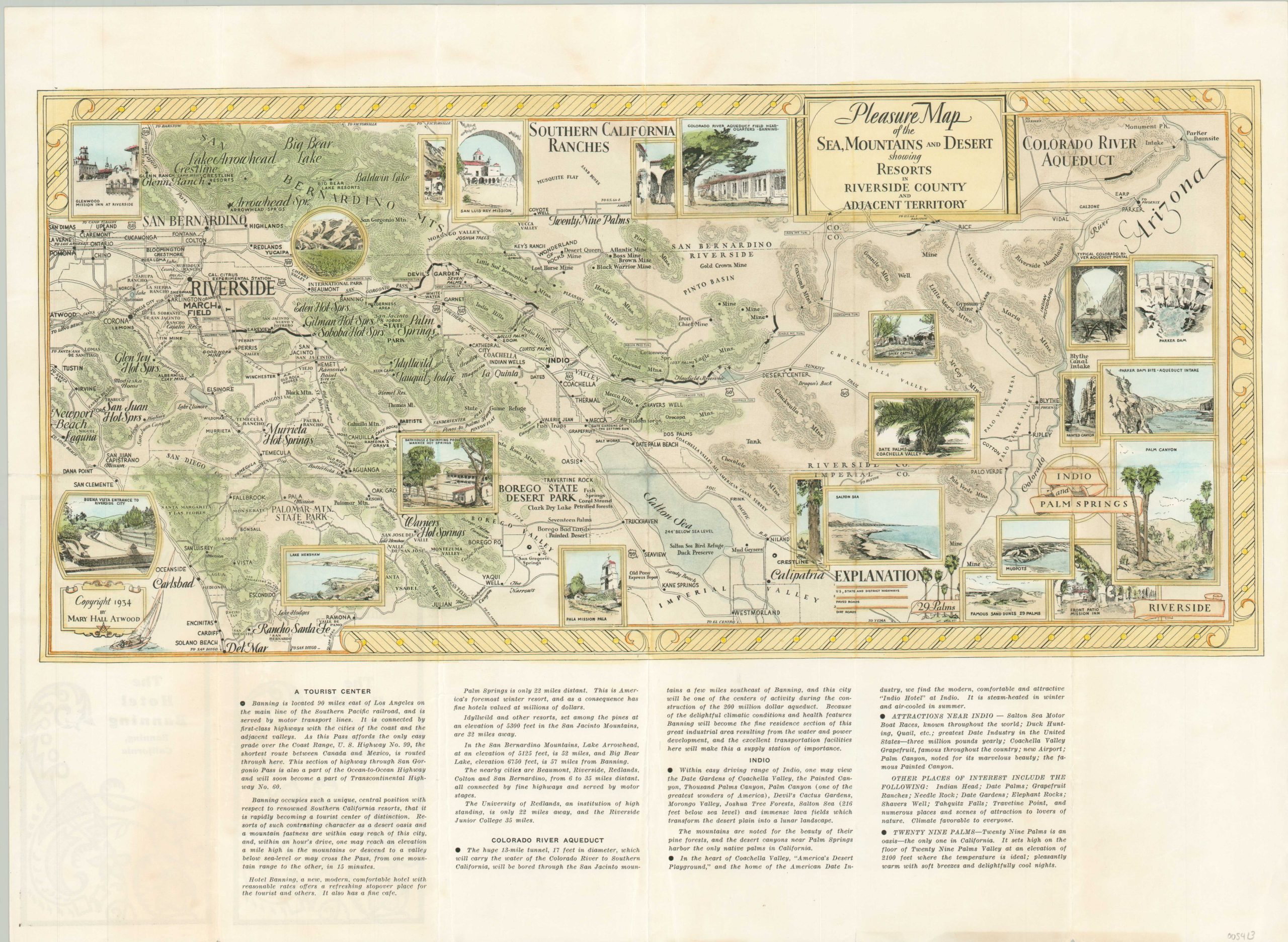
This eye-catching map of Riverside County, California, and the surrounding area was illustrated by the talented Mary Hall Atwood in 1934 and issued compliments of Hotel Banning. Atwood, a native of Chicago, moved to the Los Angeles area in the late 1920s and became well-known as an illustrator, muralist, and mapmaker.
This work was designed to highlight the regional attractions between Newport Beach and Palm Springs, encouraging tourism and business at the Hotel Banning. Numerous vignettes emphasize various locations of interest, beautiful scenery, and historic sites. Descriptive text at the bottom of the sheet provides further reasons to visit and invest, including the ongoing construction of the Colorado River Aqueduct;
“Because of the delightful climactic conditions and health features, Banning will become the fine residence section of this great industrial area resulting from the water and power development, and the excellent transportation facilities here will make this a supply station of importance.”
Map Details
Publication Date: 1934
Author: Mary Hall Atwood
Sheet Width (in): 21.9
Sheet Height (in): 15.9
Condition: A
Condition Description: Moderate creasing and soft wear along originally issued fold lines and some scattered soiling on the verso that does not affect the image. Very good overall.
Out of stock