Pleasure Map of America
$75.00
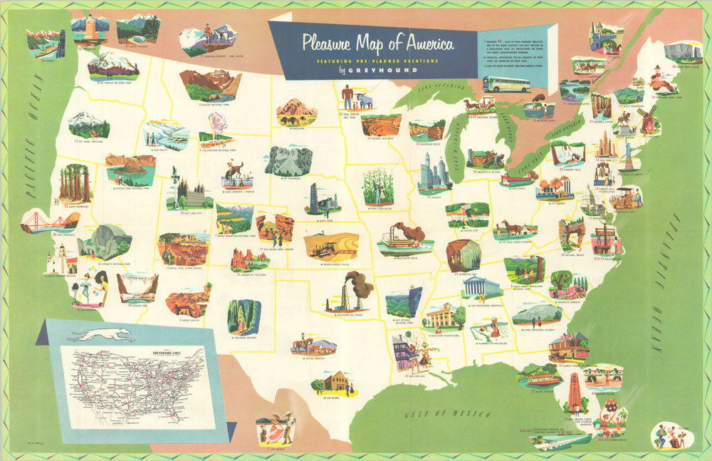
Charming map of the United States published as a vacation guide for Greyhound Bus Lines.
Description
By the middle of the 1950’s, road travel in America was all the rage. Greyhound wanted to capitalize on the newfound American freedom, and developed a series of cross country tours that would take the stress out of planning such a trip. It was advertised as a cheaper, safer, and more comfortable alternative to private travel that could take you to nearly any destination along it’s 96,000 miles of route coverage, helpfully shown in an inset map in the lower left. There are forty five destinations serviced by Greyhound that are illustrated on the map, with additional information for each available on the verso. The variety of locales presented is notable, with Iowa corn and Kansas wheat reflecting the agricultural heartland of America, and Pittsburgh, Hoover Dam, and the Oklahoma oil fields representing the industrial side of the country.
This map appears to have been previously owned by someone who was well traveled – over half of the locations depicted had been checked off in pencil.
Map Details
Publication Date: 1954
Author: M.E. Bush
Sheet Width (in): 28
Sheet Height (in): 18
Condition: B+
Condition Description: The map is in excellent condition, with a few minor pinholes at fold intersections and penciled checkmarks that have been erased throughout.
$75.00