
Pleasure Map of America
$75.00
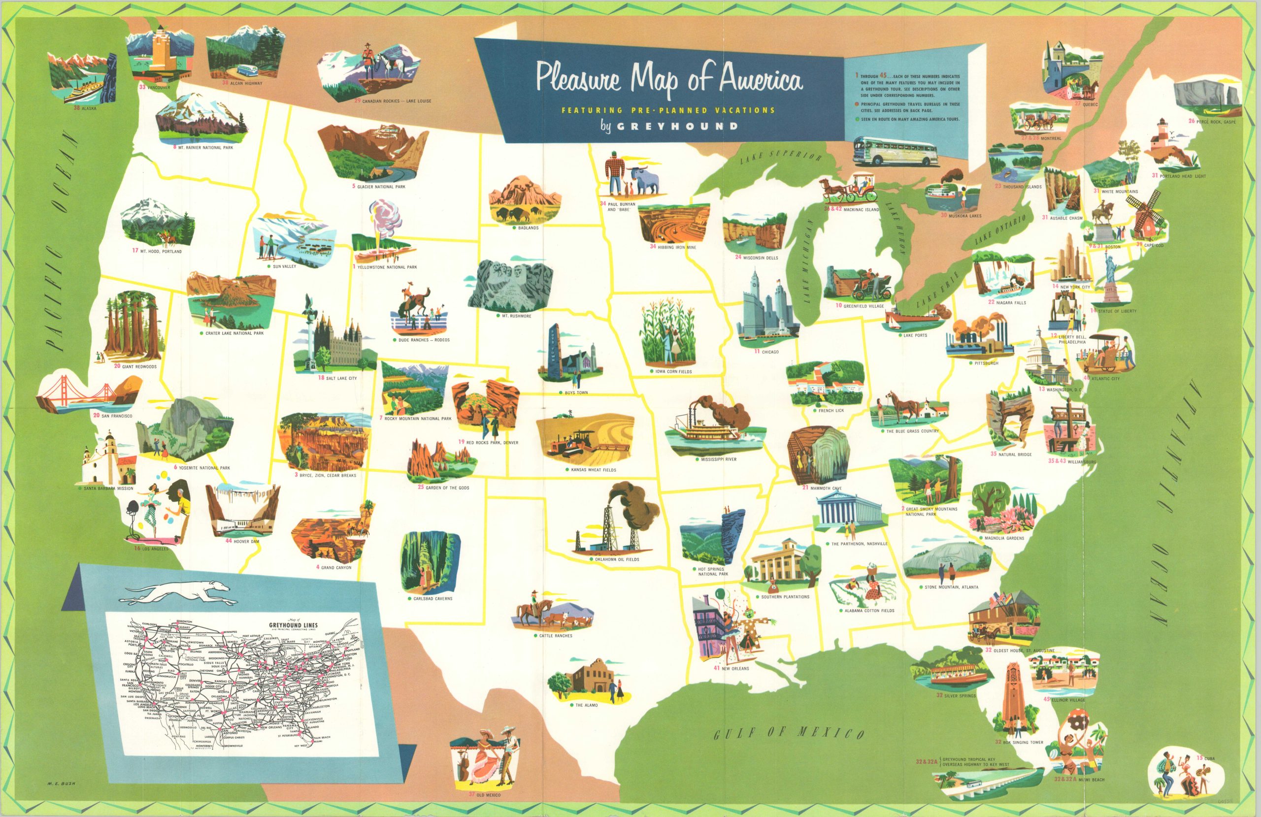
Pre-planned vacations across the United States, courtesy of Greyhound Lines.
1 in stock
Description
By the middle of the 1950s, road travel in America was all the rage. Greyhound wanted to capitalize on the newfound American freedom and developed a series of cross-country tours that would take the stress out of planning such a trip. It was advertised as a cheaper, safer, and more comfortable alternative to private travel that could take you to nearly any destination along its 96,000 miles of route coverage, helpfully shown in an inset map in the lower left.
There are forty-four numbered destinations serviced by Greyhound that are illustrated on the map, with additional information for each available on the verso. The variety of locales presented is notable, with Iowa corn and Kansas wheat reflecting the agricultural heartland of America, and Pittsburgh, Hoover Dam, and the Oklahoma oil fields representing the industrial side of the country.
Designed by M.E. Bush and published in 1953 by Greyhound Highway Tours, Inc.
Map Details
Publication Date: 1953
Author: M.E. Bush
Sheet Width (in): 28
Sheet Height (in): 18.1
Condition: A-
Condition Description: Light wear along originally issued fold lines, with a few very tiny holes along a crease in the lower left (see inset map). Very good overall.
$75.00
1 in stock