Plano de La Habana [with report]
$550.00
Improving Havana during the U.S. military occupation of Cuba.
1 in stock
Description
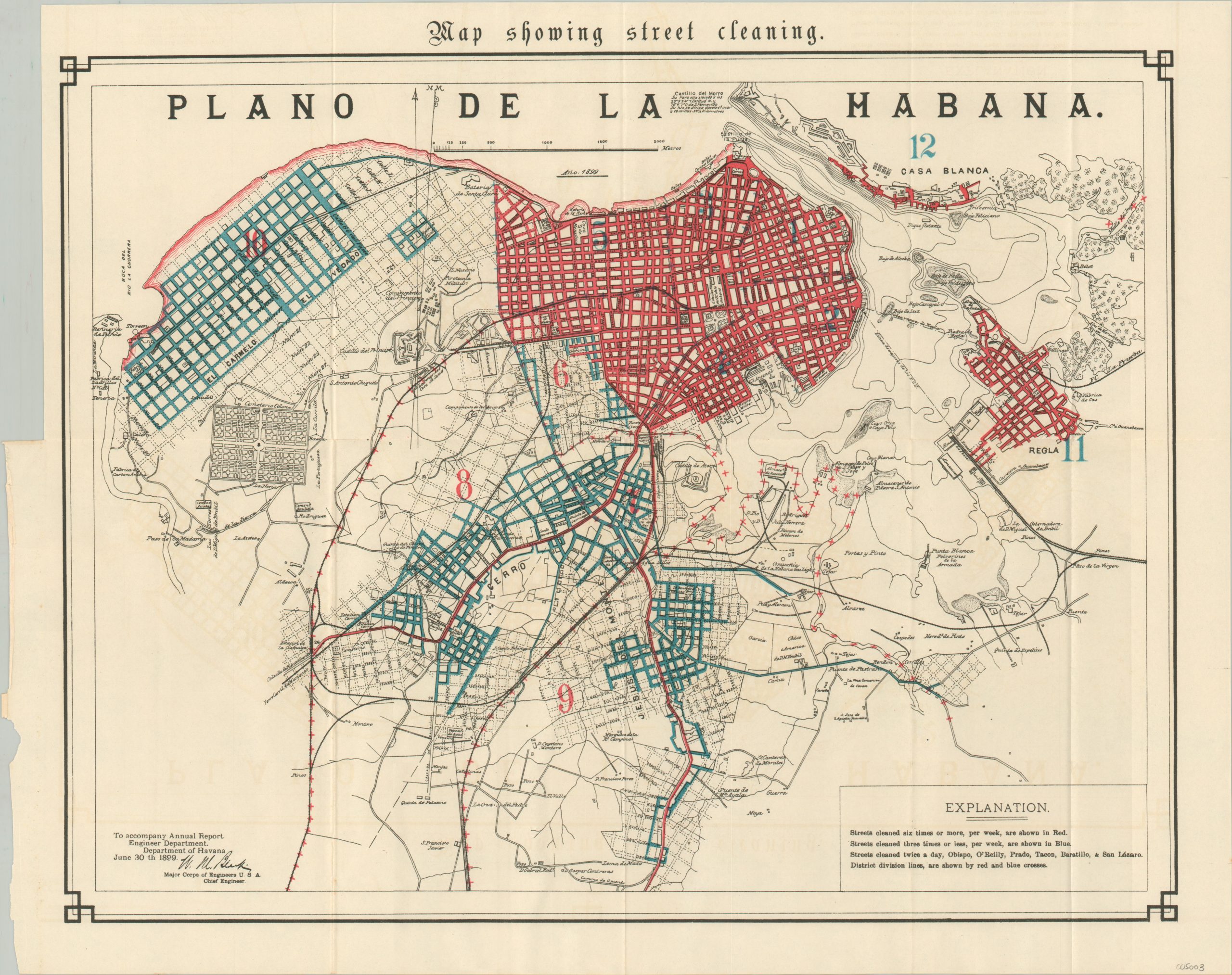
The United States occupation of Cuba lasted from 1898, shortly after the conclusion of the Spanish-American War, until 1902, when the Republic of Cuba was officially confirmed and recognized by the American government. A number of changes occurred across the island in the intervening three years, but perhaps none so dramatic as those that took place in Havana.
These three maps catalog some of the modifications that occurred under U.S. military control during the occupation period. Street cleaning, water distribution, and street paving practices are highlighted in bright blue and red overprinting across a base street plan of the city. The base map identifies various locations of interest, including prominent geographic features, local industries, transportation options, and fortifications. According to Jerry Sierra;
“An article in the New York World on July 20 1898, predicted a new invasion of Cuba following the war. “Whatever may be decided as to the political future of Cuba,” the article stated, “it’s industrial and commercial future will be directed by American enterprise with American capital.” The predictions turned out to be correct. The provisional military governments, which controlled Cuban money, refused to provide loans to farmers and landowners to get their crops in shape, using this money instead for roads and sanitation.
As a result, American entrepreneurs such as United Fruit Company president Andrew W. Preston, railroad financier Stuyvesant Fish, sugar baron Henry D. Havemeyer and others were able to come in and purchase dirt-cheap farmlands and other properties. Its widely speculated that the economic and social future of the island would have been more agreeable to Cubans if the military government had followed, instead, a policy of helping the small farmers and planters to resume production.”
The maps were published by the Government Printing Office in 1899 to accompany the first part of the Report of the Major-General Commanding the Army. The 500+ pages of the leather-bound volume include fascinating insight into the military organization and commencement of the Spanish-American War. Tables of statistics, copies of important correspondence, folding charts & maps, and numerous photographic plates provide a wealth of contemporary details about the conflict.
Sources: History of Cuba; Military Affairs;
Map Details
Publication Date: 1899
Author: Government Printing Office
Sheet Width (in): 19.25
Sheet Height (in): 15.75
Condition: A
Condition Description: Three folding street plans of Havana disbound from an original government report volume. Light wear along original fold lines and where previously bound, but in near fine condition overall. Includes the accompanying report, 546 pp. with numerous charts, tables of statistics, and photographic plates. Bound in original full leather with gilt spine. Very good to near fine overall.
$550.00
1 in stock


