
Planning Commission Harrisburg Pennsylvania
Detailed city plan of Harrisburg, Pennsylvania with a unique history as part of the Penn Railroad’s engineering department.
Out of stock
Description
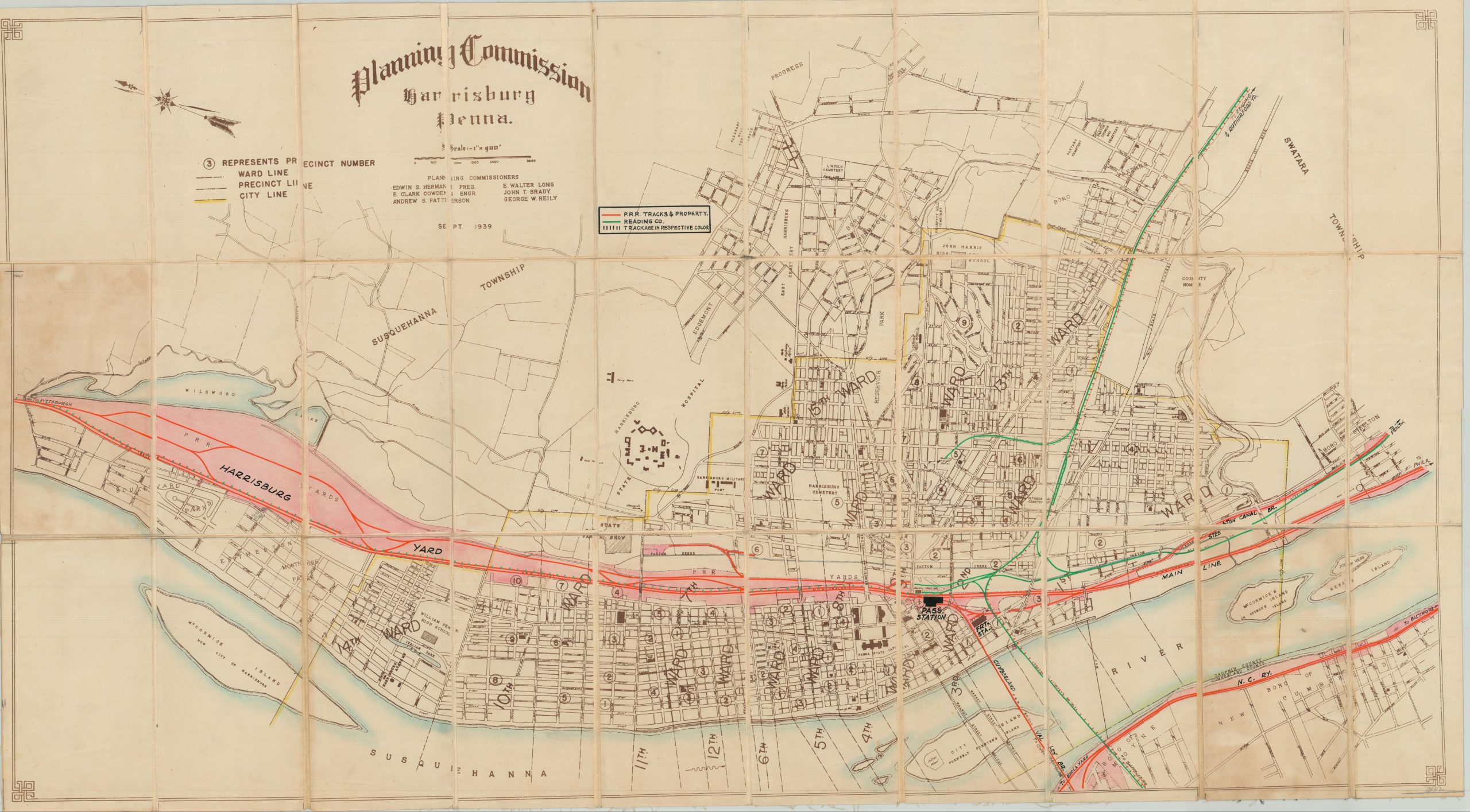
This detailed map of Harrisburg, Pennsylvania was originally published in 1939 by the City Planning Commission at a scale of 1″ to 900′. This large scale allows for a tremendous level of detail, and the map captures a fascinating snapshot of prewar Harrisburg.
The city is shown organized by wards and precincts, with neighborhoods, streets, townships, prominent local industries, schools, parks, and cemeteries all individually labeled.
This particular copy of the map was customized extensively for use in the Central Engineering Department of the Pennsylvania Railroad. It has been dissected and mounted on linen for preservation and storage convenience. Manuscript updates applied vivid color to highlight track ownership in the city up to the early 1950’s, and a custom legend added near the top of the page identifies the two primary operators; the Pennsylvania Railroad and the Reading Railroad.
Additional annotations in black ink identify particular buildings of relevance, like the Harrisburg Yard, passenger station, and freight station.
Map Details
Publication Date: 1939
Author: Harrisburg Planning Commissioners
Sheet Width (in): 43.00
Sheet Height (in): 23.90
Condition: A-
Condition Description: Dissected into 30 panels and mounted on linen with black leather covers. Two panels show moderate discoloration from the adhesive used to affix the cover on the verso. Otherwise the map is in very good condition, especially given its use and age - a clean image firmly mounted with bright hand color.
Out of stock