Plan von St. Petersburg
An engaging mid-19th century plan of St. Petersburg.
Out of stock
Description
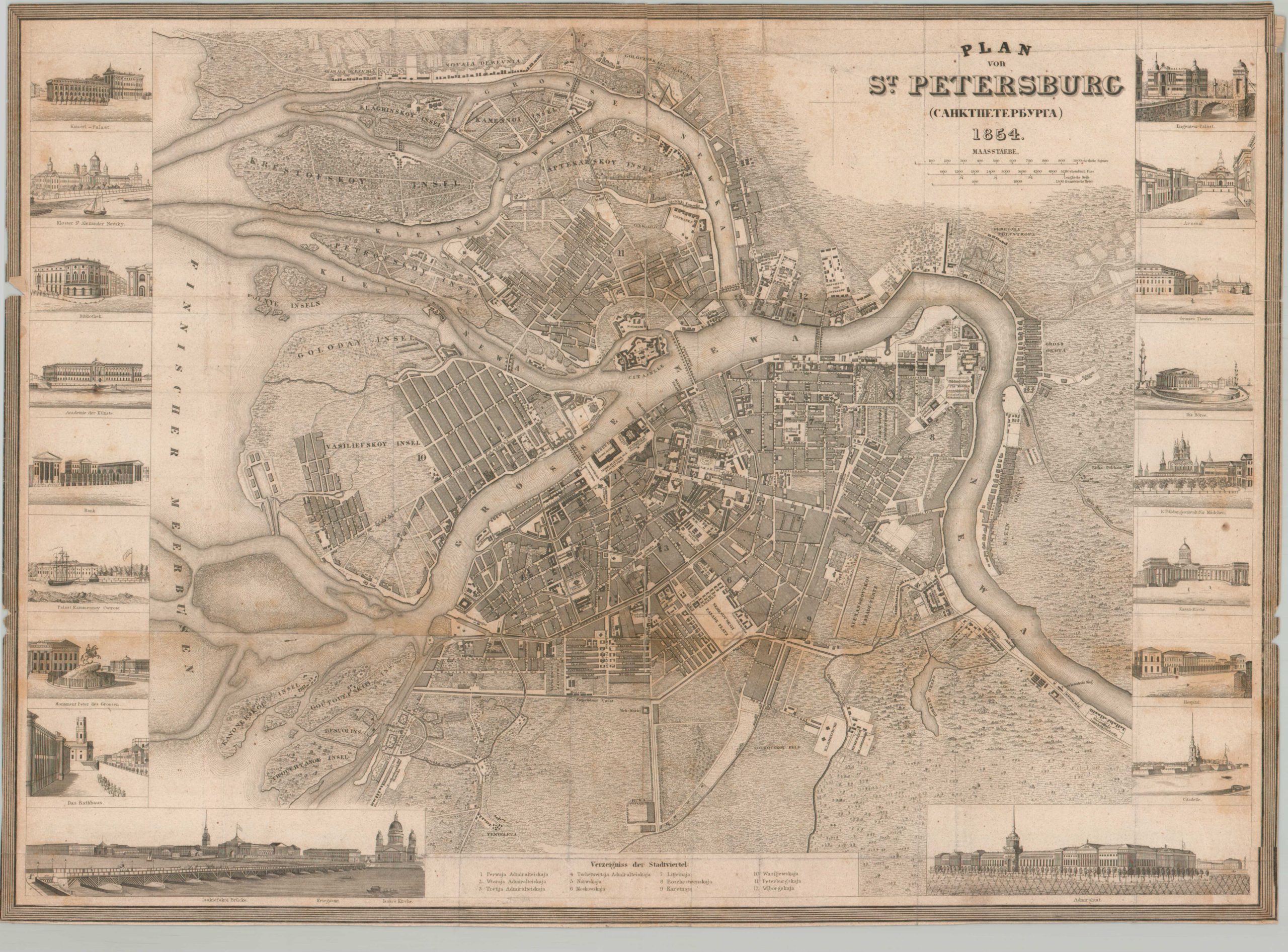
This intricately detailed plan of St. Petersburg was originally created by the Society for the Diffusion of Useful Knowledge in the 1830s. This example was updated by Joseph Meyer as part of his impressive Grosser Hand-Atlas in 1854.
The Russian capital is situated at the mouth of the Neva River, which splits into several branches and creates a distinctive local geography of numerous islands connected by a handful of bridges. Various locations of interest are labeled, including the Citadel (Peter and Paul Fortress), the Winter Palace, and St. Isaac’s Cathedral. Numerous other examples of the impressive architecture are provided in the surrounding vignettes, 18 in total.
Map Details
Publication Date: 1854
Author: Joseph Meyer
Sheet Width (in): 19.00
Sheet Height (in): 13.75
Condition: B
Condition Description: Trimmed margins and heavy wear along old folds, including some moderate toning and clean splits (repaired on verso). Scattered spotting visible in the lower right and upper center. Fair to good condition overall.
Out of stock