
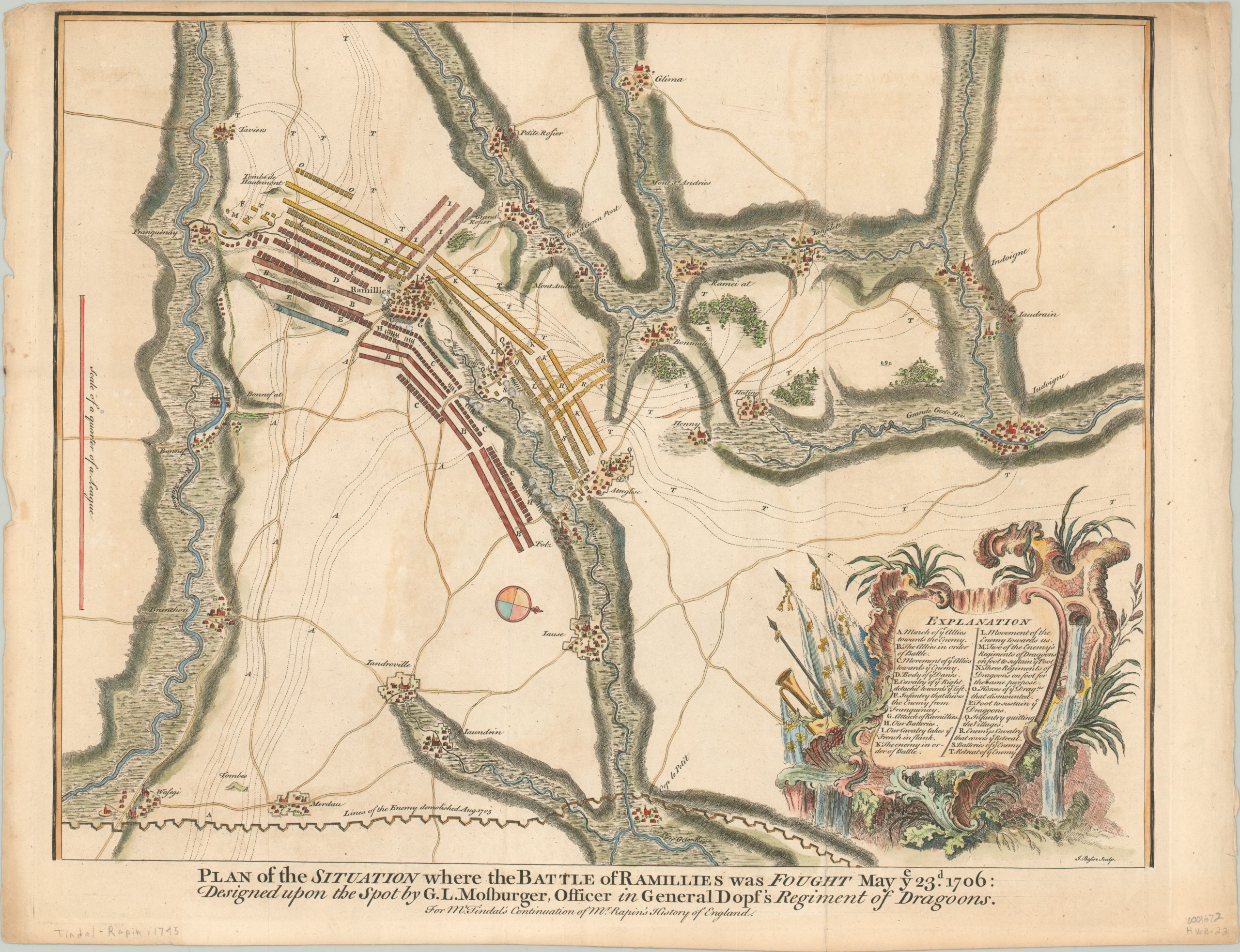
Plan of the Situation where the Battle of Ramillies was Fought May the 23rd 1706
$200.00
Detailed cartographic account of the Battle of Ramillies, during the War of Spanish Succession.
1 in stock
Description
This descriptive battle plan approximates the course of events during the Battle of Ramillies, fought on May 23rd, 1706 between the forces of the Grand Alliance under the Duke of Marlborough against a combined Spanish/French army led by The Duke of Villeroi. Though the lines and squares can make this battle plan quite daunting, the helpful explanation in the lower right provides further context on the map’s contents.
The solid bars are the order of troops at the outset of the battle, occupying the dry ground between two rivers, near the town of Ramillies. The squares and hashed bars reflect the progress of battle, as the Allied cavalry turned the flank of the French infantry and pushed into retreat through the countryside.
In just four hours, the French forces were routed, allowing the Allies to carry the offensive through the Spanish Netherlands and capture Brussels, Bruges, and Antwerp the same year. The map was engraved by James Basire and published in the 1745 edition of Nicholas Tindal’s translation of Paul de Rapin’s ‘History of England.’
Map Details
Publication Date: 1745
Author: Nicholas Tindal/Paul Rapin
Sheet Width (in): 20.40
Sheet Height (in): 15.50
Condition: A-
Condition Description: Narrow upper margin, slightly toned, and a bit of wear to the outer edges. Creasing along vertical fold lines and some faint offsetting present, most visible in the white areas. Remains in very good condition, with nice modern hand color.
$200.00
1 in stock