
Plan of Gibraltar
$200.00
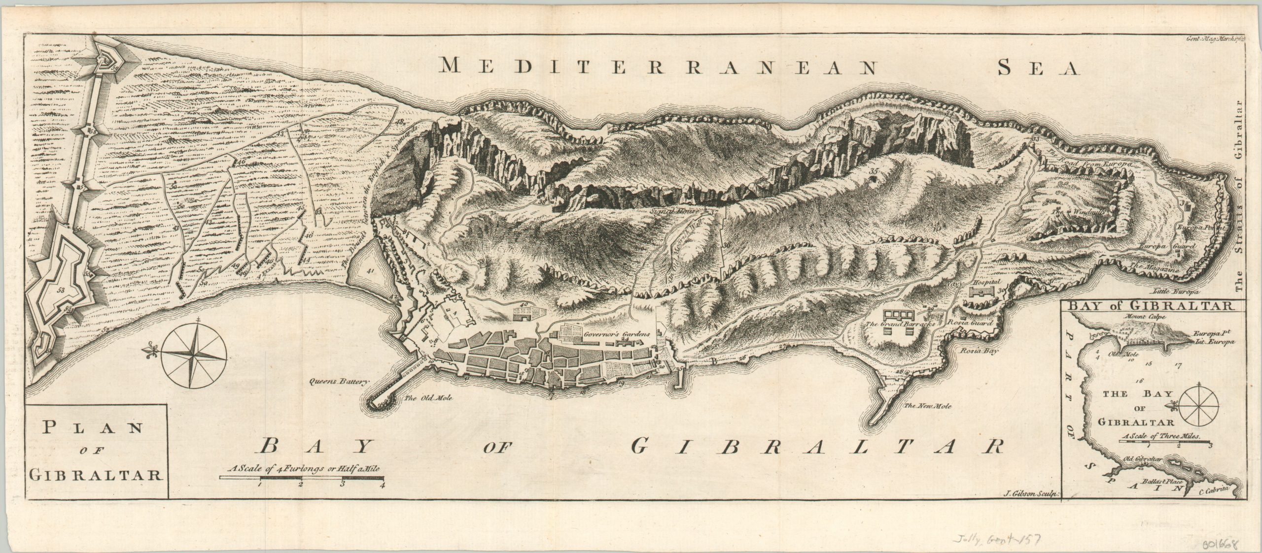
Detailed plan of Gibraltar published in London during the Seven Years’ War.
1 in stock
Description
Situated on the strait after which it is named, the fortress of Gibraltar has been a British overseas possession since it was officially ceded by Spain in 1713. Two subsequent sieges attempts were made by the Spanish (and their allies) to recapture the strategic peninsula between the Mediterranean and Atlantic; in 1727 and from 1779 – 1783 (the Great Siege).
This plan of the British fortress was issued between the two, in a 1762 edition The Gentlemen’s Magazine of London. The rugged topography of ‘The Rock’ is depicted in interesting (though not necessarily accurate) pictorial format, and numerous important buildings are labeled. An inset of the bay can be seen in the lower right, with depth soundings and the site of Old Gibraltar; now Algeciras, Spain.
The compass rose indicates that north is to the left, where one can see the adjacent Spanish fortifications. At the time of publication, the two warring nations were engaged in the Seven Years’ War, though no major engagements took place near the fortress.
Map Details
Publication Date: 1762
Author: John Gibson
Sheet Width (in): 18.10
Sheet Height (in): 7.90
Condition: A-
Condition Description: Faint creasing and wear along fold lines, and a bit of soiling in the margins. Very good or better condition, with a bold impression on a clean sheet.
$200.00
1 in stock