Plan of Georgetown, South Carolina
Federal improvements to support the economy of South Carolina in the late 19th century.
Out of stock

Description
This interesting collection of three maps was rescued from an old series of Congressional reports published by the Government Printing Office in 1896. They each highlight various elements of the waterways leading to the coastal port city of Georgetown, South Carolina, the third oldest settlement in the state.
The first sheet, drawn by Reid Whitford of the U.S. Army Corps of Engineers, shows the proposed dredging through shoals of the Sampit River to allow for a draft of a minimum 20 ft. at low tide. These improvements would facilitate increased maritime traffic, primarily in agricultural commodities.
The second sheet presents a comprehensive overview of the city of Georgetown, with populated lots highlighted in pink and the waters of the Sampit River and Winyah Bay shown in blue. It was originally drafted by Le Grand G. Walker, Clerk and Treasury Council Member, in 1885. Various locations of interest labeled throughout the image reflect the changing economic and social conditions of South Carolina in the years following Reconstruction.
For example, due to failed harvests and increased competition from other Southern states, lumber was beginning to outpace rice as the primary export. ‘Nigger head point’ – a spit of land to the south – shows how racist language was commonplace. Recent research on Potter’s Field, east of town, indicates it was a cemetery for the poor (white and black) and corpses were buried in shallow graves, leading to morbid problems during heavy rains.
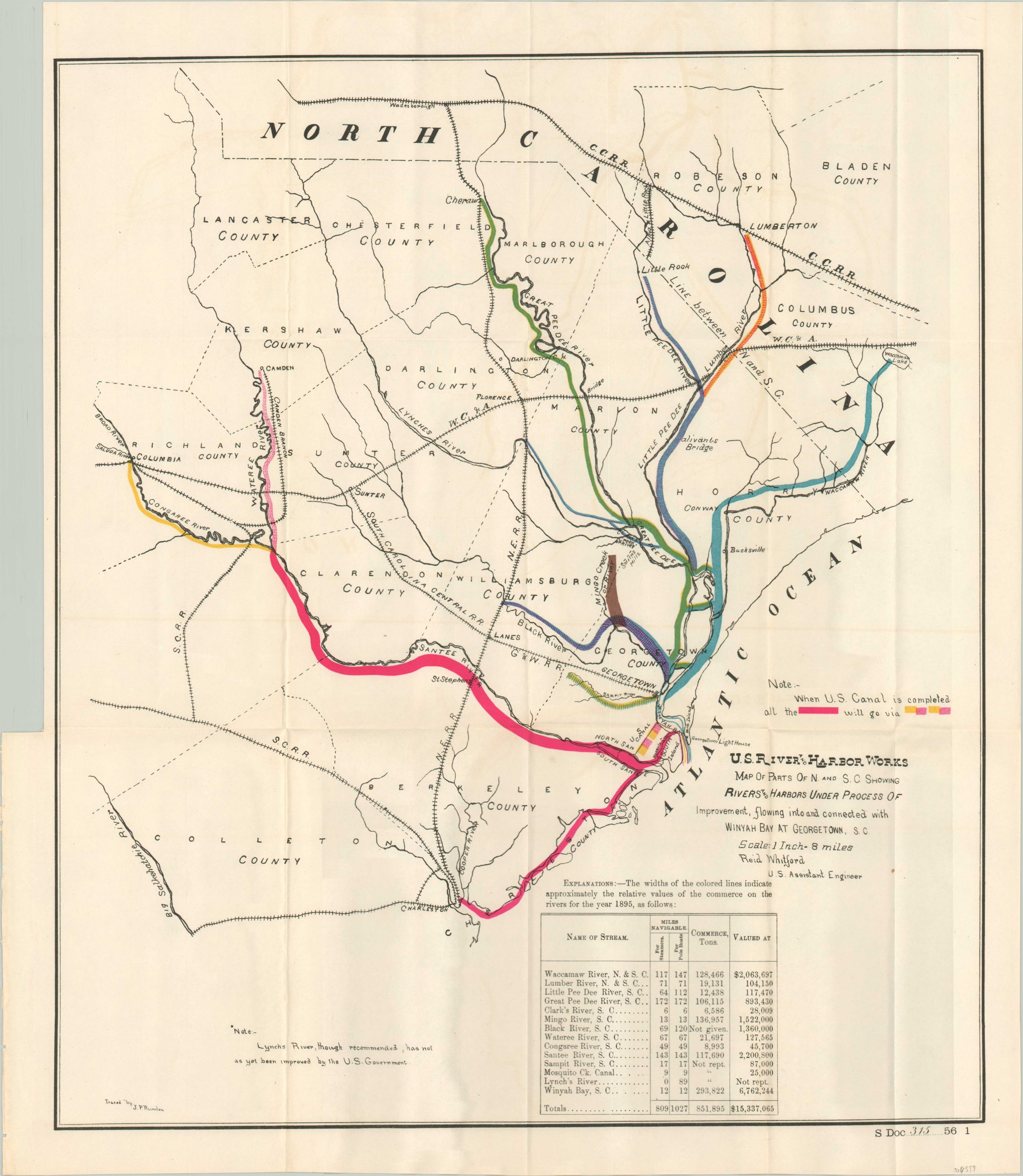
The third and final sheet, again by Whitford, shows the various rivers comprising the Winyah Bay watershed in North and South Carolina. Bright colors distinguish different areas of improvement, including ongoing construction of the U.S. Canal connecting the bay to the North Santee River. A table lists the navigable streams, their length, and estimated commercial traffic.
Sources: The National Register of Historic Places; Post & Courier
Map Details
Publication Date: 1896
Author: Le Grand G. Walker
Sheet Width (in): See Description
Sheet Height (in):
Condition: A
Condition Description: Group of three maps rescued from a broken and busted set of Congressional reports. Light wear where formerly bound. The first sheet shows moderate smudging, but the last 2 are crystal clean and just show some creasing along originally issued fold lines. Very good overall.
Out of stock