
Plan of Brookside Cemetery, Watertown, N.Y.
$50.00
A spooky plan of a New York cemetery from an early issue of a Beers county atlas.
1 in stock
Description
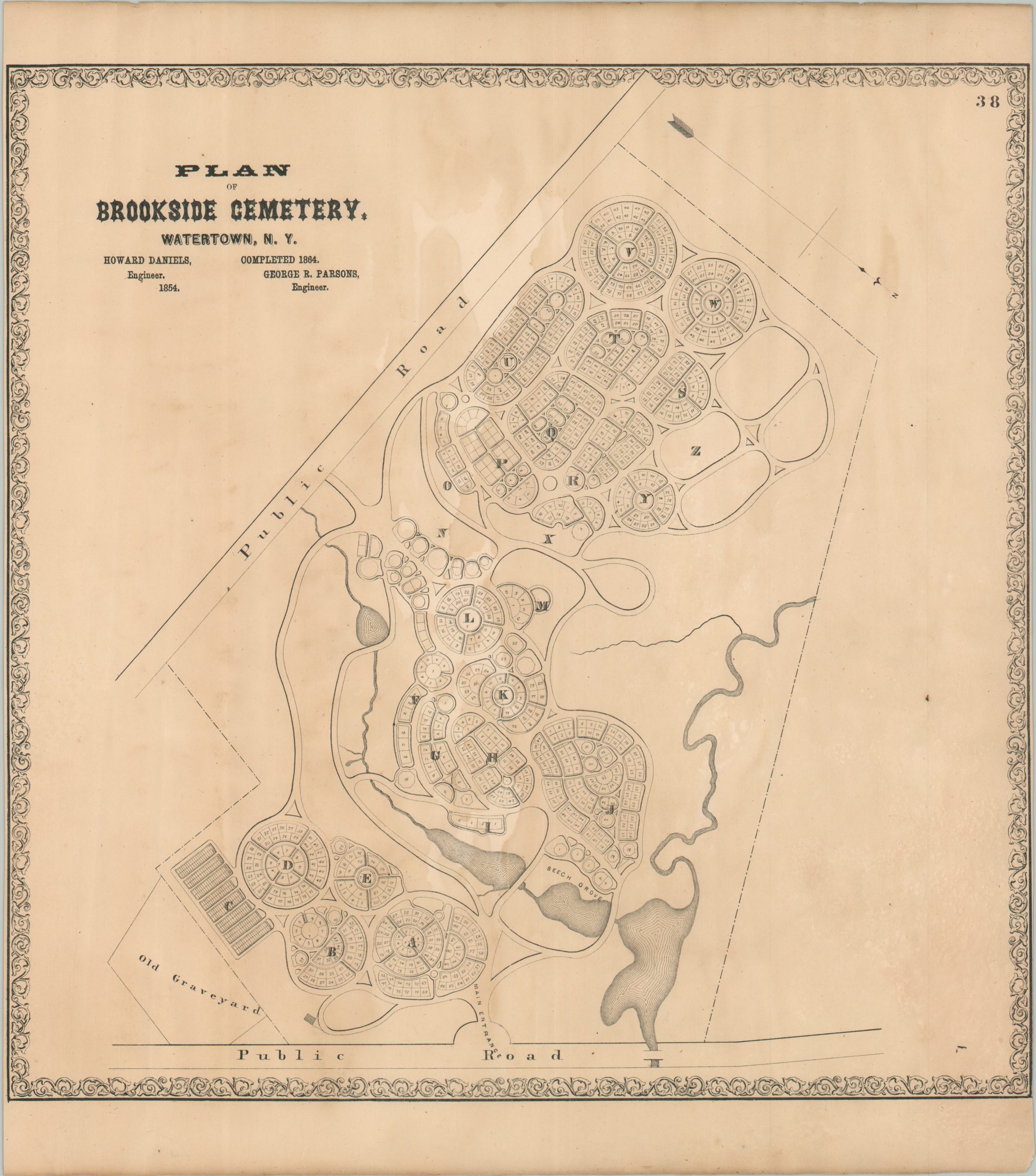
This is a detailed ground plan of Watertown’s Brookside Cemetery, established in 1854 as a tranquil resting spot for the deceased. Winding paths, numerous water features, and well-spaced plots reflect the ‘rural’ design features. The cemetery was designed by engineers Howard Daniels and George Parsons.
The map was published in 1864 as part of S.N. & D.G. Beers’ New Topographical Atlas of Jefferson Co. New York, the first county atlas produced by the Beers family (according to Ristow).
Map Details
Publication Date: 1864
Author: Daniel Beers
Sheet Width (in): 14.00
Sheet Height (in): 15.90
Condition: B
Condition Description: Narrow margins and moderate dampstaining affects the right side of the page (some discoloration and waviness).
$50.00
1 in stock