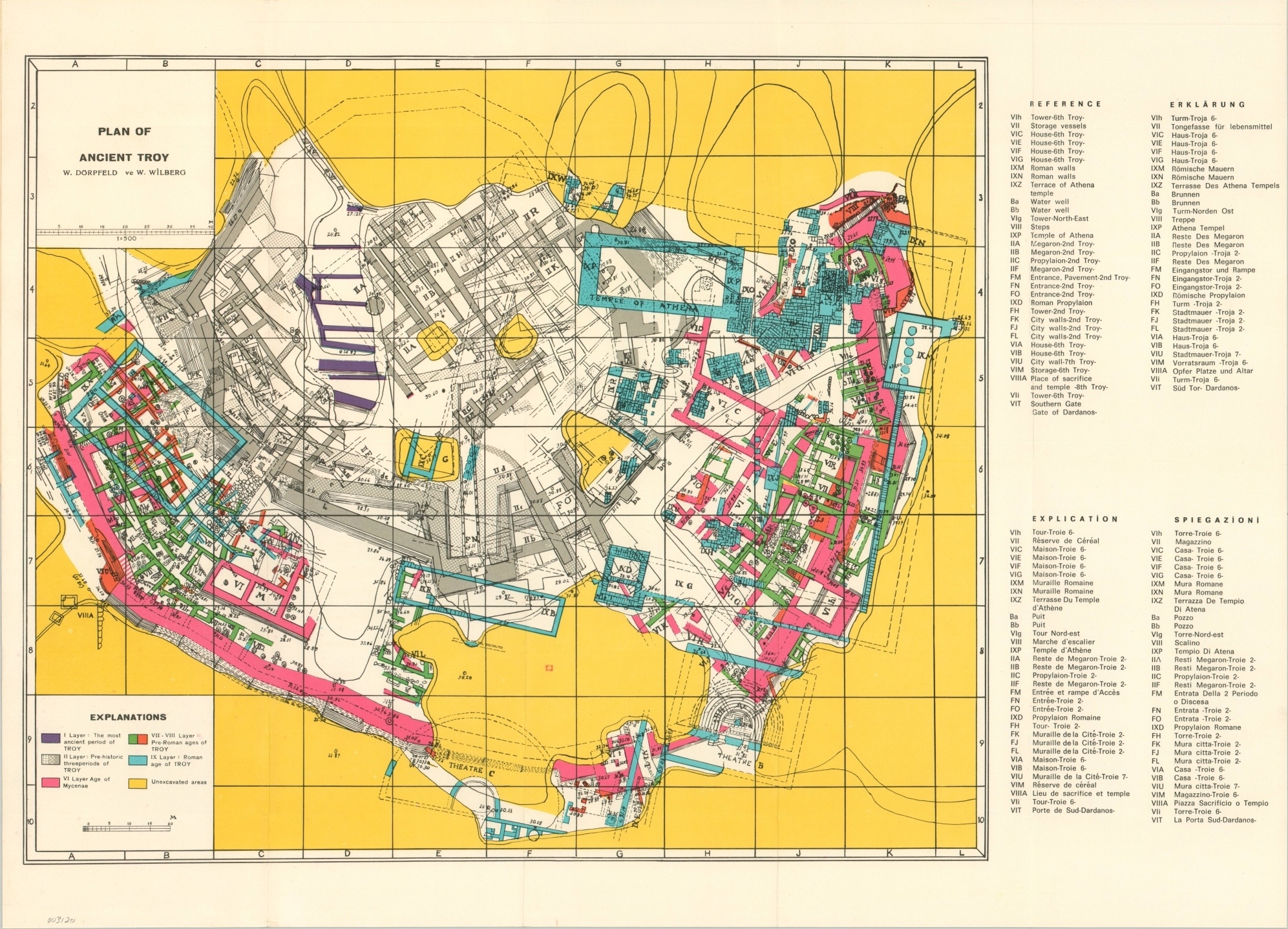
Plan of Ancient Troy
Detailed plan of the famed ruins of Troy based on an expert archaeologist.
Out of stock
Description
This vibrant pocket map was likely published around 1960 by the Troy-Anzac Tourist Travel Agency of Turkey. Using research obtained by Wilhelm Dorpfeld, one of the premiere archaeologists who worked on excavating the ancient city of Troy, the map details the historical development of the city across different epochs, identified by color.
An accompanying legend in four different languages identifies over 30 different locations of interest. The vast swathes of yellow, indicating unexcavated areas, indicating that much more work remained to be done at the time of publication.
Map Details
Publication Date: c. 1960?
Author: W. Dorpfeld and W. Wilberg
Sheet Width (in): 22
Sheet Height (in): 16.25
Condition: A
Condition Description: Folding pocket map affixed to original stiff paper wraps. Near fine overall, save for some light wear on the covers and creasing along fold lines.
Out of stock