Plan Indicador de la “Ciudad de San Jose”
$245.00
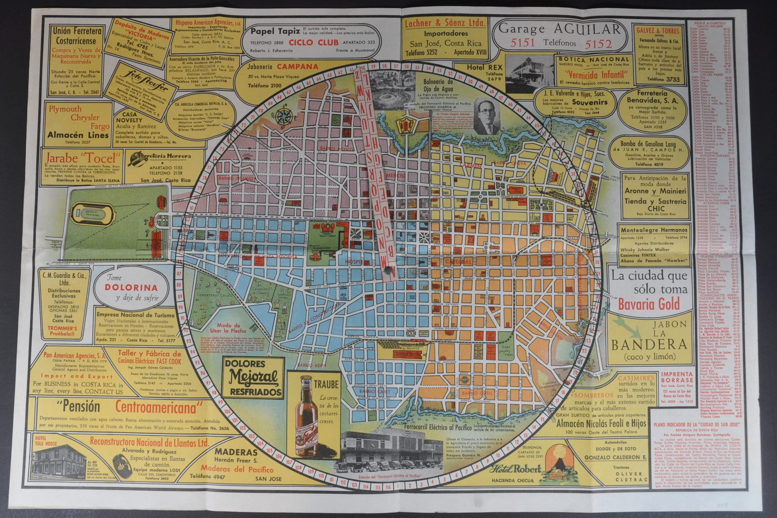
The city of San Jose shortly before the Costa Rican Civil War.
1 in stock

Description
This is a charming and vibrant Spanish-language guide map to San Jose, Costa Rica. Bright color divides the city into four sections, each labeling numerous locations of interest and important buildings. It comes with a handy feature in which the user rotates a central arrow to 1 of 116 numbers around the circumference of the image. These correspond to different streets and promoted businesses, listed on the right side of the page.
Text below offers a cautious warning for the traveler – “The houses are numbered, but there is a custom not to be guided by their numbers or names of streets and avenues.” Numerous mid-century advertisements occupy the remaining available space, promoting local merchants, hotels, and more.
The map was drawn by W.R. Valenciana in 1946 (dated signature left of the football stadium). Cartographic credit is given to Frolian Holguin Balcazar, while printing was performed locally by Imprenta Borrase. Balcazar appears to have created ‘Plano Indicador’ maps for several Spanish-speaking cities, including Barcelona, Valencia, and Madrid. They are uncommon on the market and in institutional collections, with only one listing in WorldCat at Cornell University (dated 1935). OCLC# 4973159
Map Details
Publication Date: 1946
Author: Frolian Holguin Balcazar
Sheet Width (in): 29.4
Sheet Height (in): 19.9
Condition: A
Condition Description: Large sheet with creasing and light wear along old fold lines. A reference tag in the center pivots around a metal rivet, reinforced with a piece of linen on the verso. Near fine condition overall.
$245.00
1 in stock