
Plan de Paris
A historic look at the rapid expansion of the Paris city limits.
Out of stock
Description
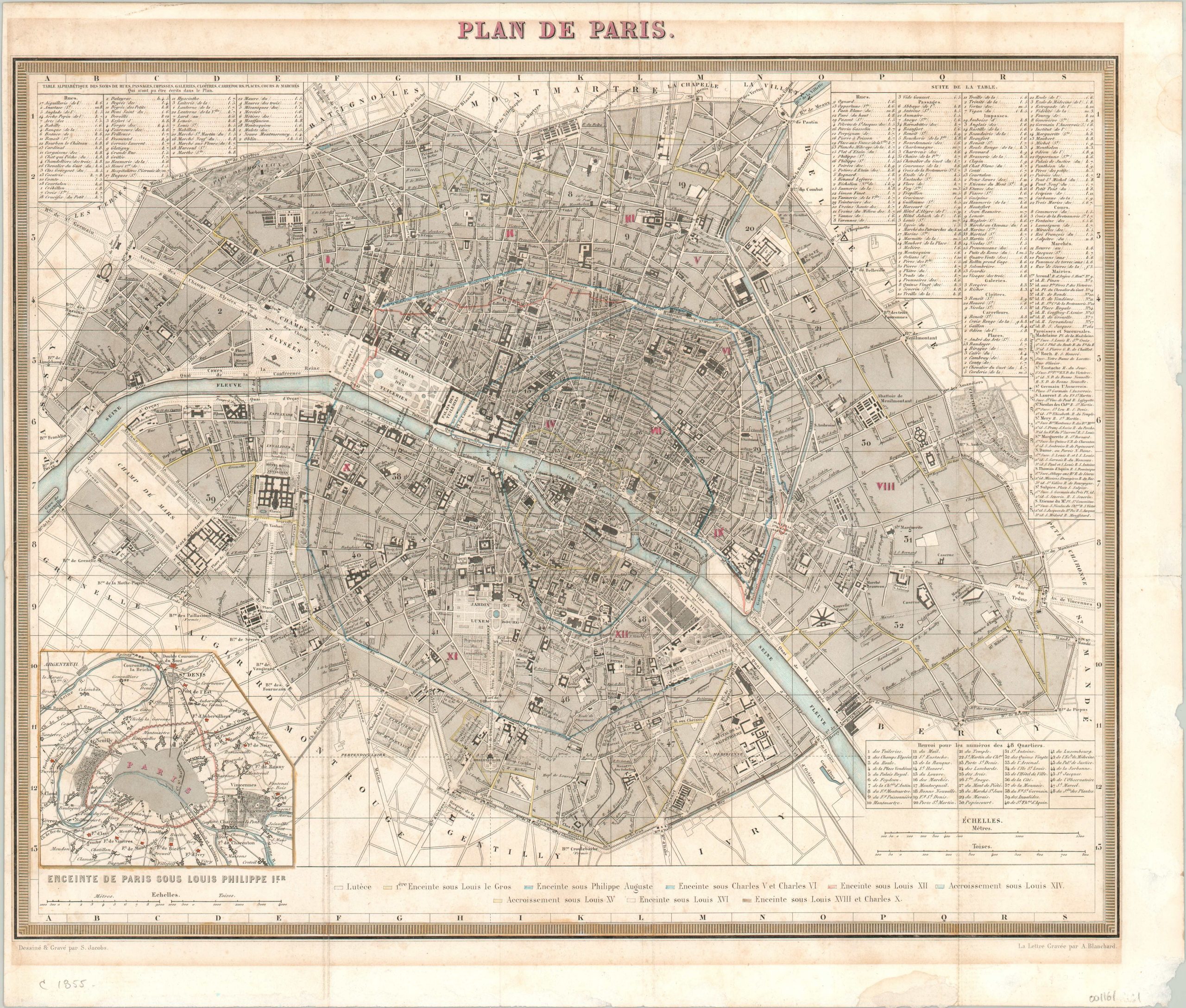
This is a lovely plan of Paris, France, focusing on the city’s historic past and significant growth. Color keys of expanding city walls delineate the limits under several reigns, from the Roman times to the death of Louis XVIII in 1824.
The steel plate engraving allows for finely detailed labels identifying street names, important buildings, gardens, and other locations of interest. Immediately outside the map is an extensive street index corresponding to the grid system in the border, as well as an inset map showing the environs of the city under Louis Philippe, who abdicated in 1848.
Map Details
Publication Date: c. 1855
Author: S. Jacobs
Sheet Width (in): 18
Sheet Height (in): 15.25
Condition: A-
Condition Description: Wear along fold lines and some faint foxing visible along the lower half of the sheet. A narrow left margin, while the others have a few abrasions. Overal in very good to excellent condition, with lovely touches of original hand color.
Out of stock