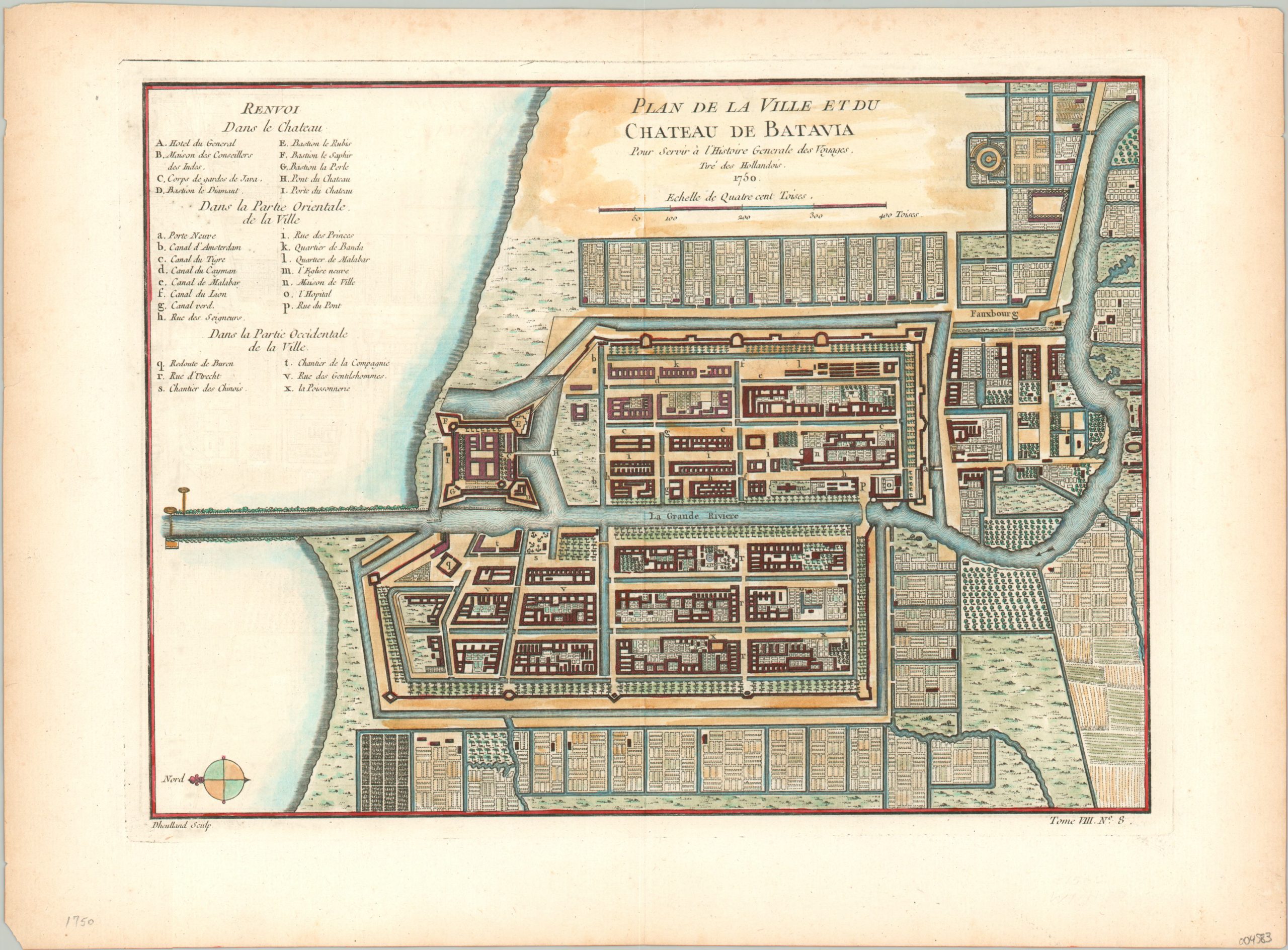
Plan de la Ville et du Chateau de Batavia [Jakarta, Indonesia]
Batavia, capital of the Dutch East India Company.
Out of stock
Description
This detailed plan of Batavia (modern-day Jakarta, Indonesia) shows the capital of the Dutch East India Company in the mid-18th century, as the joint-stock firm (the first in the world) attempted to maintain control over the lucrative Southeast Asian trade markets. The city was established on the island of Java by the Dutch in 1619, who gradually expanded control across the region over the following century. In 1740, thousands of local Chinese residents, many sugar mill workers, were killed in a pogrom for fear of domestic unrest.
The image, oriented with north to the left, provides a wonderful overview of the colonial capital. Thirty-one different points of interest are identified according to the key in the upper left. They are grouped by the Castle, Eastern, and Western parts of the city and include administrative buildings, company headquarters, bastions, canals, and more.
The view was published in Paris in 1750 as part of Jacques Nicholas Bellin’s ‘L’Histoire General des Voyages.”
Map Details
Publication Date: 1750
Author: Jacques Nicholas Bellin
Sheet Width (in): 14.75
Sheet Height (in): 10.6
Condition: A
Condition Description: Faint discoloration and light wear visible in the outer margins. Light darkening along the edge of the plate strike. Very good overall - issued on thick laid paper with attractive hand color.
Out of stock

