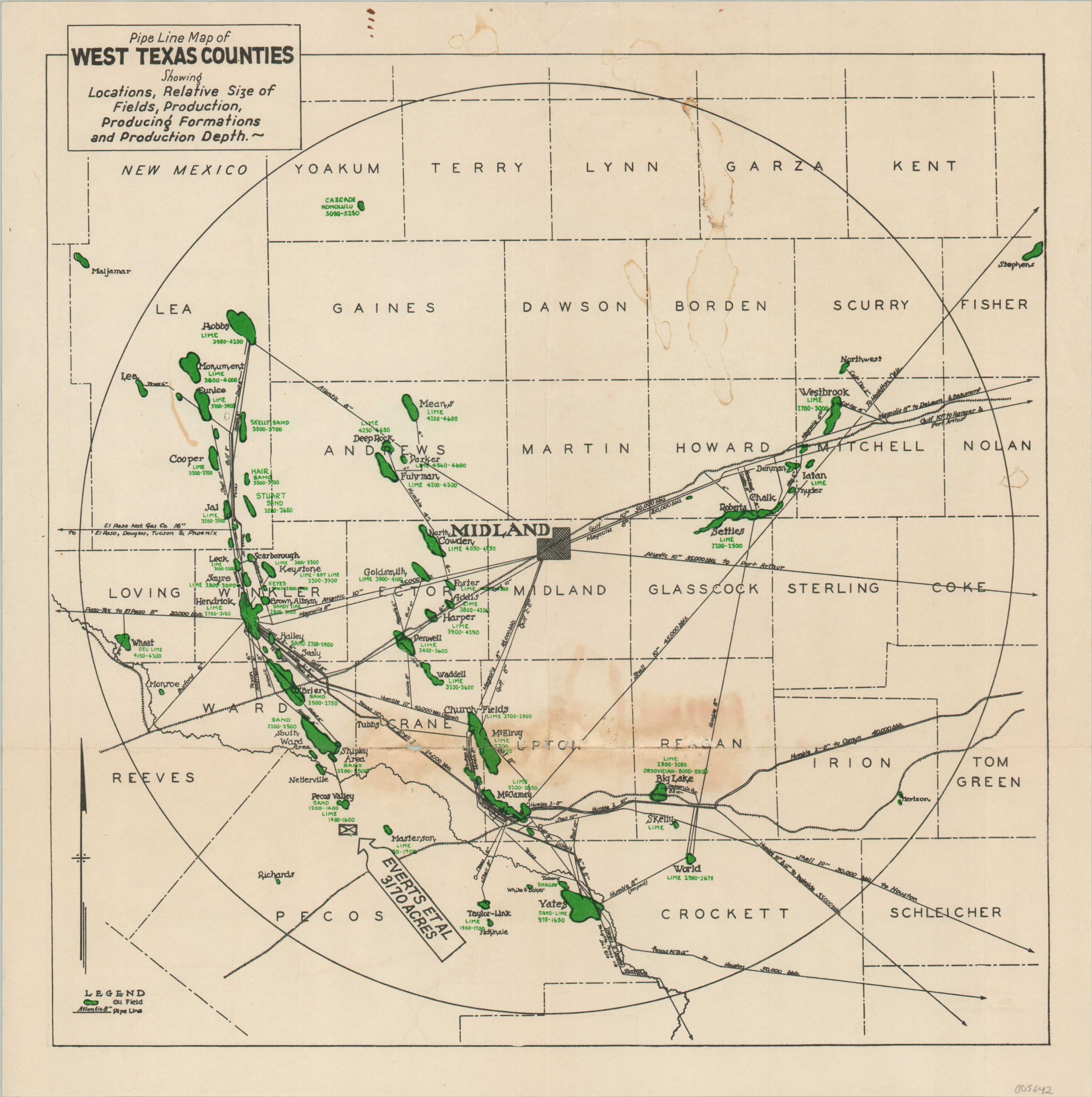
Pipe Line Map of West Texas Counties…
“Showing Locations, Relative Size of Fields, Production, Production Formations and Production Depth.”
Out of stock
Description
This map of West Texas focuses on the oil and natural gas production center of Midland. A circle about 200 miles in diameter encompasses a vast network of oil pipelines connecting numerous fields, highlighted in green. The producing depth (ranging from 1,200 – 8,500 ft.) and geologic formations are also listed.
A box south of the Pecos Valley Field identifies 3,170 acres for sale by Everts et. al., helping to identify the otherwise anonymous map as a promotional item for a group of land speculators or realtors. Difficult to date, but likely published in the late 1930s based on the presence of the Skelly Sands Field, first tapped in 1935, and an online reference to C.A. Everts et. al. from 1938.
The 1930s saw major discoveries across the state that would help propel Texas’ oil production to the nation’s leader going into World War II. Scarce, with no entries in OCLC.
Source: Texas Almanac
Map Details
Publication Date: c. 1938
Author: Anonymous
Sheet Width (in): 15
Sheet Height (in): 15
Condition: B
Condition Description: Numerous spots of damp staining visible in the lower center and upper right. Moderate creasing and wear along old fold lines, with about 1" of separation in the lower center. Between fair and good condition overall. Blank on verso.
Out of stock