Pioneer Trails
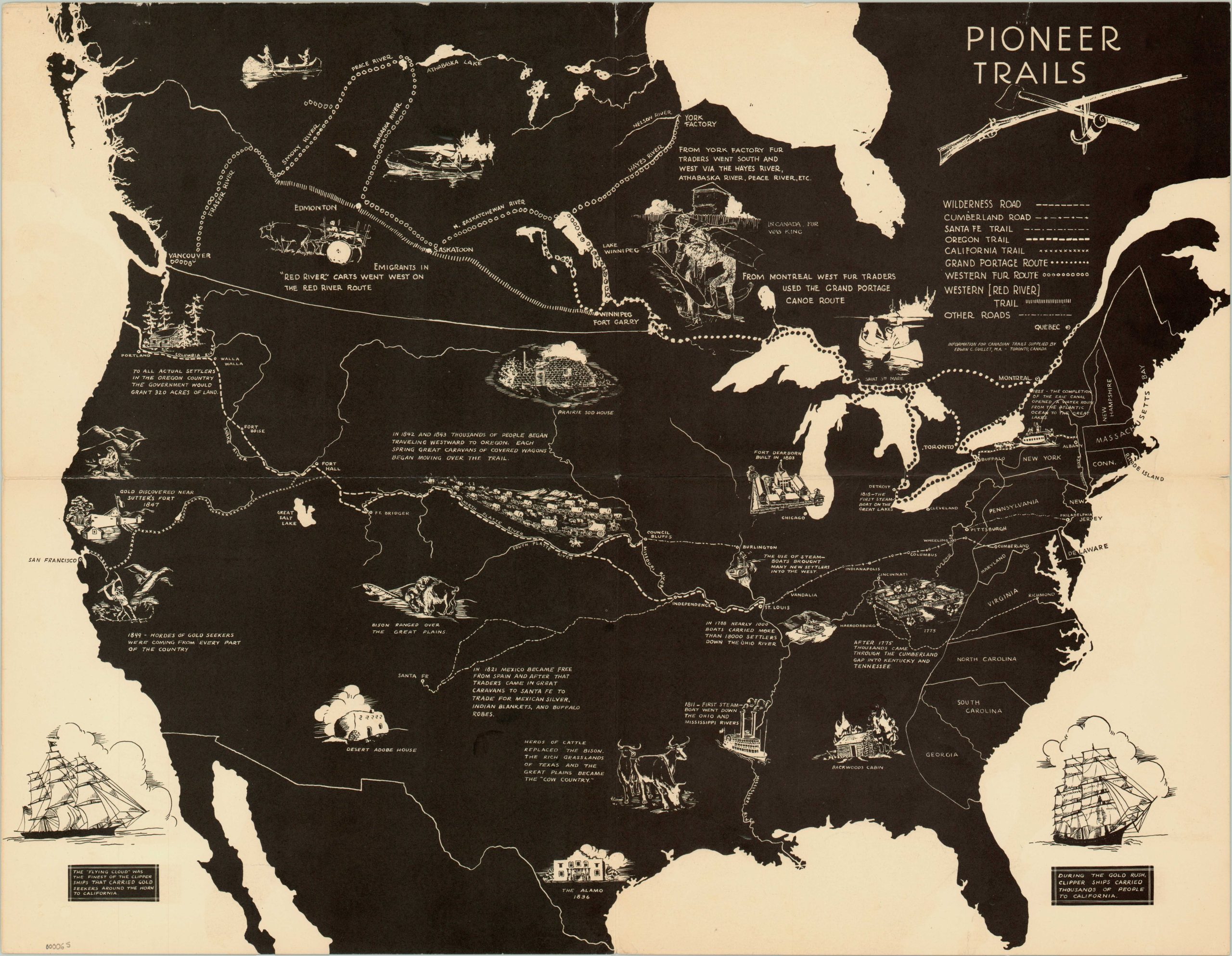
Inverted color image of the major routes used for westward expansion in Canada and the United States.
Out of stock
Description
This educational map, whose publisher is unknown, was likely created in the late 1940’s during Edwin Guillet’s illustrious career as a Canadian author and historian, perhaps as commemoration for the 100th anniversary of the California Gold Rush. Unlike many other maps covering westward expansion, this one includes trails used throughout Canada’s settlement in addition to those in the United States. Eight different routes are depicted using stylized lines that weave across the page through vignettes of major historic locations like Fort Dearborn, Sutter’s Fort, and The Alamo. Various homestead and transportation types are also shown.
As if to emphasize the undeveloped land through which the pioneers traversed, the only major boundaries present on the map are those for the original thirteen colonies, and between nations. Two ship vignettes in the lower corners also allude to the sailors who made the trek around Cape Horn, rather than the overland route, to the West.
Map Details
Publication Date: c. 1940s
Author: Unknown
Sheet Width (in): 22
Sheet Height (in): 17
Condition: B+
Condition Description: The map is in very good condition, with slight marginal wear and small tears along fold lines (repaired on verso).
Out of stock

