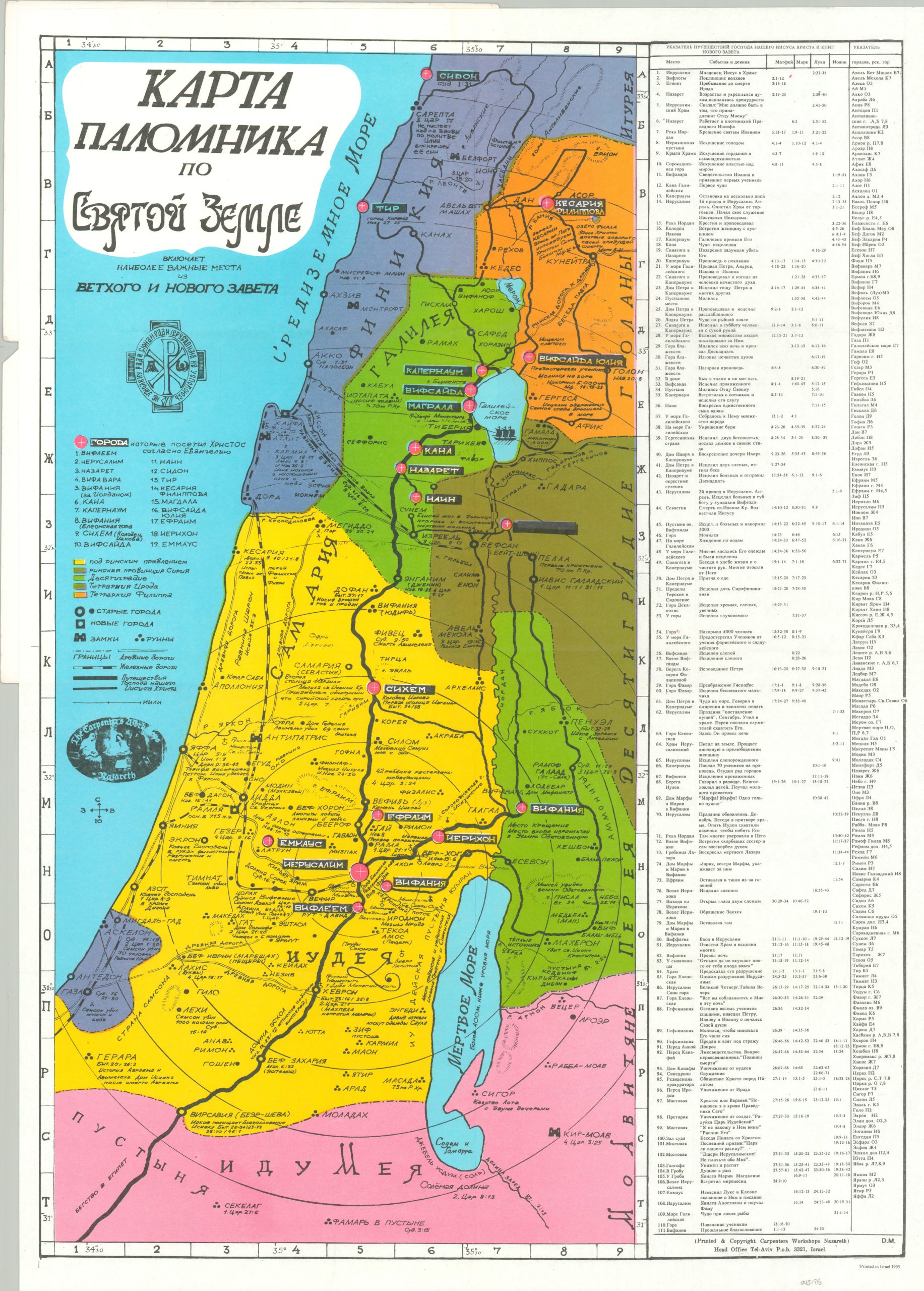
[Pilgrim’s Map of the Holy Land]
The Holy Land – past and present (in Russian).
Out of stock
Description
This informative historical map of Jesus’s travels throughout the Holy Land was originally designed in 1942 by Theodore Matthesy. This is a later edition, issued in Russian by the Carpenter’s Workshop of Nazareth in 1995.
Bright colors identify territorial ownership according to the accompanying legend while text and symbols describe the various places visited and routes undertaken. The 19 towns visited by Jesus, according to the Gospels, are numbered and identified within the image. An index on the right side lists 111 different stops on Christ’s journey, with his respective deeds and the supporting Bible verses listed for reach.
A visual cartographic companion to the Gospels of Matthew, Mark, Luke and John.
Map Details
Publication Date: 1995
Author: Theodore Matthesy
Sheet Width (in): 19.5
Sheet Height (in): 27.25
Condition: A
Condition Description: Light creasing and wear along originally issued fold lines and around the outer edges of the sheet. Near fine condition overall.
Out of stock

