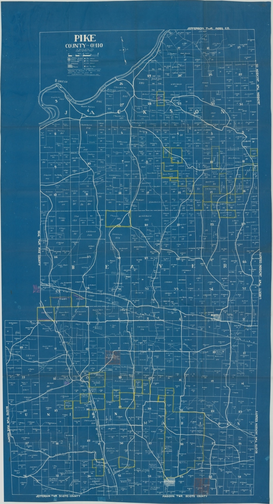
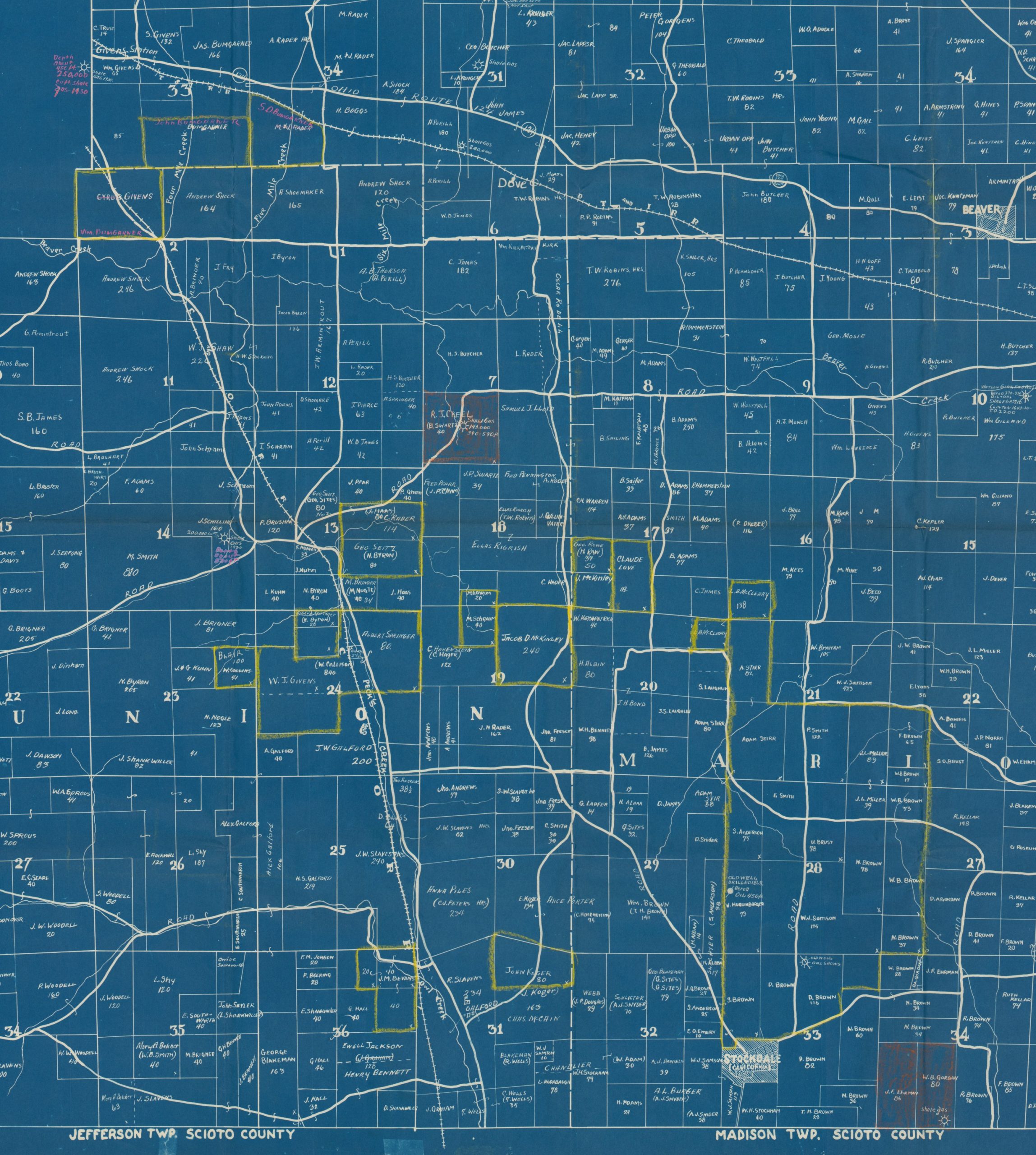
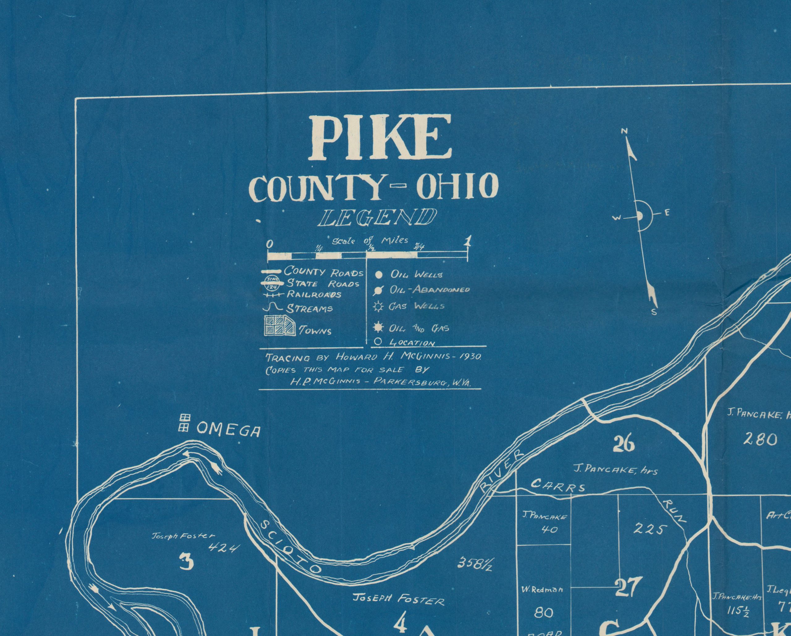
Pike County – Ohio
$200.00
Customized oil map of Pike County, Ohio formerly owned by the cartographer.
1 in stock
Description
This huge plat map covers Pike County in southern Ohio. Though topography is absent, it’s important to note that the county is part of Appalachia and thus rugged and mountainous. Like many other locales in that scenic region, Pike County was home to a number of oil deposits.
Both oil and gas wells (in operation or abandoned) are noted throughout the map, in addition to geographic features and transportation routes. Lots are labeled individually by size and owner, and a number of annotations highlight particular tracts or outline large sections.
Further annotations and a signature on the verso indicate the notes were likely applied by the original cartographer, Howard McGinnis. The map was published by Mr. McGinnis in Parkersburg, West Virginia (another Appalachian area notable for its oil deposits) in 1930.
Map Details
Publication Date: 1930
Author: Howard H. McGinnis
Sheet Width (in): 35.50
Sheet Height (in): 66.00
Condition: B+
Condition Description: Thick blueprint paper folded into 32 segments, with wear and creasing along fold lines. Two tears at fold intersections have been repaired with archival tape on the verso, with no image loss and only a bit of extraneous wrinkling. Contains several annotations in oil pencil and ownership markings of the cartographer (H.P McGinnis - Parkersburg, W.Va.) on the verso.
$200.00
1 in stock