[Picture and Detail the Change? – China]
$375.00
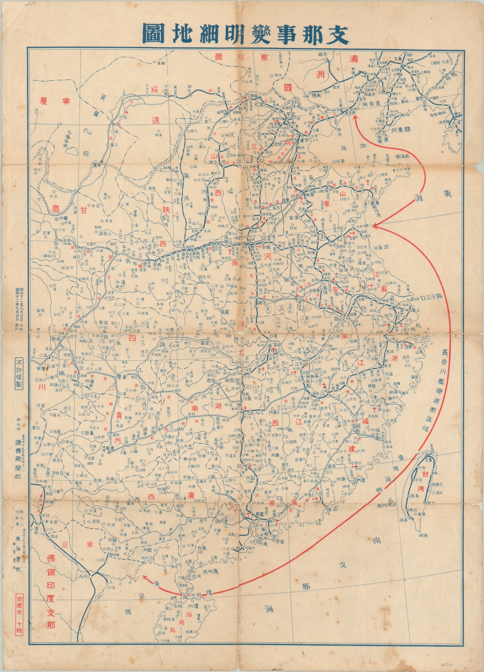
Japanese military plan of China during the opening months of the Second Sino-Japanese War.
1 in stock
Description
This map of China was issued during a surging Japanese offensive in the beginning phases of the Second Sino-Japanese War (perhaps the changes references by the characters in the title?). It was printed in Tokyo in September of 1937 (Showa 12), and shows military installations, railroads, and the naval operations area of Admiral Hasegawa.
Aircraft played a vital role in battles for Tianjin, Beijing, Shanghai, and Nanjing, and numerous locations, possibly airfields or bombing targets, are marked with a small red monoplane symbol. Several manuscript annotations around the last location are also of interest, as the city would soon suffer one of the most tragic and horrific experiences of the entire conflict – the ‘Rape of Nanking.’
Map Details
Publication Date: 1937
Author: Yomiuri Shimbun News Agency
Sheet Width (in): 15.25
Sheet Height (in): 21.10
Condition: B-
Condition Description: Creasing and heavy discoloration along former fold lines, with numerous places of separation repaired with archival tape on the verso. Scattered spotting within the bottom third of the image and several chips along the outer edges of the sheet.
$375.00
1 in stock

