Pictorial Profile of the Illinois Waterway
$55.00
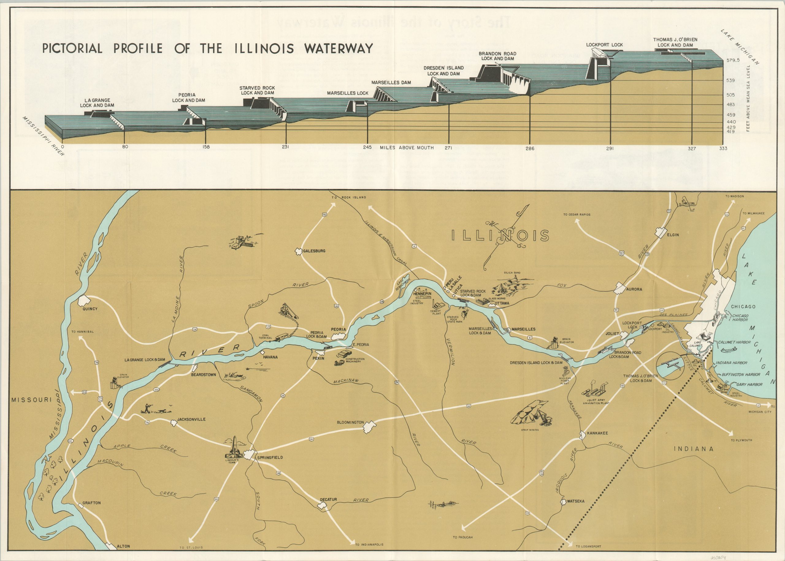
Connecting Lake Michigan to the Mississippi River.
1 in stock
Description
Linking the Calumet River at Chicago to the Illinois River at Grafton, the 333-mile-long Illinois Waterway is a critical avenue in the transportation of bulk commodities between the Great Lakes and the Mississippi River. Eight locks, managed by the Army Corps of Engineers, moderate the approximately 580 ft of elevation change and are depicted on the upper half of the sheet. The bottom presents a map of the route on a custom projection oriented with northwest at the top.
Various industries that utilize the waterway, like mining, manufacturing, and agriculture, are illustrated pictorially alongside. Of interest is the Joliet Army Ammunition Plant, a production site for ammunition and TNT during the Vietnam War. Photographs and descriptive text on the verso tell ‘The Story of the Illinois Waterway.’
Designed by the Chicago District of the Army Corps of Engineers and published by the Government Printing Office around 1969.
Map Details
Publication Date: c. 1969
Author: U.S. Army Corps of Engineers
Sheet Width (in): 23.75
Sheet Height (in): 17
Condition: A
Condition Description: Creasing and light wear along originally issued fold lines. Near fine overall.
$55.00
1 in stock